Jalama Beach – February 2015

Riding in the winter (even in So-Cal) presents some problems, mostly related to weather but you’ve also got to take hours of daylight into consideration.  This month I was able to convince my co-pilot to come along and pick the destination; she did a fine job.  Jalama (“Halama”) Beach is a secluded section of the shoreline located 5 miles north of Pt. Conception and just south of the land that is owned by Vandenburg Air Force Base.  I’ve been told that missile launches viewed from the campground are spectacular.

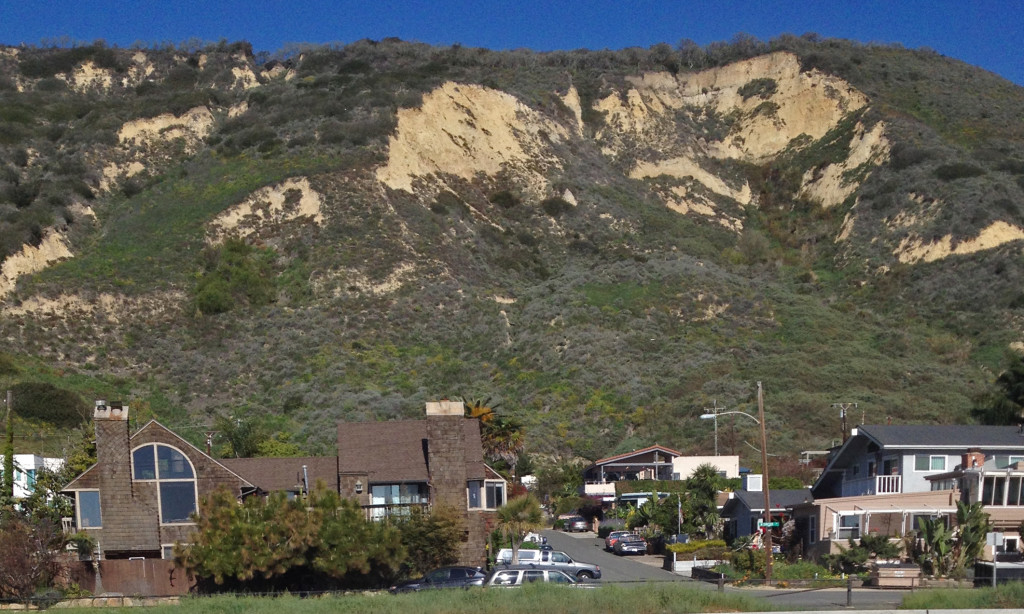
While doing my research on the ride route and what might be interesting along the way I was reading about the 2005 landslide at La Conchita (video).  Those of you from Southern California probably know about this but I never really realized the SIZE of this landslide.  On the way up I looked over with a new appreciation of what happened. Property insurance in and around La Conchita is available only through Lloyd’s of London, and it is expensive!!

02 Slide

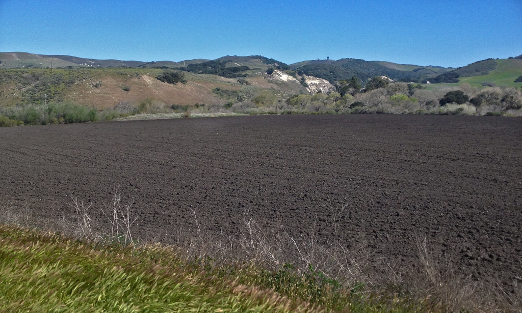
On up the coast along the 101 to Hwy 1 then a left turn onto Jalama Rd.  Soon after turning onto Jalama road we saw a few of these small farm & ranch properties.  Individually owned and operated just the way they have been for generations.

An earthy smell permeated the air near these fields of recently turned  dark and rich soil.

An earthy smell permeated the air near these fields of recently turned dark and rich soil.

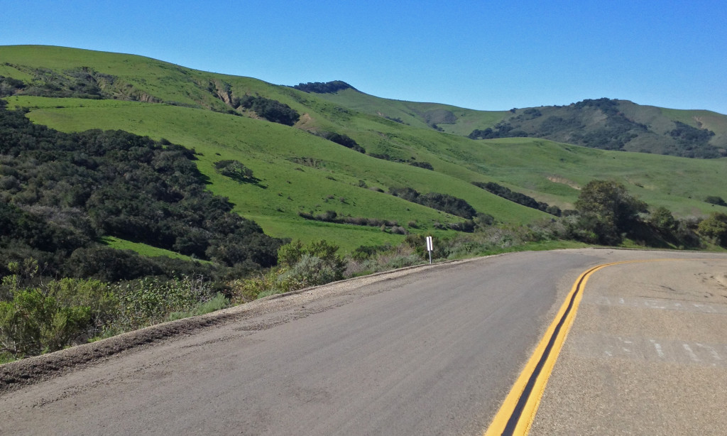
The vast majority of the area is too steep to cultivate and but for the road, is untouched.

The vast majority of the area is too steep to cultivate and but for the road, is untouched.

02 Green4

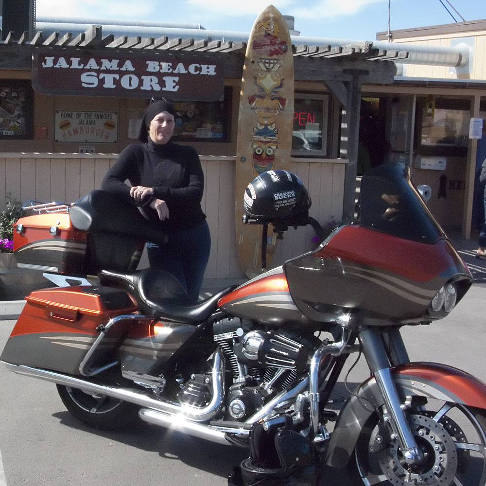
The wind blows a lot here, and it got stronger the closer we got to the ocean.  The small store is fairly well stocked and breakfast and lunch is available at the grill.  Windy, no cell phone service, and no internet doesn’t really meet our criteria for extended stays.

02 JBS

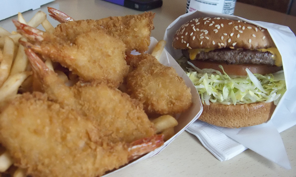
The Famous Jalama Burger & some fried shrimps for my co-pilot.  The food is good - not great.

The Famous Jalama Burger & some fried shrimps for my co-pilot. The food is good – not great.

On the way back we went up through Lompoc (pronounce that POCK not poke) then down through Buelton, Solvang, Santa Barbara, and back down the coast on the 101.

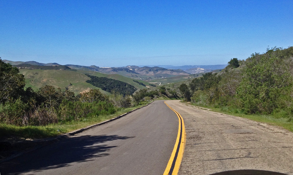
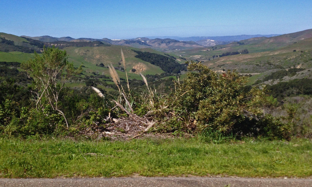
Difficult to keep your concentration on the road ahead with views like this right and left.

Difficult to keep your concentration on the road ahead with views like this right and left.

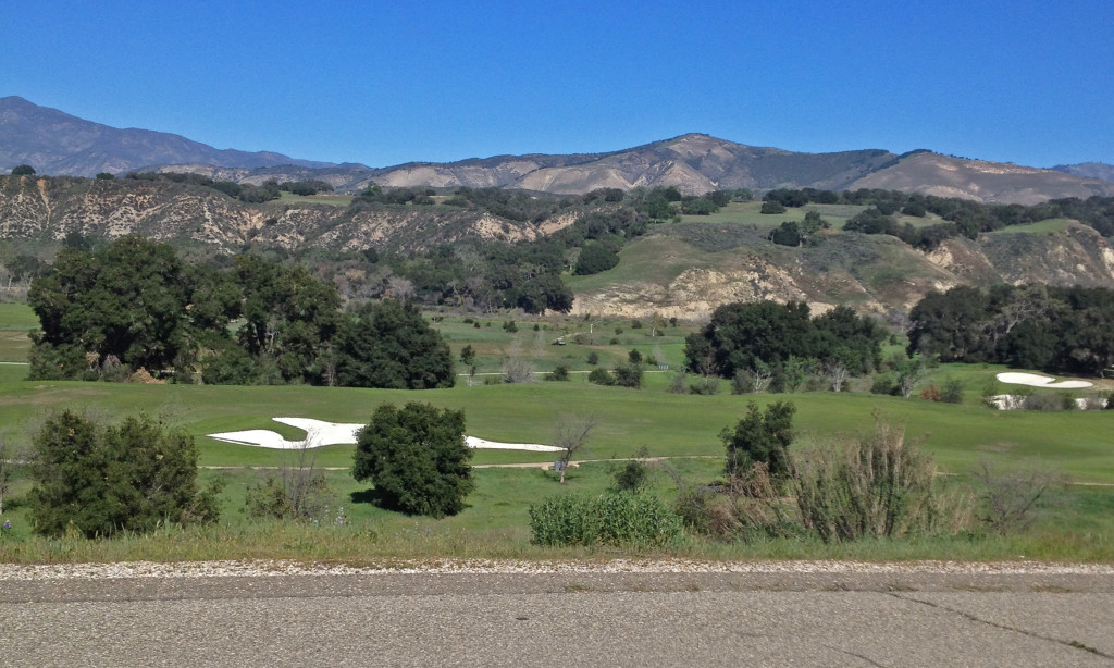
Rancho San Marcos finally green enough to play.  The drought almost ended this course.

Rancho San Marcos finally green enough to play. The drought almost ended this course.

Just west of Solvang is Ostrichland USA - They have all things ostrich - we'll stop someday...

Just west of Solvang is Ostrichland USA – They have all things ostrich – we’ll stop and check it out someday…

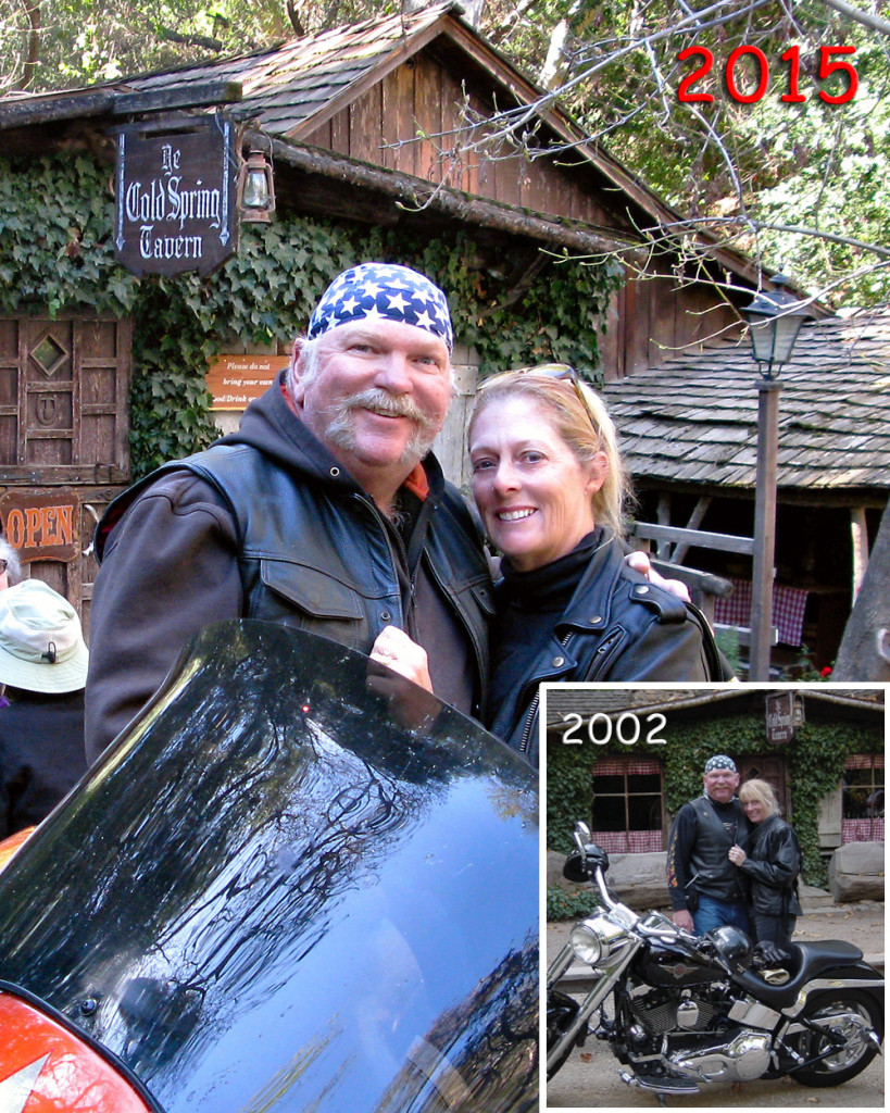
Hwy 154 out of Solvang takes you past Lake Cachuma then up over the mountain range and down into Santa Barbara.  It’s a popular road with motorcyclists due in no small part to a little place off the road called Cold Spring Tavern.  A stagecoach rest stop in 1886 and still a rest stop today but these days it’s mostly motorcycles and fancy cars that you’ll see.

In addition to being a very cool (no pun intended) place to spend some time relaxing, there is a restaurant (caution – low ceilings & uneven floor) with good food & on Sundays there’s live entertainment and some of the best tri-tip I’ve ever had – hot off the grill.  This also happens to be  where I brought Robin on our first date – we were married one year to the day later.  We’ve been back often but never tried to re-create the photo from day one.

02 CS3

That’s where we’ll end this month’s ride; hope you’ve enjoyed the trip.

See you next month.

Dead Dinosaurs – January 2015

I planned this ride back in December but I got the flu for a New Year’s present and after I got that kicked enough to go on a motorcycle ride, there was rain and other commitments that just kept me off the bike.  SO – this is a little late but it was worth the wait.

You know by now that I prefer the road less traveled to the interstates but there are times that it can’t be avoided.  Mostly due to the short winter days, portions of today’s ride required some mile eating time up on the slab.  However – the great back roads experience more than made up for the few miles spent on the concrete superhighway where you spend most of your time protecting yourself from the texting, shaving, make-up applying, or otherwise brain dead drivers mindlessly pointing their death dealing machines.  (apologies to all of my readers; I know you are paying attention while driving).

Usually when I go up towards Palmdale I use Sierra Highway to avoid the 14 freeway.  However, Soledad Canyon Road is actually better if you’re not in a big hurry.  I’ve taken this route before but today was a great reminder that I need to take it more often.

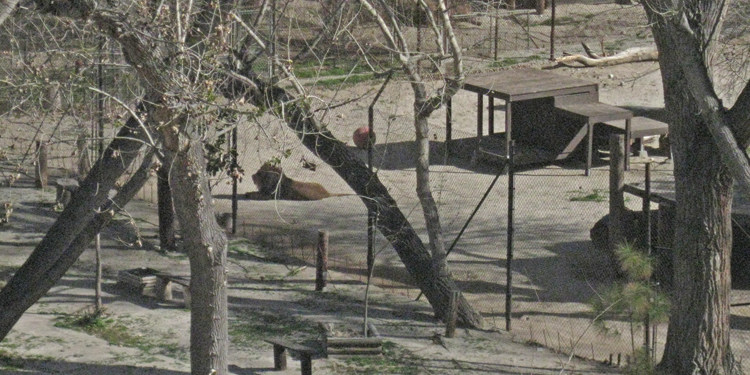
01 KingJust south of Acton you’ll notice the fence on the side of the road goes from four feet and barbed wire to fourteen feet and extra heavy chain link topped with barbed wire.  This is the location of the Shambala Preserve.  Back in 1972 Tippy Hedren established this animal sanctuary that cares for endangered exotic big cats such as African lions, Siberian tigers and Bengal tigers, leopards, and even a liger (lion/tiger mix).  Most of the animals at Shambala were born in captivity, orphans, are no longer wanted at circuses or zoos, or are given up by private owners who could no longer care for them.  I stopped to look through the fence but couldn’t see any animals so I started walking back to my bike – then I heard a loud roar followed by another answering roar; this happened two or three times.  I’ve never heard a lion roar in real life, it is IMPRESSIVE (you can actually feel it).  I headed in that direction and got to see the King of Beasts himself make his last roar then he laid down in the sun.  You can get a tour of Shambala but reservations are required.

From Acton I headed for Tehachapi Mountain Park, just because I’ve never been there.  A few miles on the slab then a left turn at Roseamond and a right turn on Tehachapi Willow Springs Road.  This back road into Tehachapi is new to me but will be the preferred route from now on; a nice smooth road with long sweeping turns and almost nobody on it.

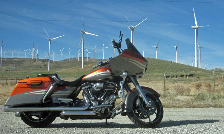
Ever wonder what one of these babies cost?  The big ones are 3-4 MILLION installed.  These are located in the hills west of Mojave.  The little black things are horses.

Ever wonder what one of these babies cost? The big ones are 3-4 MILLION installed. These are located in the hills west of Mojave. The little black things are horses.

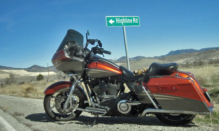
01 HighlineThis is horse country and I’m sure that’s where this road got it’s name.  A Highline (picture) is a line put up between two trees to tie horses, mules, etc.  I made one for Robin to use when she goes horse camping and she loves it.

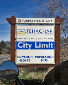
01 tspI didn’t take any pictures from Tehachapi Mountain Park but I can tell you that it’s all pine trees up there and at 5,600 ft and it’s cold this time of year.  Tehachapi is a nice place, small enough to be mostly rural but with just enough of the modern conveniences.

In case you were wondering, the Purple Heart City proclamation is a way of honoring the sacrifices of those that were either wounded or killed by the action of enemies of the United States during war time and has nothing to do with the number of Purple Heart recipients living in or from the City.

From Tehachapi I headed for Lake Isabella.  I was on 58 for about 10 miles then turned right to Caliente.  Although almost a ghost town now, Caliente prospered during Southern Pacific Railroad’s construction of Tehachapi Pass line. For a time, the Telegraph Stage Line and the Cerro Gordo Freighting Co. also ran through Caliente and its full-time population grew to 200. There were approximately 60 buildings, including 20 or more saloons.  The buildings still standing are mostly dilapidated and uninhabited.

01 vistaThe Caliente Bodfish Rd is not a road less traveled, it is a road NOT traveled.  95% of the road doesn’t even have a center stripe, which makes navigating the right hand turns a little interesting.  It didn’t matter much though, speed in the turns was about 15 mph and there was nobody on the road.  Great mountain road that really allows you to enjoy the view.

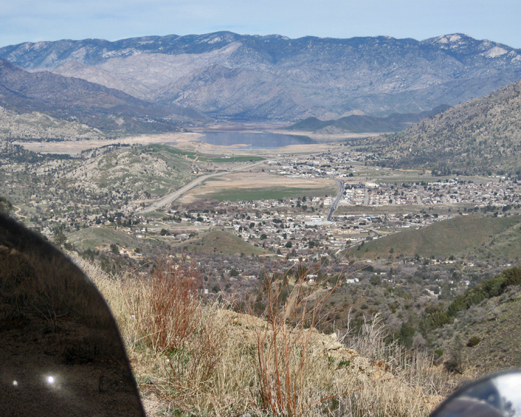
Looking down on Bodfish and Lake Isabella.  Only other way to get this view is from an airplane.

Looking down on Bodfish and Lake Isabella. Only other way to get this view is from an airplane.

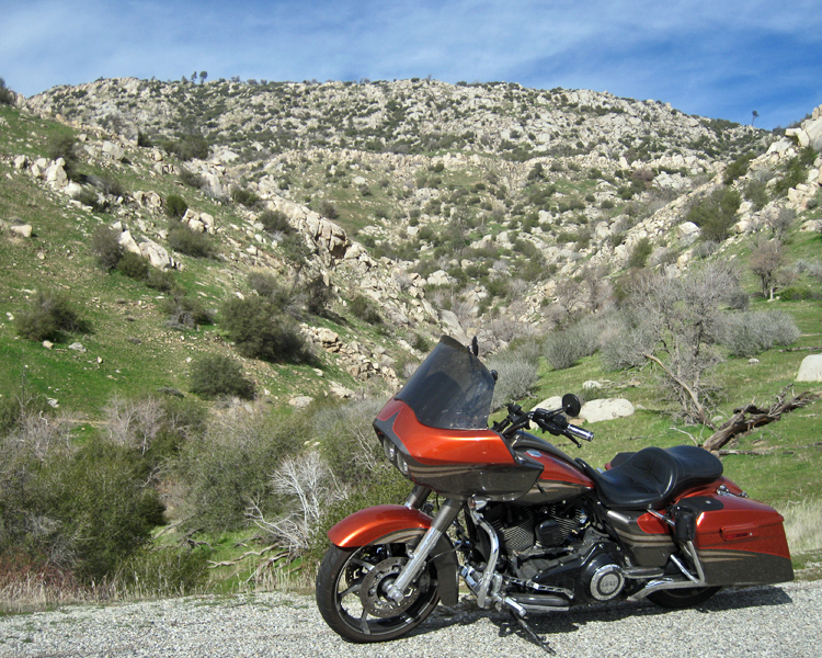
Highway 178 southwest of Lake Isabella.

Highway 178 southwest of Lake Isabella.

Highway 178 goes down the Kern River Valley and follows the Kern River from Lake Isabella.  I would have taken a picture of the river had it been impressive but it was barely a trickle in most places.  Still, 178 is a GREAT road especially after it goes down to one lane each direction.  The speed limit is 55 and you can go that fast in just about every turn – if you’ve got the stones to do it, and are unencumbered by slower vehicles.  If my dad ever gets out to CA with his SlingShot – this will be THE road when we go for a ride.

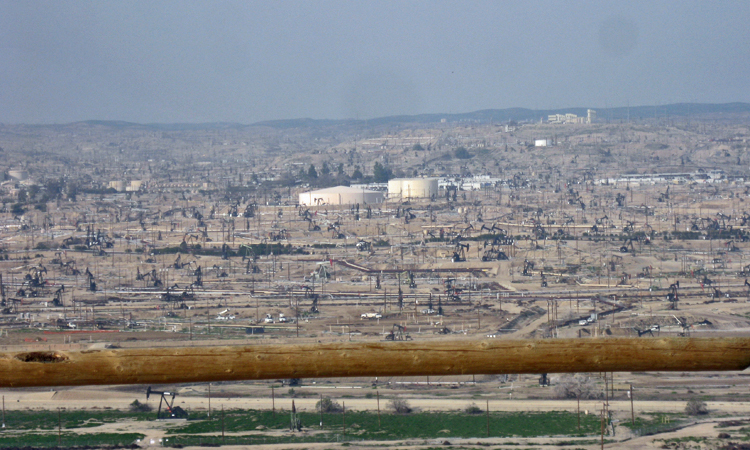
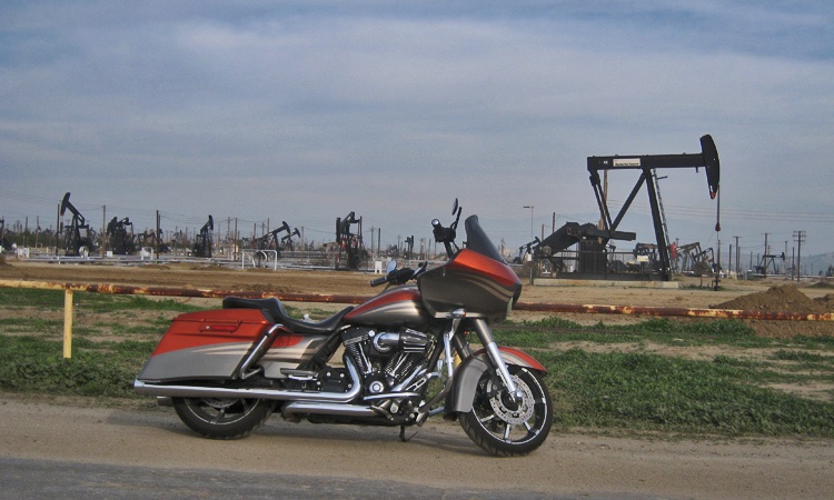
The view from Panorama Park in Bakersfield - nothing but oil wells in the Kern River Oilfield.

The view from Panorama Park in Bakersfield – nothing but oil wells in the Kern River Oilfield.

This is where we get to the Dead Dinosaurs.  We take a lot of things in life for granted; what do you think this world would be like without oil?  I hope they can find an alternative fuel or a way to affordably and renewably manufacture petroleum products because eventually the oil will dry up.  I am absolutely thrilled however, to be living in the time of gasoline, diesel, and jet fuel, and to know that it won’t run out in my lifetime.

Paying homage to the Nodding Donkey that pulls its life blood from the ground.

Paying homage to the Nodding Donkey that pulls its life blood from the ground.

My carbon footprint might be slightly bigger than it should be, but I assure you, nobody is having more fun spending their carbon credits.  See you on the road…..

California Missions – December 2014

Every 4th grade student in public school in California studies the missions and related history as part of the curriculum.  Part of the lesson even requires the building of a diorama depicting one of the missions.  I might know a little more about the missions had I gone to elementary school in California but it’s doubtful.  I didn’t tend to my lessons like I should have back then which is probably the reason that the only thing I remember from 4th grade is being on the wrong end of Mr. Barton’s paddle for two, eye crossing and extremely embarrassing swats.  Today you would be doing time in a penitentiary for that kind of discipline on a 4th grader; but it worked on me – I didn’t want any part of four swats next time around.

I thought I’d take a couple days and see all 21 missions from San Diego to Sanoma, but after visiting the mission in Ventura I realized that there was NO WAY to get to all 21 in two days.  So, I started locally, and went north, visiting missions along the way.  I have enjoyed doing my research, and although I don’t know all the details, I do have a general knowledge of the mission system and the time period.  Time to get on the bike…SFR 1
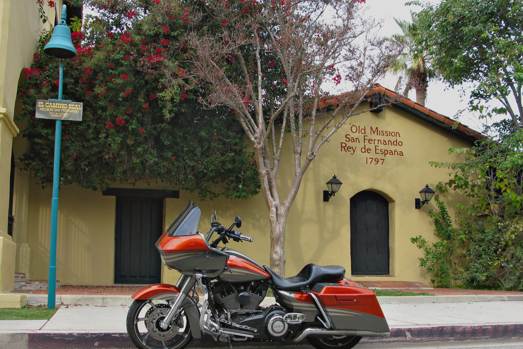
The San Fernando Mission has been totally rebuilt with nothing remaining of any of the structures but one.  This is the Convento where the clergy was housed and although it has been through a couple of restorations, it’s still the original walls.  It’s the only two story adobe building in California and the largest adobe building in the state as well.
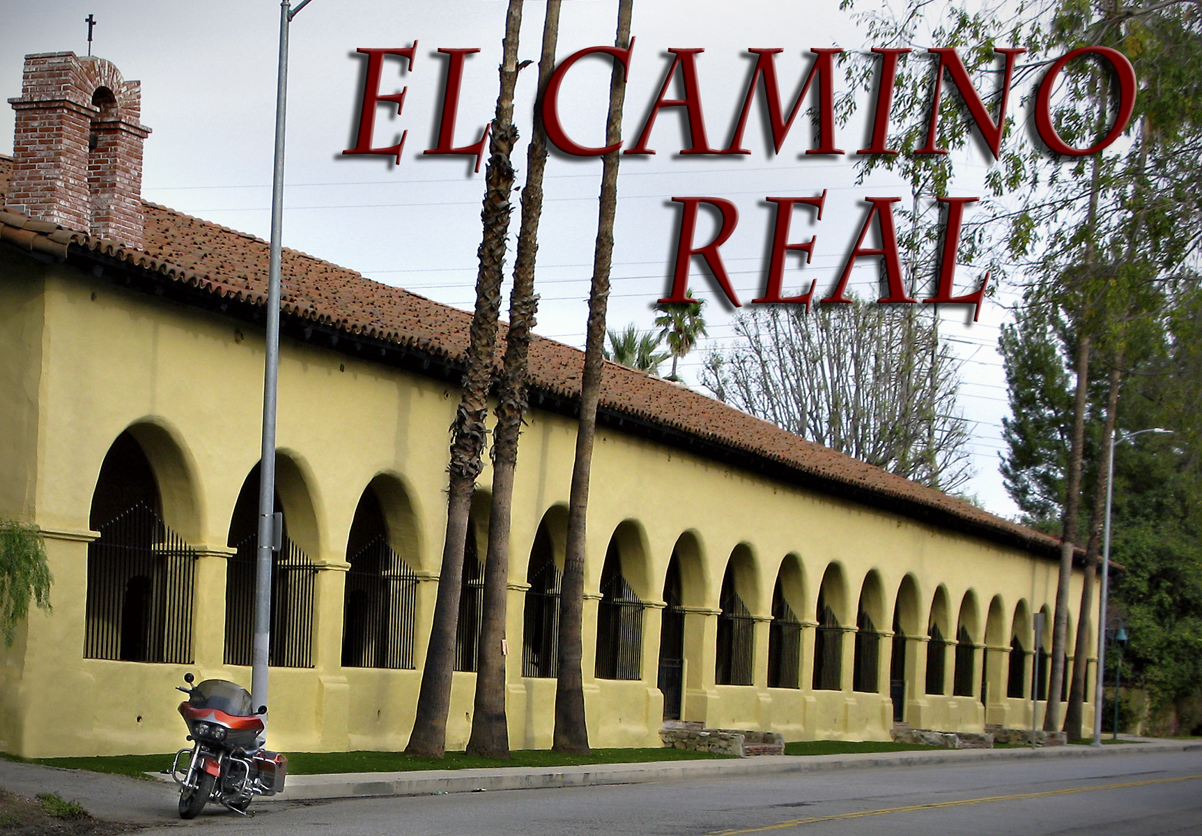
SFR Convent 1

The adobe walls of the Convento at the San Fernando Mission are four feet thick.
Bell

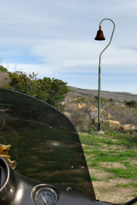
Along the Camino Real between Santa Barbara and Buelton

El Camino Real connects all 21 of the missions and is translated as “The Royal Road” or even “the King’s Highway”.  The romanticized version of the route is that while driving on the El Camino Real your tires are tracing the same path as the missionaries’ sandals. Tradition has it that the padres sprinkled mustard seeds along the route in order to mark it with bright yellow flowers – here is the rest of the story.  It is marked every mile or two along the way by these bells; you’ve probably seen them on the 101 highway north of Los Angeles.  The bells used to be made of iron but these days they are made out of concrete to discourage theft – people continue to steal them though.  If you would like a “real” bell the company that made the originals will be more than happy to sell you one.  El Camino Real Bells  Okay, enough about this road and the bells on it.
SFR Padre

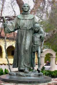
Father Junipero Serra with one of the Indian children indigenous to the area.

Most of the missions I visited have a statue of Father Junipero Serra.  In 1768 he was appointed superior of a band of 15 Franciscans for the Indian Missions of Baja (lower) California. The Franciscans took over the administration of the missions on the Baja California Peninsula after the Jesuits were forcibly expelled from New Spain by King Carlos III.  In 1769 the Spanish governor decided to explore and establish missions in Alta (upper) California. The missions were primarily designed to convert the natives to Christianity.  Other aims were to integrate the neophytes into Spanish society, and to train them to take over ownership and management of the land.  The Indians learned agriculture and construction skills and started building the missions and living in and around them.
San Buenaventura Mission

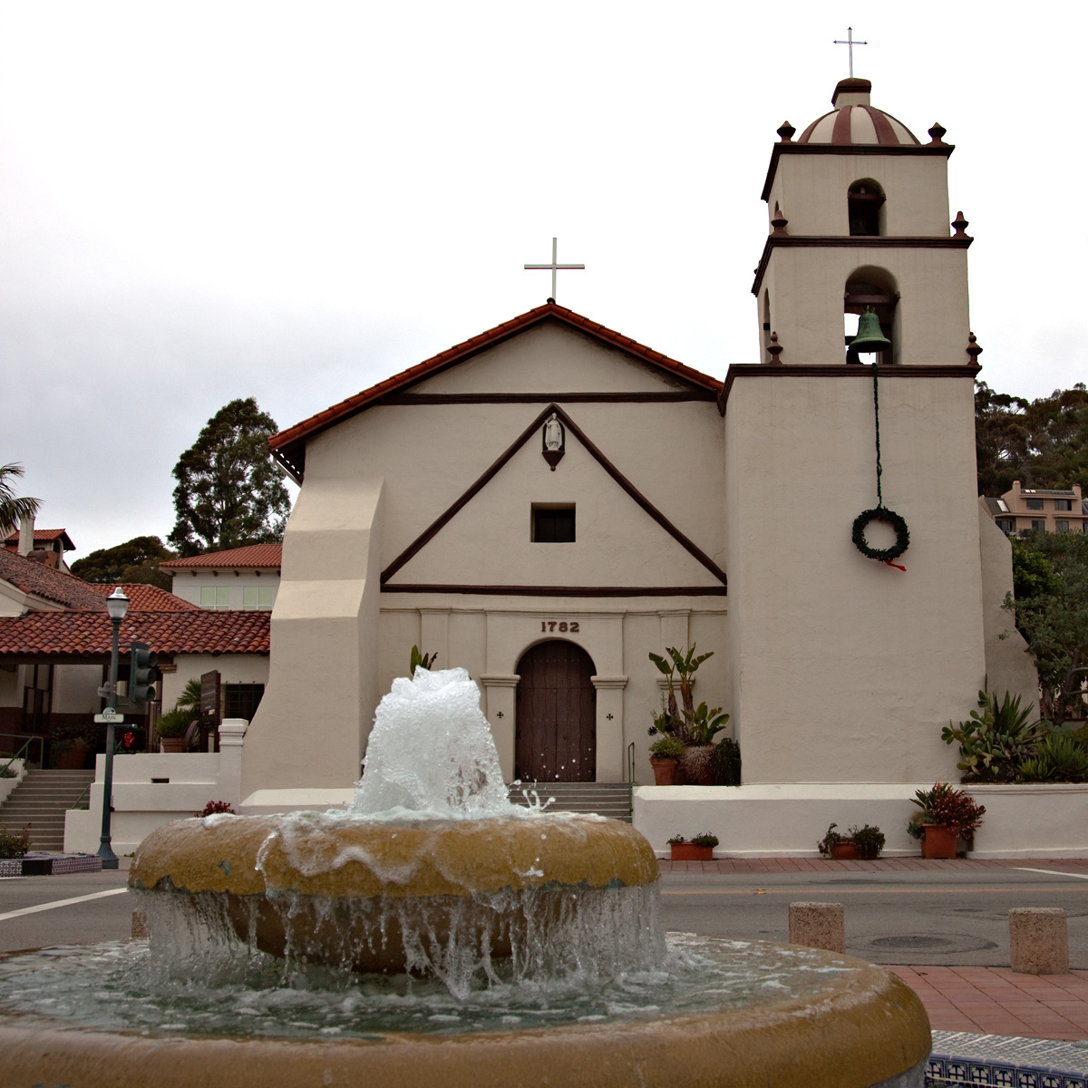
the Old Mission San Buenaventura

Plenty of places to pray

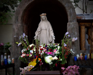
In the courtyard with a kneeler in front of the statue and flowers and candles all around.

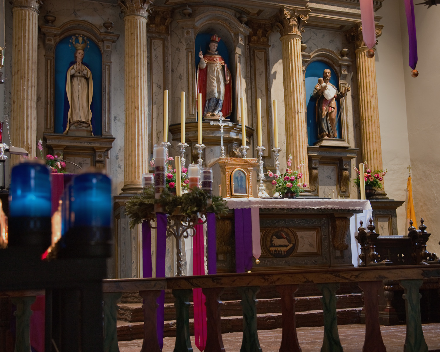
I have literally driven and ridden by  Old Mission Buenaventura several times & while I knew it was a church, I never realized it was one of the California Missions.  My Catholic roots run deep, and the beautiful statues and chapels take me back in a way that nothing else can.  Like many of the missions, the chapel here is still used for Mass. Inside the chapel it’s a little dank but that adds to the authenticity.  None of the lights were on so it was lit as it would have been.
VTU Alter

It was really dark in here – this exposure, taken from the first pew, was two full seconds.
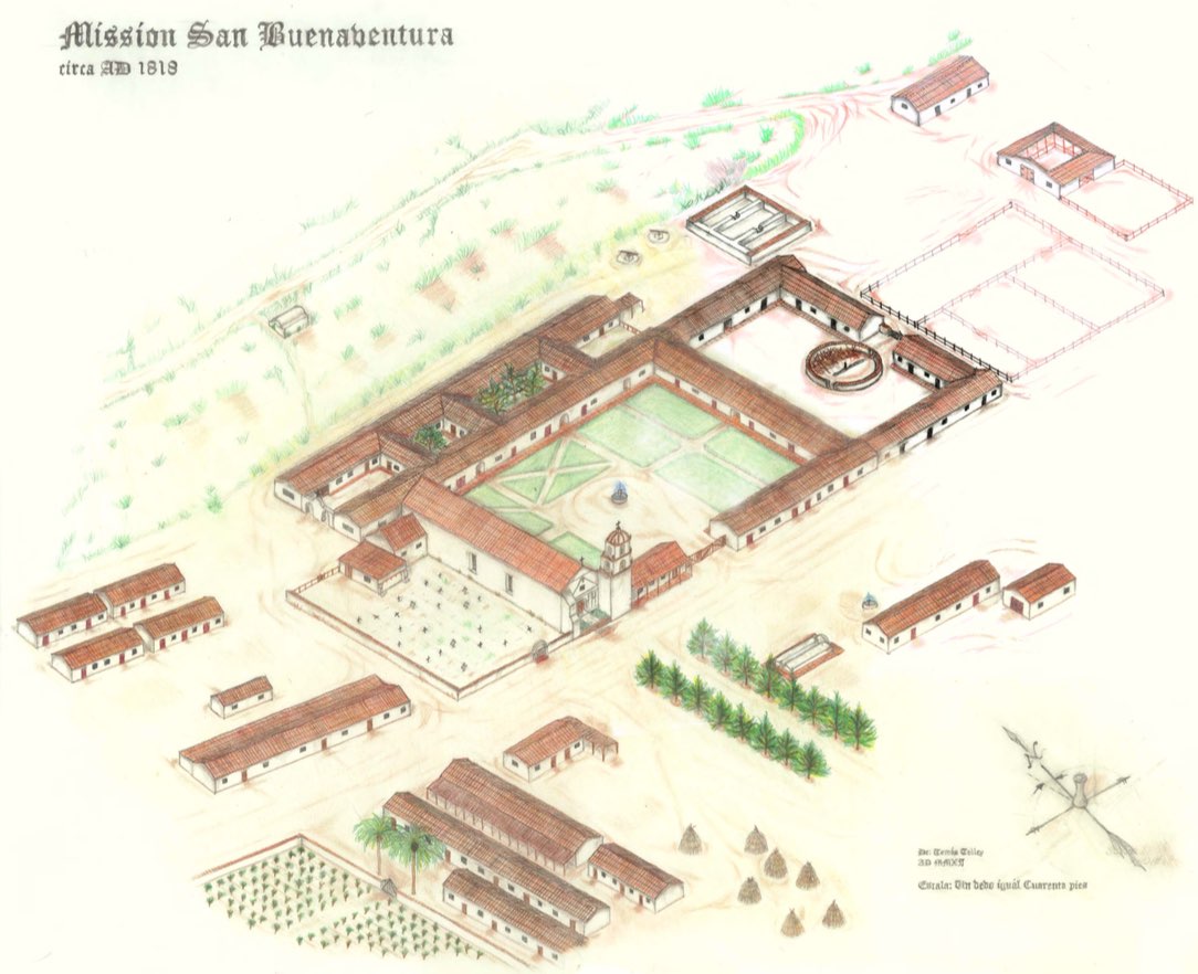
The way it looked in 1818.  What's left is part of Main Street downtown Ventura.

The way it looked in 1818. Now what’s left is in downtown Ventura.

The ride northbound on the 101 is a familiar route.  There are other, more preferable, ways to get up the coast but if time is any factor at all, you gotta get on the slab.  It does go right along the coast though so at least it’s scenic, and traffic was almost nonexistent.  I got off the slab at my earliest opportunity and stayed off for as long as possible.  One of the best parts of this ride was seeing the positive effects of our recent rain.
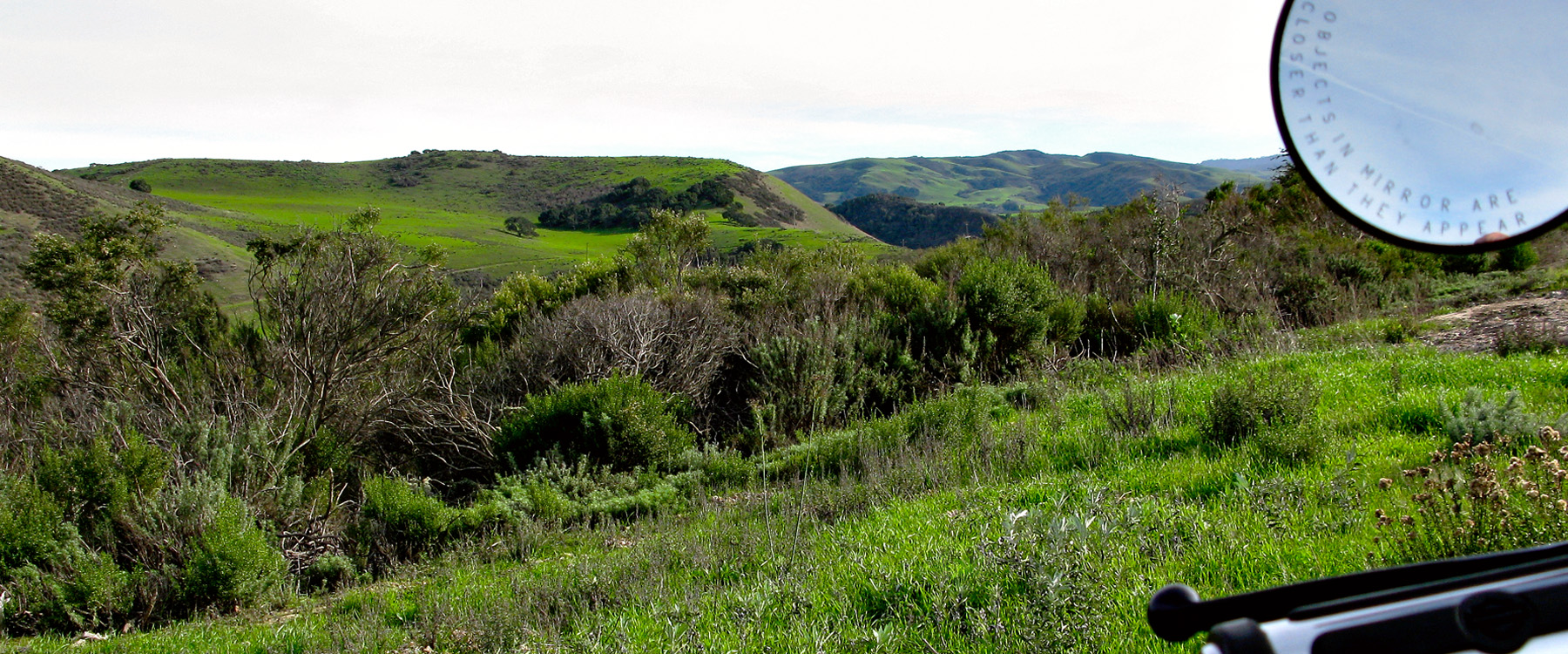
The hills that are normally brown have started turning green.

The hills that are normally brown have started turning green, almost looks like Hawaii.

Called the Queen of the Missions for it’s beauty, the Old Mission Santa Barbara lives up to it’s moniker.  There is a nativity scene in front of the Mission complete with donkeys, sheep and goats, but there is no baby Jesus.  After all, he hasn’t been born yet; on the night of  December 24th, he will be there.
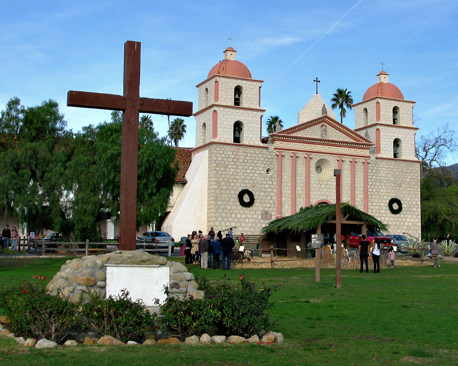
SBA Mission

The Old Mission Santa Barbara was called the queen of the missions because it is so beautiful.

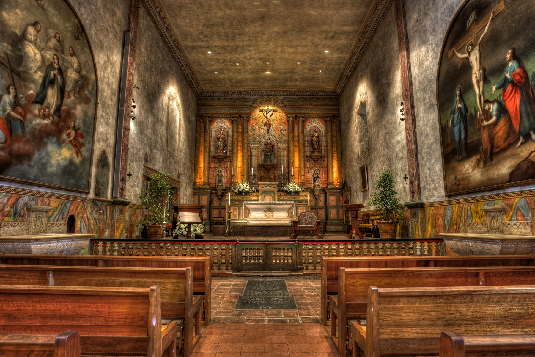
Breathtaking inside the chapel, you could easily spend a whole day at this Mission.
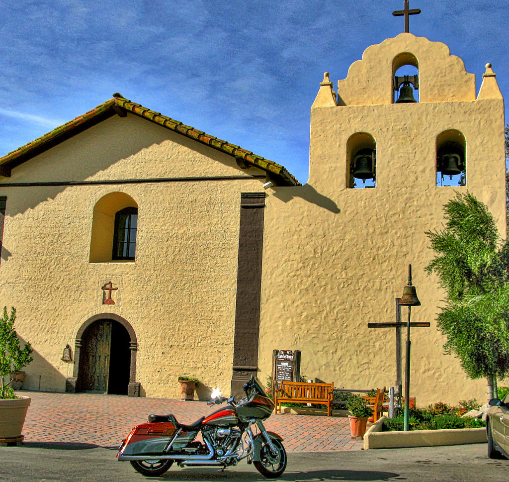
Old Mission Santa Ines - Mass is being said, Shhhh.....

Old Mission Santa Ines – Mass is being said, Shhhh…..
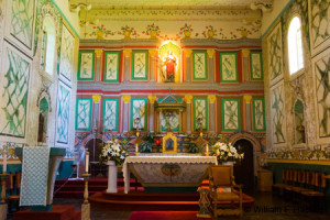
Obviously I didn't make it inside so I got this picture of the alter off the Internet.

Obviously I didn’t make it inside Santa Ines, so I got this picture of the alter off the Internet.

It’s a short ride from the Santa Ines Mission to Old Mission La Purisima Concepcion.  If you’re interested in what Mission life was really like, this is where you need to go.  It’s a California State Historic Park and after a nominal admission fee you will be walking a little.  I didn’t take the free guided tour, but I will be definitely be taking it in the near future when I come back.  I know I missed a lot just walking around.

 The grounds and buildings at La Purisima Concepcion are among the most complete and authentic Spanish Mission restoration projects in the West.
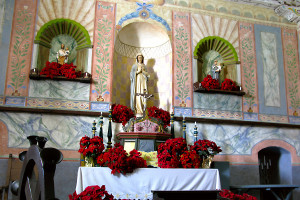
The grounds and buildings at La Purisima Concepcion are among the most complete and authentic Spanish Mission restoration projects in the West.

LPC 3Inside the chapel at La Purisima.  Services are only held here once a year on Founders Day so no problem getting inside for pictures.  When the restoration was done they made new adobe bricks and built the place like it was done originally.  I’m sure there’s some rebar here and there to ensure earthquake survivability.
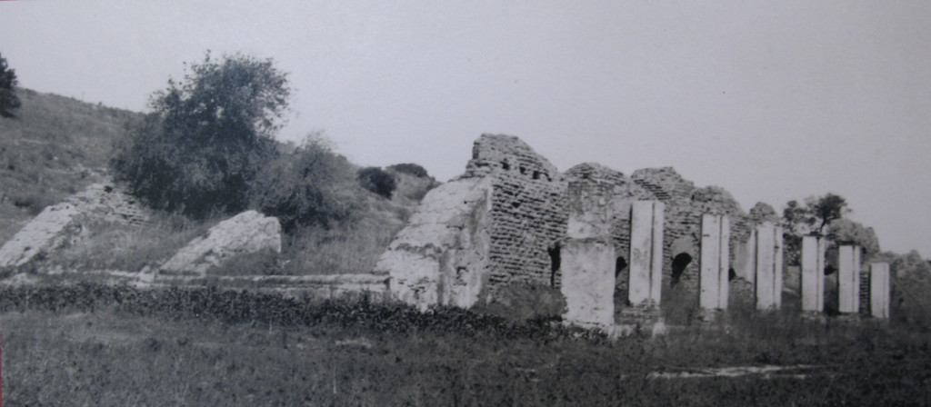
What was left of the living quarters before the reconstruction.
What was left of the living quarters before the reconstruction.

LPC 4

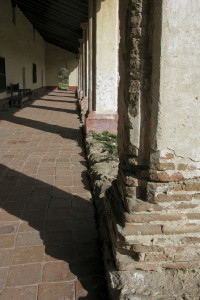
The porch was a gathering place.

Three of the pillars from the building above were used in the restoration and are the only original part of the reconstruction.  Adobe bricks kind of melt away when exposed to water so when the roof starts to leak the building is doomed.

Many forces worked together to bring an end to the mission system. The missions had served their purpose as the primary means of “settling” California.  By the 1830s the missions controlled about one third of the land that would become California, and the total population In the missions, presidios and towns that were formed had grown to about 30,000.  Also, the ever increasing settlers came to covet the lands and property of the missions.

California became part of Mexico in 1821. There was considerable support in Mexico City to end the mission system and the control of these valuable properties by the Catholic Church. Finally in 1831-32 the missions were “secularized” by the Mexican government. Land was distributed to the Indians (most of whom were quickly hoodwinked out of their holdings). The major beneficiaries were former soldiers, settlers and others with influence that were given large land grants. Many of the former mission churches became parish churches but some were abandoned and the Indians largely dispersed into the towns and ranches, or moved to the interior.

My plan was to go to more of the missions, and I will at some point but this post is long enough already and I want to get it published before Christmas.  So I’ll leave you with this:

CSL


Veteran’s Day – November 2014

Veterans Day is the day we should be remembering all the service men and women that are the very reason you are able to be reading this blog in English and as a free American.  Check out the link for a brief history of Veterans Day.veterans day cartoons - Google SearchEveryone should be required to serve two years in the military; that would solve a lot of problems.  At the very least, we wouldn’t have political hacks making decisions about our military and ultimately the safety of our country when the closest they’ve ever been is eating a TV dinner and watching an episode of McHale’s Navy.

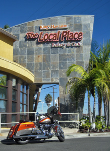
King's Hawaiian bread has a bakery & cafe just off the 405 in Gardena - YUM YUM!!

King’s Hawaiian bread has a bakery & cafe just off the 405 in Gardena – YUM YUM!!

In honor of Veteran’s Day, we thought we would take a little ride down to San Diego and tour the Aircraft Carrier Midway.  I did some research and noticed that the Battleship USS Iowa is on display at the LA Harbor, right next to the Cruise Ship dock.  That’s kinda on the way to San Diego so we decide to stop there as well.

First things first – Gotta put some fuel in the furnace.  I was going to stop at the Gaffey Street Diner (a Diners Drive-Ins and Dives location) down in San Pedro, but I had me a hankerin for some Hawaiian.  We used to make chow runs to this place when I worked at LAX.  The parking lot always has cop cars in it, so you know the food has to be good and reasonably priced – Perfect!!

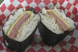
Spam & Egg Musubi - now THAT's Good Eats.

Spam & Egg Musubi – now THAT’s Good Eats.

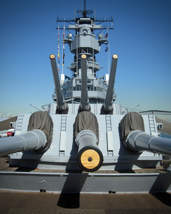
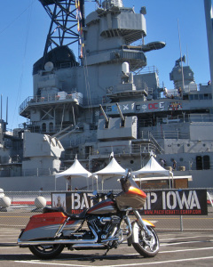
If I’m stopping at The Local Place I’ll be having at least one of these culinary delicacies.  It’s a simple thing, just some fried spam and a sliver of egg, surrounded by steamed rice wrapped up in a sheet of Nori (edible seaweed).  Now, I know that many of you would rather eat a green bug, but they are very good.  Hawaiians love their Spam.  When they are stocking up for hurricanes in Hawaii one of the first things the stores sell out of is Spam.  They have other VERY good food at the Local Place so you don’t have to eat spam if you don’t want to.  Also, if it comes with bread, that bread is of course King’s Hawaiian sweet bread, everything is most excellent I assure you.  Okay, back on the bike…VD5 IowaVD4 IowaDesigned in 1938 and built in 1940 when the closest thing they had to a computer was a slide rule, the Iowa-class Battleships (six were made) are quite a feat of engineering.  These battleships were fitted with an amazing amount of firepower.  Nine 16 inch guns capable of firing at targets up to 23 miles away and other guns of every shape and size all over the place.  It has to be seen to be appreciated.  The Iowa-class remain the most heavily armed gun ships the United States ever put to sea. The USS Iowa is a very interesting museum with an equally interesting history.  I could go on and on but if you’re interested, go ahead and click on the links and you can read much more about it.  The walk through of the USS Iowa only takes about an hour (you can stay longer) and is worth every minute.

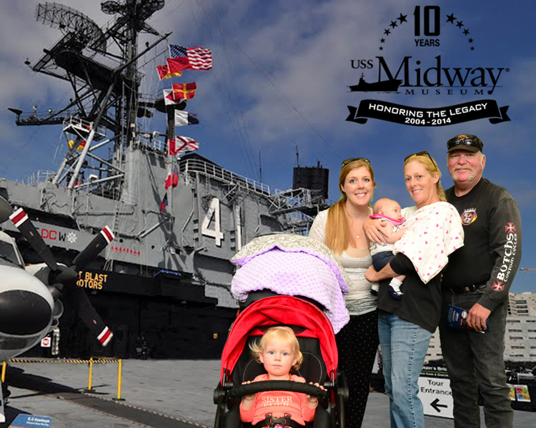
Robin had planned to ride with me but ended up driving down a day early for more grand baby time.  She did hop on the bike for the short ride over to the Midway museum.  We planned to go alone but Stephanie thought it would be a good outing for everyone so we got on the bike and Stephanie and the granddaughters followed close behind.

On the deck of CV-41 the Aircraft Carrier USS Midway.

On the deck of CV-41 the Aircraft Carrier USS Midway.

The Aircraft Carrier Midway is huge, you could easily spend the whole day there.  The flight and hanger decks are filled with military aircraft over the years including helicopters.  Many of the aircraft have dedicated docents and really, there are docents all over the place (same thing on the USS Iowa) that are more than happy to share information and/or stories for as long as you want to listen.  I was amazed at the vastness of the maze of hallways and compartments inside the ship.  I guess you’d figure it out since you wouldn’t be going anywhere else for a while, but I’d imagine it’s gonna involve some getting lost.

The little girls were absolute angels but we didn’t want to press our luck and were on and off the Midway in just over an hour.  It was a very good introduction and we’re all looking forward to a future visit and a more in depth experience.

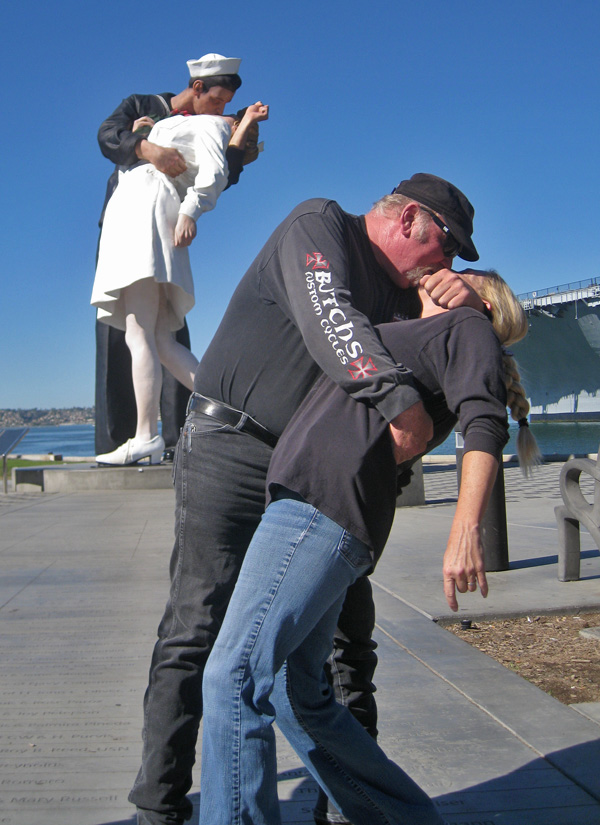
Unconditional Surrender Statue in Tuna Harbor Park, just south of the USS Midway

Unconditional Surrender Statue in Tuna Harbor Park, just south of the USS Midway

San Diego is definitely a Navy town and we couldn’t resist stopping here before we left.  I’m glad Stephanie was there so I didn’t have to find someone to take the picture.  The Unconditional Surrender statue has an interesting history.  It is “The Kiss” from Times Square but the artist said he based it on a photo taken by a Navy photographer Victor Jorgensen rather than the more famous shot (same people & time just a better angle) taken by Alfred Eisenstaedt,  The Navy guy’s image is public domain while Alfred’s is registered & copyrighted, etc.

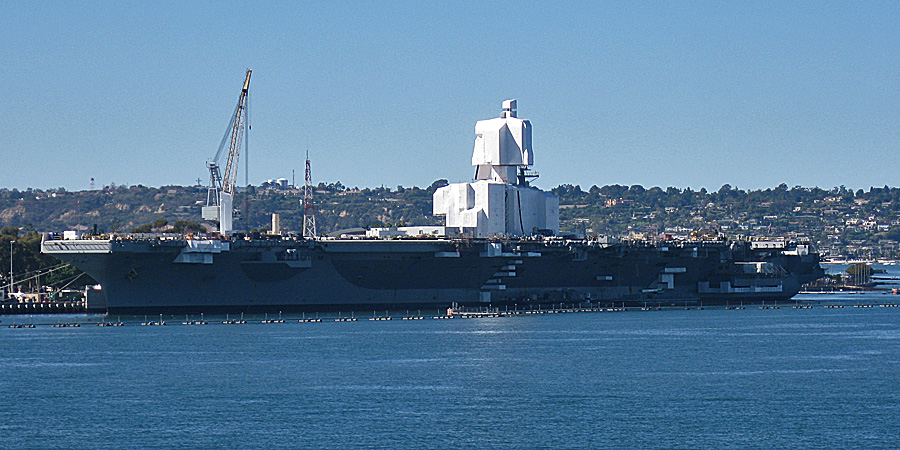
Across the harbor, the Ronald Regan Nuclear Air Carrier getting some fresh paint.

Across the harbor, the Ronald Regan Nuclear Air Carrier getting some fresh paint.

Moving and inspirational thoughts on Veterans Day have been voiced by people much more eloquent than I.  So, instead of trying to come up with something new, or quoting someone else, I would just like to thank all the veterans out there and their families that support their servicemen and women.  Without our strong and dedicated United States military, this would be a much different country – and world…..VD Cartoon1


Pahrump, Nevada – October 2014

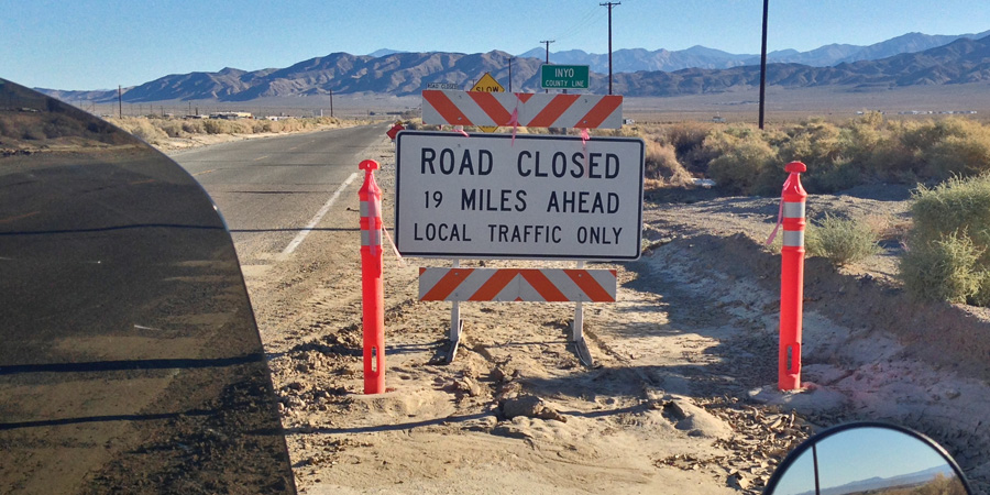
 I was on the road a couple hours before the sun came up this morning headed for a three day golf outing in Pahrump Nevada.  I made this ride this last year but the road was closed (washed out) north of Trona, California.  Instead of turning around and going back through Ridgecrest to 395 and up to Olancha, I opted for the detour.  That detour was, according to the gas station attendant, “a very good dirt road – no problem.”  Most of you have heard this story so I’ll just say that the detour road would have been “no problem” if I’d been driving a 4×4 Jeep – on a big full dress motorcycle it was a BAD JOKE; It took everything I had, some incredible luck, and a considerable amount of fancy language to navigate those 27 miles of hell. I won’t be doing that again…

This would turn most people around - I should have been one of those....

This would turn most people around – I should have been one of those….

This time I checked the status of the Trona Wildrose Road and it looked like everything was good so I thought I’d try it again.  Leaving so early gave me enough time to make a couple photo stops along the way and still make my tee time in Pahrump.

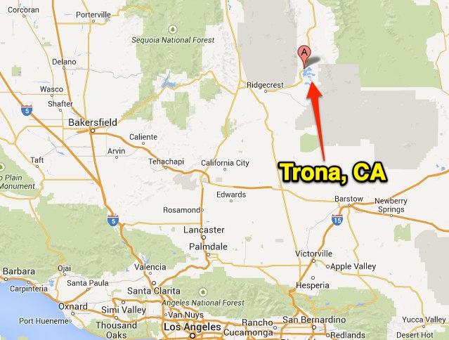
This will probably be more than you ever wanted to know about Trona, California.

This will probably be more than you ever wanted to know about Trona, California.

Trona was officially established in 1913, as a self-contained company town, wholly operated by its resident mining company to house employees.  The mine started as a borax facility but now processes sodium carbonate (soda ash) from the mineral “trona” in the nearby dry lake bed at Searles Lake.  Soda ash is most widely used in water softeners and in the production of glass.

Trona is known for its isolation and desolation. Because the searing heat and highly saline soil kills the grass, the Trona Tornados (from the 162 student high school) play football on the only dirt field in the USA (other than Alaska) . At one point Trona boasted an 18 hole golf course that was all sand except for the “greens”, which were a softer grade of brown colored dirt.  Wonder what a membership there cost??

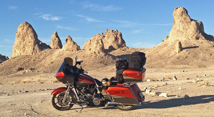
Sunrise at the Trona Pinnacles.  October 10, 2014.

Sunrise at the Trona Pinnacles. October 10, 2014.

Consisting of over 500 spires, some as high as 140 feet, the Trona Pinnacles are the most outstanding examples of tufa (porous rock formed as a deposit from springs of streams) in NorthAmerica.  The Pinnacles are about 10 miles south of town; 6 miles of which is dirt road.  Not bad, glad I went – but I won’t be signing up for that again any time soon.

The Pinnacles are recognizable in more than a dozen hit movies. Over thirty film projects a year are shot among the tufa pinnacles, including backdrops for car commercials and sci-fi movies and television series such as Battlestar Galactica, Star Trek V: The Final Frontier, Disney’s Dinosaur, The Gate II, Lost in Space, and Planet of the Apes.

Still pretty warm on an October morning.

Still pretty warm on an October morning.

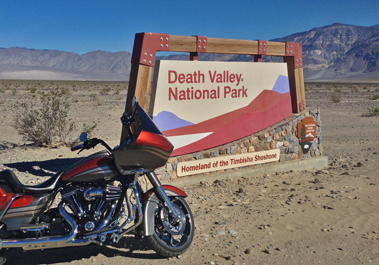
After Trona the ride goes through the Panamint Valley and then up over the Panamint Range and down into Death Valley.  Hwy 190 is the road into Death Valley from the west and the climb up over the Panamint Range is a wonderful motorcycle road.  Big sweeping turns and virtually no traffic so you can really have some fun if you want.  My buddy said that he used to take these turns at 90mph; I was a little closer to the speed limit in my trip up.  I did manage to get my GoPro camera working and shot a little video for you – the videos and music splicing should get better – this is my first attempt.

I decided to ride home after golf on Sunday instead of staying until Monday like most everyone else.  I stayed on Hwy 190 all the way to Olancha and took Hwy 395 south which really helped keep the sun off to my right & out of my eyes.  Although an enjoyable ride there wasn’t a lot of time to stop and smell the roses or take pictures.

Until next time…

Desert Run – September 2014

I normally reserve my trips to Phoenix for cooler times but once in a while a summer run through the desert isn’t all bad.  As always, I try to find a route that keeps me off the freeway – even though it takes a little longer, it makes the ride much more enjoyable.

My ride to Phoenix starts in Thousand Oaks and goes through Acton, Apple Valley, 29 Palms, then into Arizona at Parker, and up to Wickenburg before heading over to my Mom & Dad’s house in Peoria.  Between 29 Palms and Phoenix there is almost nobody else on the road and if you want, you can grab a fist full of throttle and make it a high speed desert run.  I stuck a little closer to the speed limit but I was still moving right along.  I did stop to take a few pictures along the way this time through, something I’ve been wanting to do.

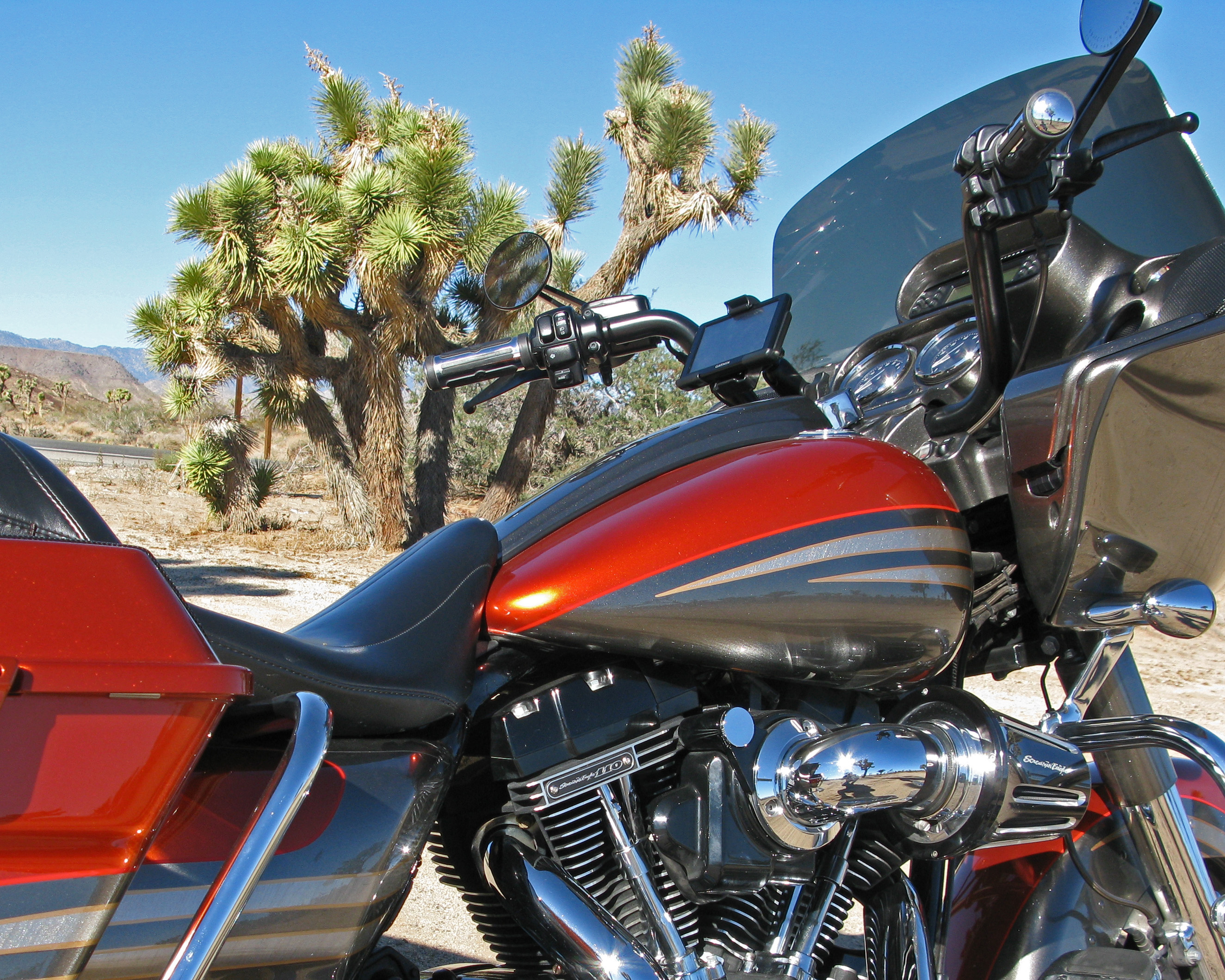
Joshua tree outside of Yucca Valley, CA.

Joshua tree outside of Yucca Valley, CA.

The Joshua tree (Yucca brevifolia) was named by a group of Mormon settlers who crossed the Mojave Desert in the mid-19th century. The tree’s unique shape reminded them of a Biblical story in which Joshua reaches his hands up to the sky in prayer. Joshua trees are fast growers for the desert; it has a top-heavy branch system, but also has what has been described as a “deep and extensive” root system, with roots reaching up to 36 ft away. It can live for hundreds of years with some specimens surviving up to a thousand years. The tallest trees reach about 50 ft. Once they bloom, the trees are pollinated by the yucca moth, which spreads pollen while laying her eggs inside the flower. The moth larvae feed on the seeds of the tree, but enough seeds are left behind to produce more trees.

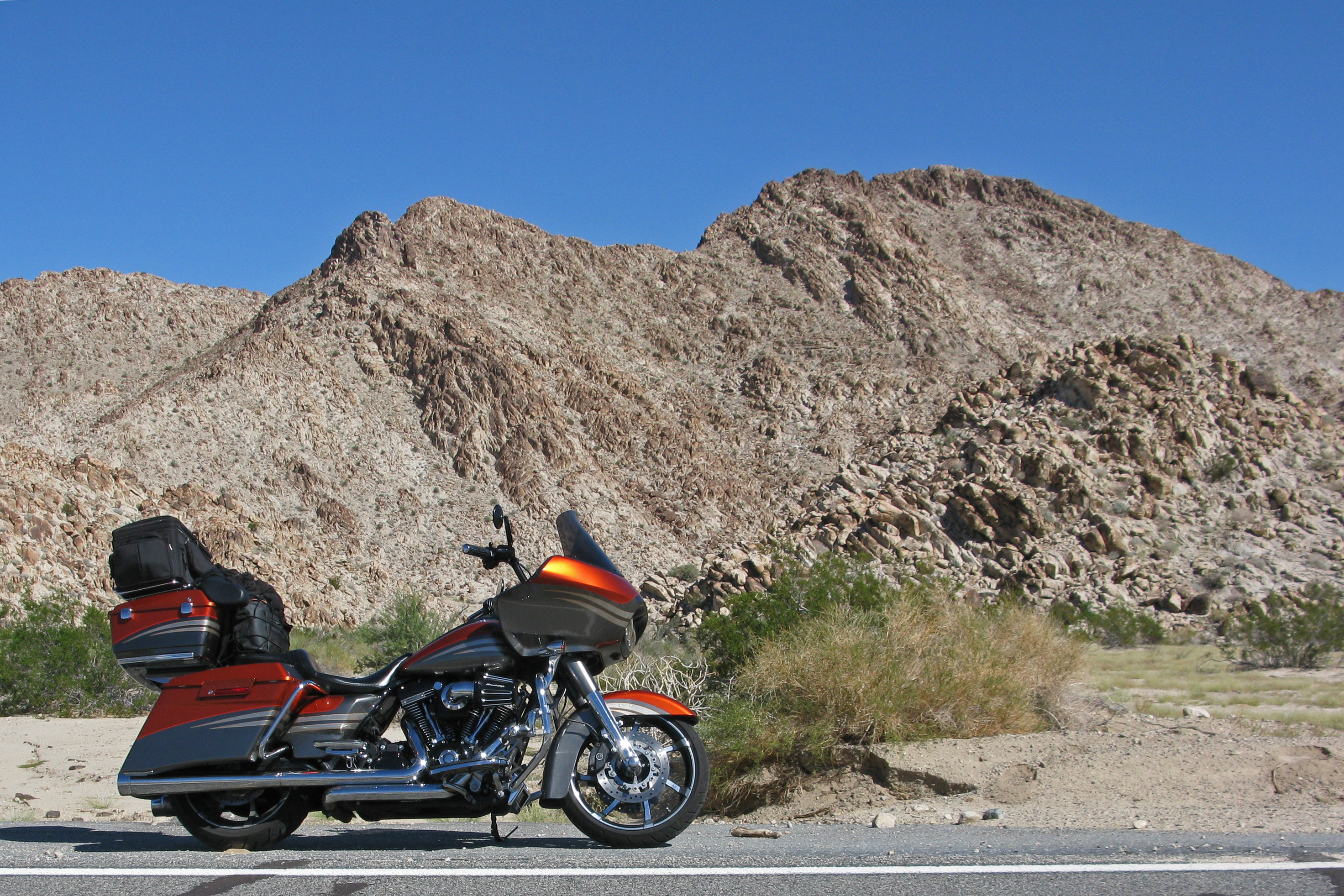
Chocolate Mountains - East of 29 Palms (hwy 62)

Chocolate Mountains – East of 29 Palms (hwy 62)

Mountains in the desert; when you’re eastbound on Interstate 10, just past Indio you make that big climb up to Chiriaco Summit you are going up the west side of the Chocolate Mountains, then it’s a gradual descent all the way to Blythe.  Hwy 62 is about 25 miles north and runs roughly parallel to Interstate 10; much more scenic – but still HOT.  It’s difficult to tell in the pictures but it’s hot enough that you really want to keep moving.

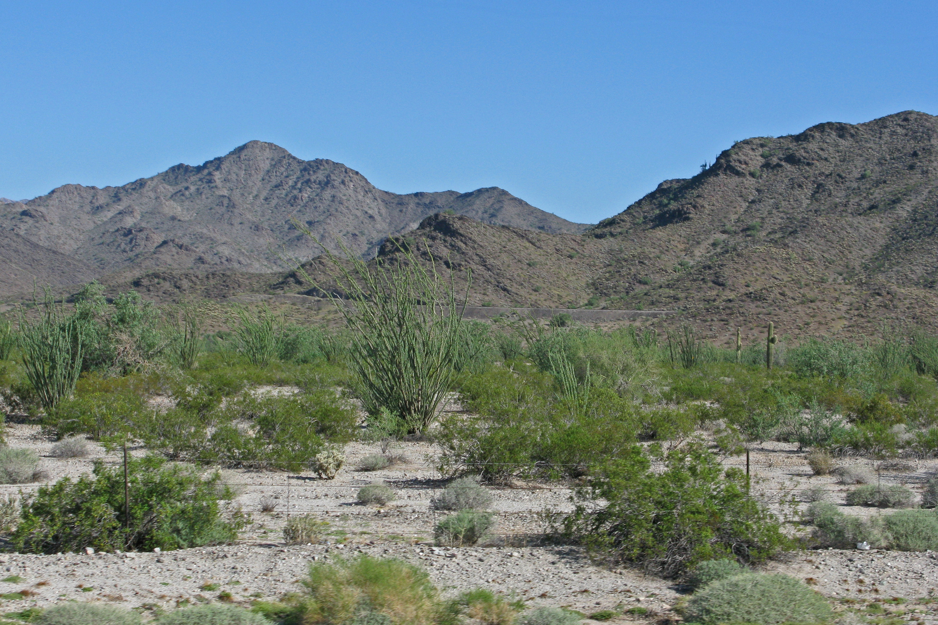
This is just about as green as the desert ever gets.

This is just about as green as the desert ever gets.

The Arizona desert looks a little different than the California desert, and it did a pretty good job of sucking up the water from the recent monsoon rains.  I sure would have liked to have been here when it started raining – the desert has a very unique smell when it starts raining.  It doesn’t look like this very often or for very long.

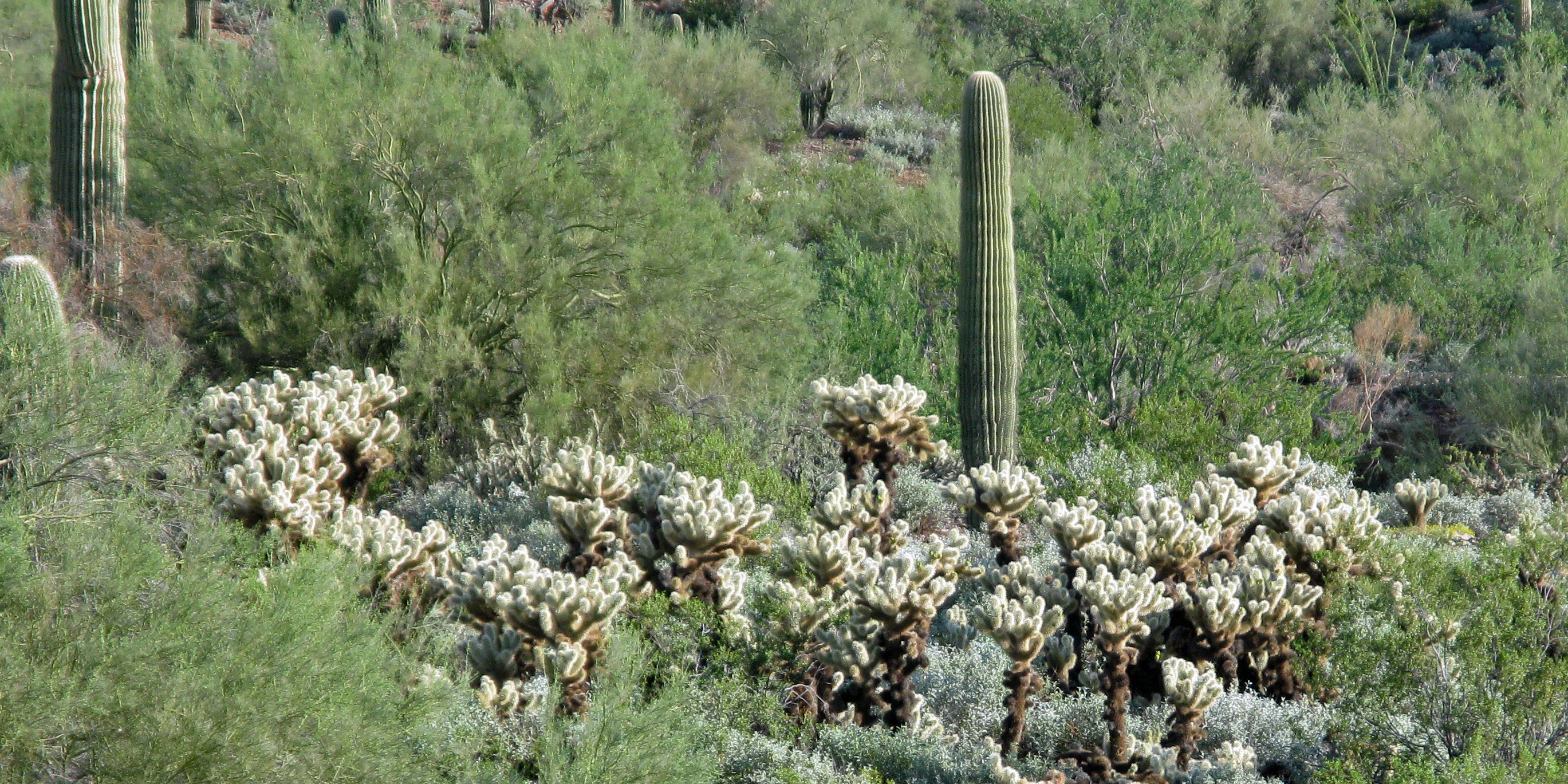
Teddy Bear Choilla Cactus (Jumping Cactus) - Stay Away!!

Teddy Bear Choilla Cactus (Jumping Cactus) – Stay Away!!

These little beauties are not to be trifled with.  Called “jumping cactus” because they seem to jump out and stick you – they don’t really jump.  The connections between the cactus stems is easily broken; the slightest touch will leave you wondering how to remove one of these nasty thorn covered segments without getting stuck a whole lot worse in the process.  I can tell you from personal experience – it ain’t easy and it hurts – A LOT.

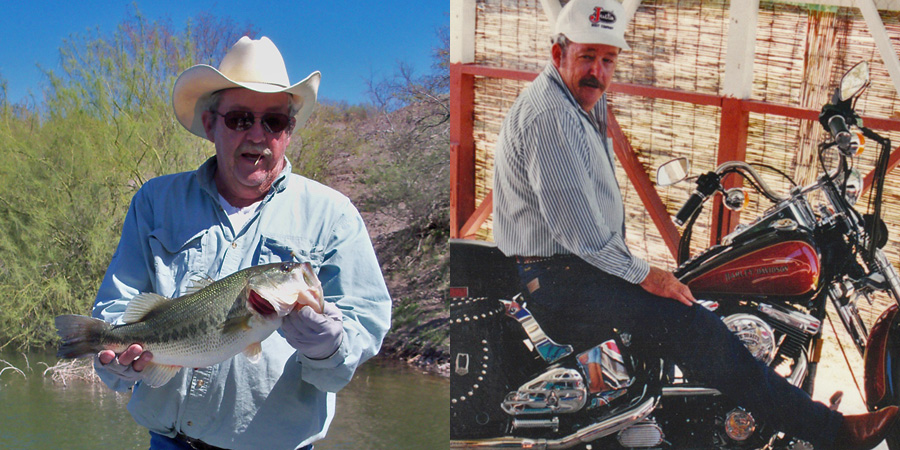
Sadly, the reason for my desert run is to attend the memorial services for my only uncle.  My father’s brother, Jackie was a great guy.  He will be sorely missed and fondly remembered by everyone that knew him.  Jackie loved the outdoors and spent as much time as he could either hunting, fishing, or on a motorcycle.  His passion was fishing though, and he must have caught well over a thousand bass in his life. Many of his friends shared some very nice stories at his memorial and the reception that followed.  Jackie enjoyed making other people laugh, and wasn’t above a little practical joke every now and then to make it happen. Jackie’s laugh was unique and infections.  On the way out of the memorial they played, “Happy trails to you, until we meet again….”, I could hear my uncle laughing about that and it made me smile.  I completely agree with the philosophy on death and dying printed on the inside cover of the memorial pamphlets at Jackie’s services.  You can check that out here if you’re interested.

Angostura Lake in Mexico - fishing out of my old Champion boat. Astride John's Harley at PopPop's house (Jackie's father) at either Christmas or Thanksgiving.

Angostura Lake in Mexico – fishing out of my old Champion boat.
Astride John’s Harley at PopPop’s house (Jackie’s father) at either Christmas or Thanksgiving.

I don’t like the heat that goes along with the desert but I grew up in this environment and it’s home to me and and it never looks better than when it’s all green.  I enjoyed hunting and fishing with my uncle but he and I never did get to go on a bike ride together.  On my way back to California I took the same route I took on the way out and it really seemed to me that my uncle was riding right there beside me.

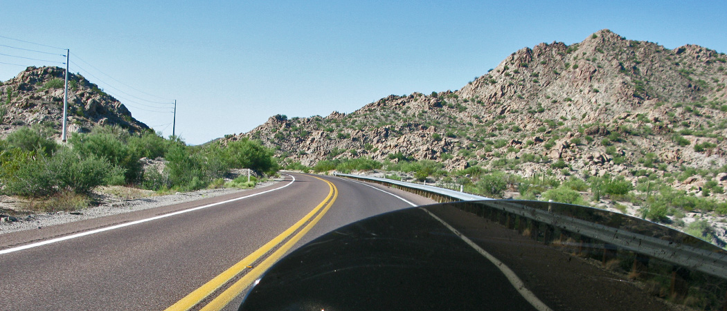
Between Lake Pleasant and Wickenburg - going home with Jackie.

Between Lake Pleasant and Wickenburg – going home with Jackie.

The ride back wasn’t nearly as hot as it was on the way out.  When I left my parent’s house I was thinking I would make my way down to the Interstate, but I was enjoying the ride so much that I just couldn’t spoil it by getting on the slab.

Highway 60 east of Wickenburg, Arizona.

Highway 60 east of Wickenburg, Arizona.

With the wind at our backs and the road to ourselves, Uncle Jackie and I enjoyed the back roads all the way back to Thousand Oaks.  I’ll miss my uncle but I’m really looking forward to having his spirit with me for the rest of my days….