This Year’s Adventure Begins

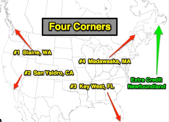
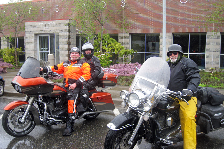
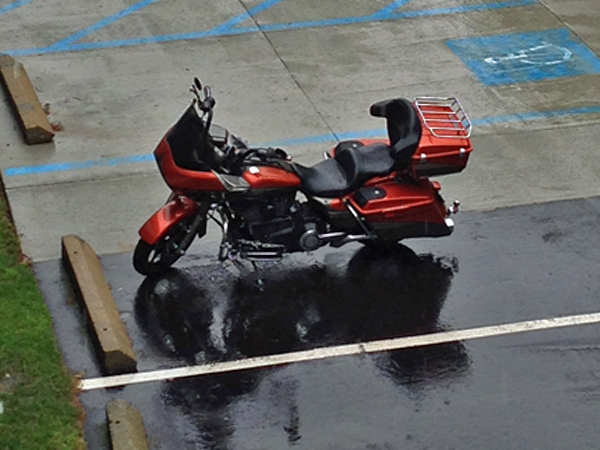
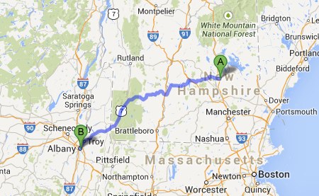
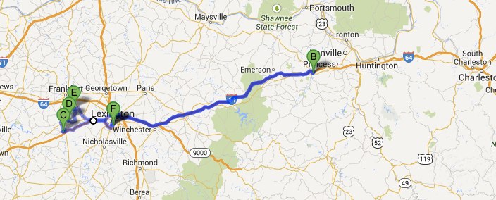
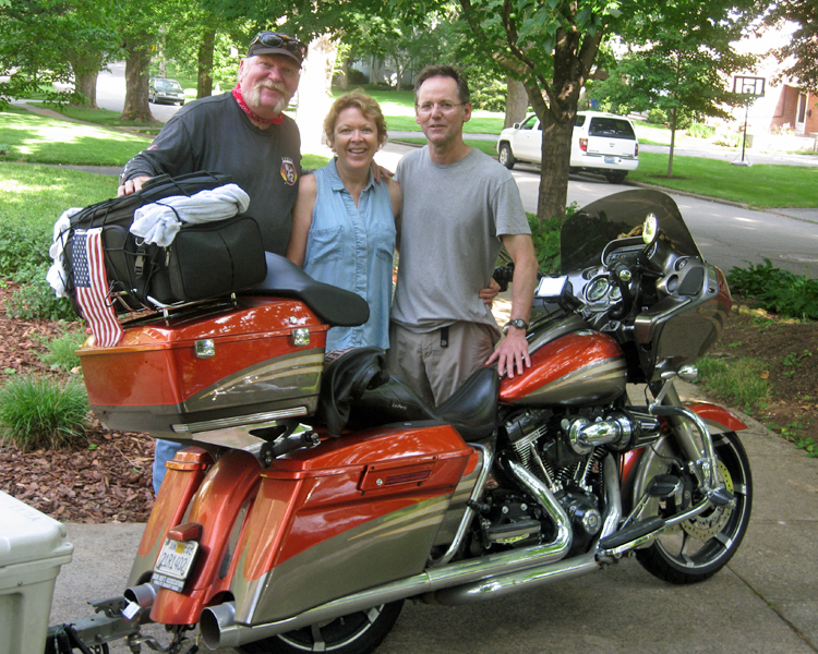
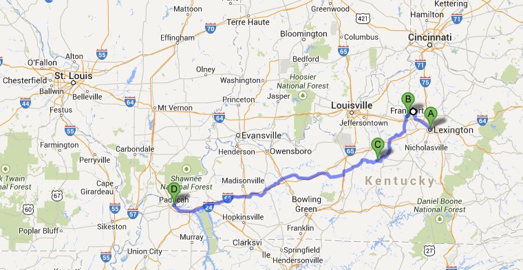
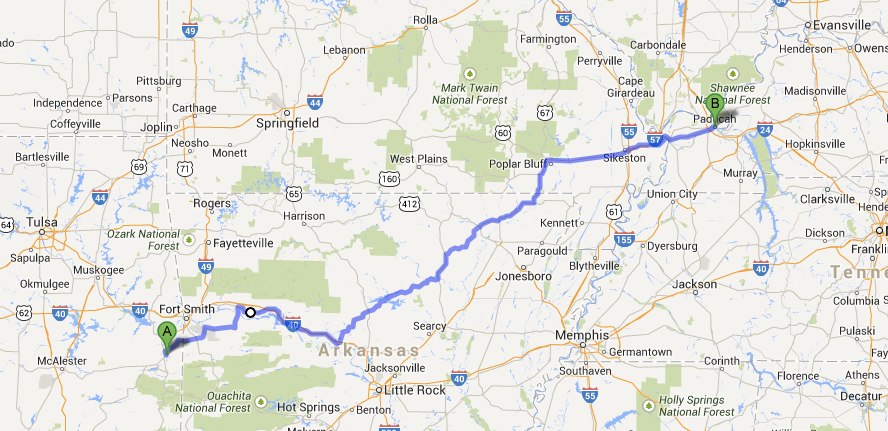
Here I go again – or more accurately, here “we” go. This year I’ve got company; at least part of the time. Robin will be there at all 4 corners and Newfoundland – and – I’ve got friends that will be joining me here and there along the way. Start date is April 2, 2014In the rain??

This is "Plan A" - the A stands for Always subject to change......

This is “Plan A” – the A stands for Always subject to change……

Day 1 – Thousand Oaks to Petaluma (429 miles)

Nothing fancy here, just a little ride up the 101. There was a lot of traffic leaving town and again in the San Fransisco area but since we didn’t bring the trailer we were able to maneuver our way through the congestion with ease.  There is one thing I love about California that no other state offers – the ability to legally cut traffic on a motorcycle.  Put the rain gear on – too late for the first batch of rain, took it off to eat breakfast and never put it back on; should have put it back on, but we didn’t. We were dried out by the end of the day though, so it’s all good.  Lagunitas Brewery for dinner and an adult beverage or three and Motel 6 within walking distance to lay our heads and prepare for tomorrows trip up to Roseburg, Oregon.

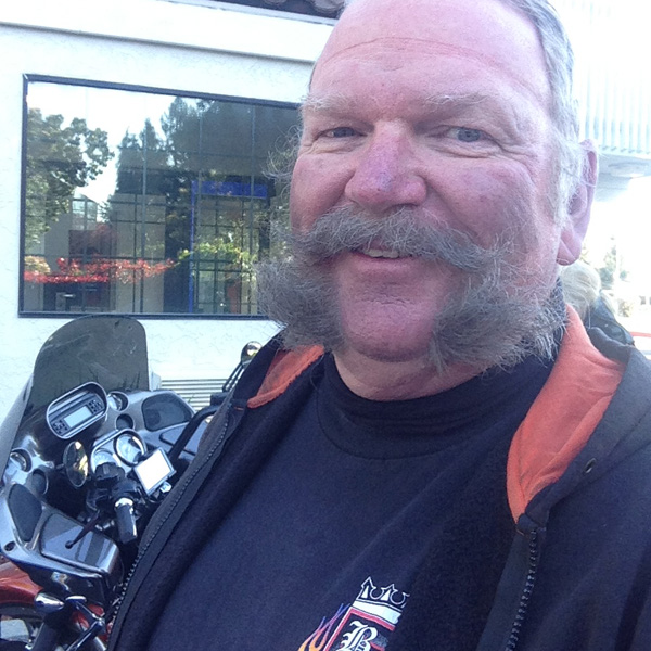
Now that's a mustache in need of some attention.....

Now that’s a mustache in need of some attention…..

Day 2 – Winston, Oregon (460 miles)

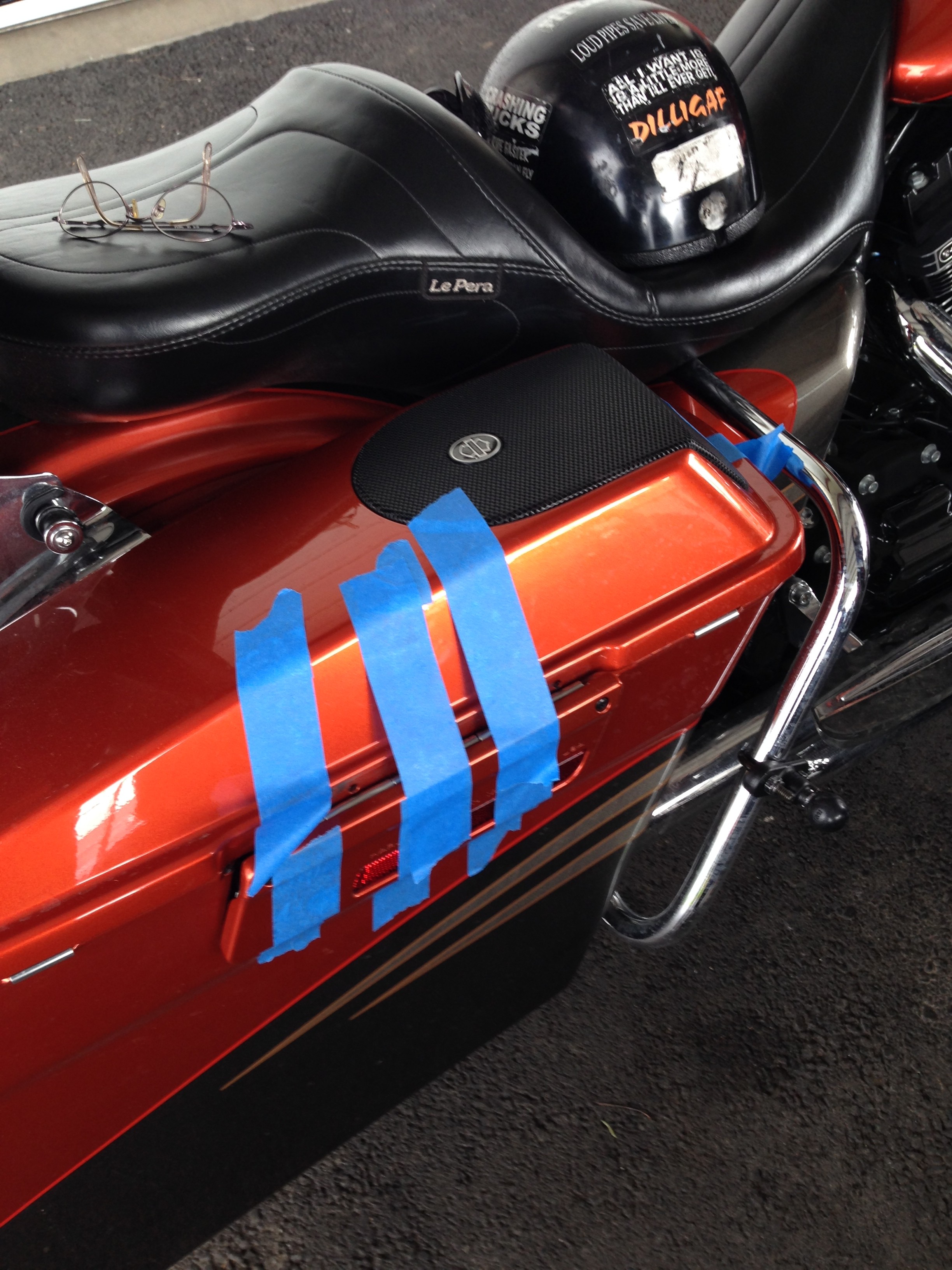
Based on the weather man we were sure to encounter some rain today but it was supposed to be after 1:00. So – we started out without the rain gear but packed it on top so it would be easy to get to. Destination – breakfast 160 miles up the road in Garberville, CA. There was no rain but the last 100 miles of this ride was COLD. We only had one electrical connection for two sets of heated jackets so naturally, Robin is the one with the heat. When we stopped for gas with 100 miles to go, she saw how cold I was and gave me the controller. When we got to Garberville – she told me that wasn’t going to happen again. I knew it was coming but I was sure happy to have the Gerbings heated jacket working for that portion of the ride. I was planning on stopping tomorrow for another controller but when we got to our friend’s house here in Winston, he had an extra – WHAT LUCK. So, now we’re both hooked up for warmth. When we stop to get my bike fixed I think Rich will be looking for an electric jacket. Oh yea, I didn’t tell you – ALL Five of the screws connecting the latch to my right saddle bag lid are gone. Robin took the lid off and luckily caught it before it fell. Tomorrow we will be stopping at the Harley dealer and getting that taken care of.  No rain all day was good.  We really enjoyed our short visit with Bill & Debbie and are looking forward to seeing them again on our way back down in a couple days.

Lid tape


Day 3 – Tacoma, Washington (328 miles)

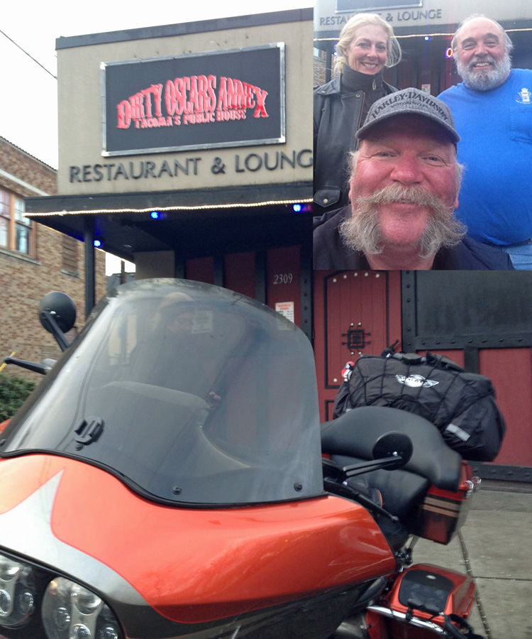
Little bit of a late start this AM but we don’t have a lot of miles to do and the time we spent having coffee and chatting with Bill & Debbie was not only enjoyable but allowed us to leave after a local rain shower had passed. We caught up to that rain shower and many others throughout the day. The rain gear worked pretty well though and we were mostly dry through it all. First destination this AM was Latus Harley Davidson in Eugene, Oregon (about 75 miles up the road). Despite being short staffed in the mechanic department they got my bike in and go the saddle bag lid repaired. It did take two hours but for at least half of that time it was REALLY raining outside so we were kinda happy to be inside. Destination #2 was the Gerbings heated clothing store. I thought my stuff would work after Bill gave me everything I needed but I was about a foot short & needed an extension cord.  They close at 4:30 though and my GPS said we would get there at 4:27. It was a fun ride up Interstate 5 in the rain trying to make the deadline. We pulled in at 4:22 but I now both Robin and I have our heat working (she found some electric glove liners at Latus’ that work VERY well). Last stop before the Super 8 here in Tacoma was Dirty Oscar’s Annex. Irish Death is their dark beer on tap, Parmesan tater tots, and their buns for their burgers are home made from pretzel dough. Food was excellent, company better.  We laughed and went over the events of the day, and days past.

– Life is GOOD –

Straight out of Diners Drive-Ins and Dives. We highly recommend this place.

Straight out of Diners Drive-Ins and Dives. We highly recommend this place.

Day 4 – Blaine, WA and back (297 miles)

Slept in a little this AM and it was a good thing. Riding in the rain all day takes a little more awareness. Up until today the possibility and probability of rain has been something we had to deal with – today it was the ACTUAL rain that we had to deal with. No back roads here, just a run up Interstate 5 to our first corner then back. I think it might have not rained on us for 20 minutes total. But we knew it was coming and were prepared as you can be for such events; cold and wet, just put up with it and get the miles behind you. We did have a very nice start to the morning having breakfast with my sister Sharon and her wife Sheri. Took us a while longer than anticipated to get there due to a bad address I picked up off the interweb the night before and my GPS revealing its sense of humor.  It was all fine in the end though – good breakfast with family and corner #1 DONE.  A productive day in spite of the adverse weather.

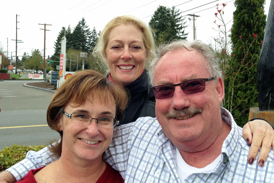
With Sharon and Sheri (At The Original Pancake House) - Bothell, WA. April 5, 2014

With Sharon and Sheri (At The Original Pancake House) – Bothell, WA. April 5, 2014

United States Post Office, Blaine, WA - April 4, 2014

United States Post Office, Blaine, WA – April 4, 2014

Day 5 – Winston, Oregon (332 Miles)

Started the day headed for Olympia and breakfast at the Black Bear Diner with Robin’s brother Rick and his wife Stacy. The ride out was wet, but nothing like yesterday’s all day rain.  Breakfast was very good and the portions there are monstrous if you ever go. Enjoyed the time and conversation with Rick & Stacy and were back on the road – this time without the rain gear. It was still wet here and there but nothing worth having all that extra rain gear on for. By the time we got out of Washington it was actually warming up. We were able to switch off the heat and eventually were riding without the chaps and winter gloves. Robin would like to mention that she was never warm enough to change out of her winter and heated wear. Looks like we’ll be out of the rain for the rest of the way – pretty dang happy about that!!

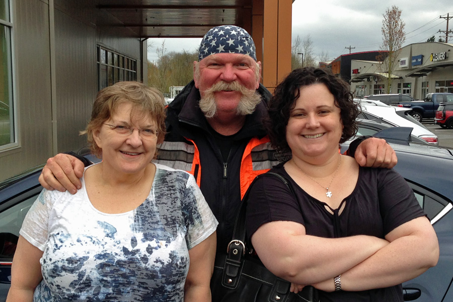
Robin with her Brother Rick and Stacy outside Black Bear Diner - April 6, 2014

Robin with her Brother Rick and Stacy outside Black Bear Diner – April 6, 2014

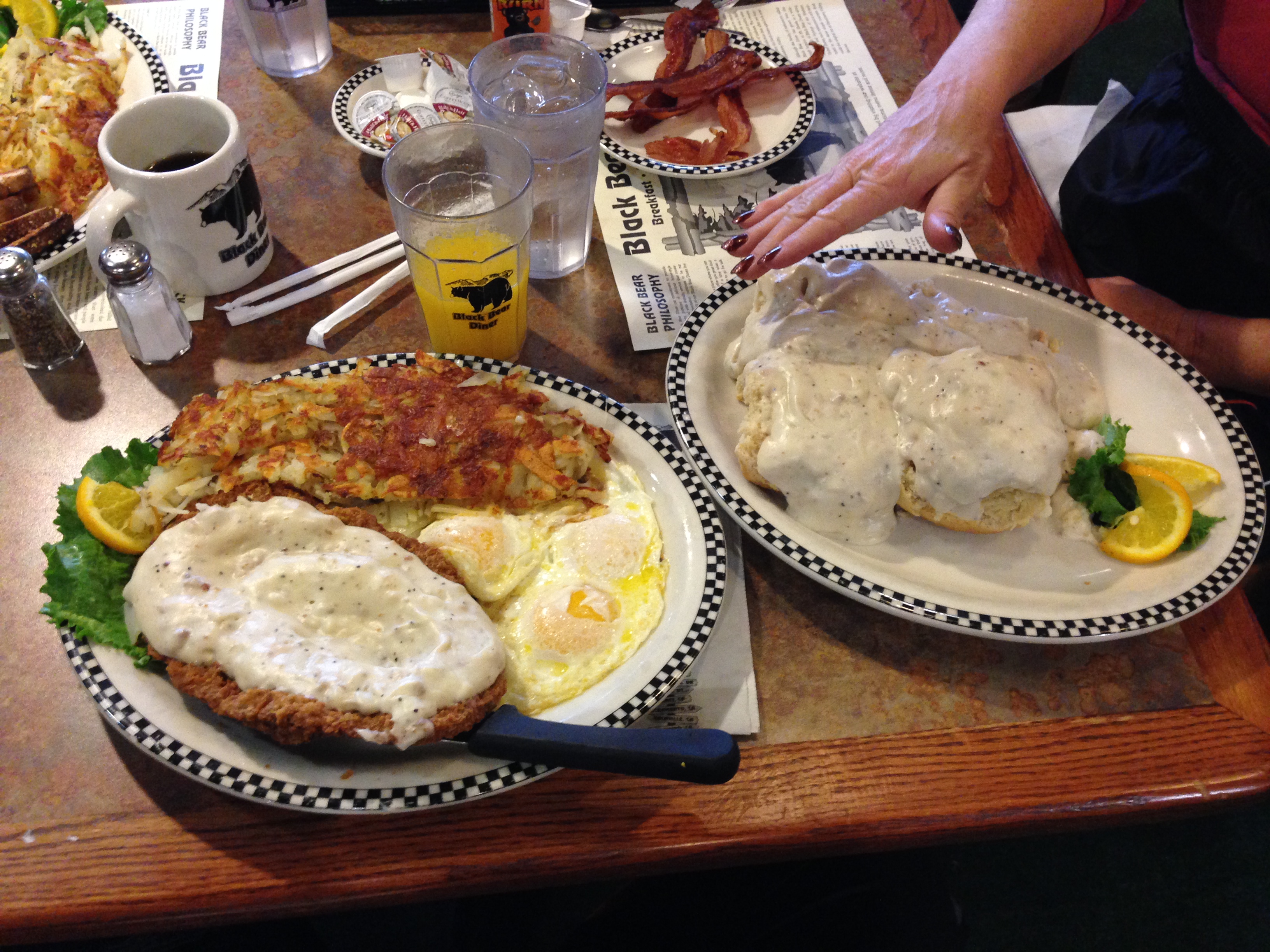
Chicken Fried Steak & Eggs. That's not a side of Biscuits & Gravy either, it comes that way!!!

Chicken Fried Steak & Eggs. That’s not a side of Biscuits & Gravy either, it comes that way!!!

Day 6 – Sacramento, CA (412 miles)

Bill & Debbie were kind enough to put us up again on our way back south. Not only that, but for dinner, Bill made smoked tri-tip that was mouthwateringly delicious. He had a little gizmo for his BBQ called a NanoQ; I’m going to have to look into gettin me one of those. After we dinner we sat around the table talking and laughing about our lives until it was time for bed. After a sound night’s sleep we were up early and on the road by 8:00. The ride to Sacramento was very cold to start with, and Debbie, you were exactly right about the fog making it quite a bit colder.  We stopped for breakfast at the Black Bear Diner again (it’s a chain, who knew…) but this time, I did not order the “Hungry Bear” portion and ended up with less than half as much food – and I still couldn’t eat the whole thing.  That was in Grants Pass, OR – it was warming up as we went farther south and that was FINE with us. By the time we got to Shasta even Robin was shedding some of her warm stuff. At the last gas stop for the day (120 miles north of Sacramento) we were all down to t-shirts. The weather should be pleasant all the way – maybe even a little warm, a welcome change for sure!!  Thanks again to Bill & Debbie, great people – great friends, great times.  See you again in June.

With Bill & Debbie at their house in Winston, OR - April 7, 2014.

With Bill & Debbie at their house in Winston, OR – April 7, 2014.

Day 7 – Thousand Oaks, CA (395 miles)

Up with the sun this morning and a fairly early start in an effort to beat the heat and get home at a decent time. Very doubtful that Rich will be able to beat the traffic since he has so much city riding to do to get home but Robin and I shouldn’t have too much problem. Hwy 99 kinda parallels Interstate 5 southeast through central California. We were on Hwy 99 which more of a “rural” route. Interstate 5 doesn’t really even go through any “towns” after you leave Sacramento until you get down to Los Angeles. Anyway – along with rural goes farm equipment on the roads.  There was a livestock trailer at one of our gas stops that was leaking the contents of it’s floor all over the ground. The odor was enough to make you gag and it took some effort to avoid the “slick” left in it’s wake on his way out of the station! We were making pretty good time on old 99, in fact on this whole trip I don’t think anyone really passed us on the road. That is until we got our tail feathers clipped in Bakersfield. A motorcycle officer for the CHP thought we should have a little chat that included a reminder that 80+ mph in a 65 mph zone was a little too fast. We thanked him for the warning and were back on the road looking for the local A&W because it was HOT and one of those is kind of a ride tradition.  The A&W that my GPS took us to (only one exit south of where we got pulled over) had turned into a Popeye’s Fried Chicken place. Nothing else really on our way before we were going to be going our separate ways.  SO – one last tank of gas, we said our goodbyes and we were on the last leg of this trip. The cooler air going up over the Grapevine was very nice and although it was hot in the valley, it wasn’t that bad.

Home for a little over a week now and then I’ll start on the next 3 corners of my little adventure. Should be pulling out of here on April 18th – see you all again then…..

Last leg of this trip. Leaving Bakersfield, CA - April 8, 2014

Last leg of this trip. Leaving Bakersfield, CA – April 8, 2014

Day 8 – San Ysidro, CA (241 miles)

Got on the road this morning heading for corner #2. We stopped here and there along the way and it took most of the day to make this rather short (comparatively speaking) ride. First stop was to see some dear friends of ours in Claremont.  It was sure good to see Glenn & Marlene again. On down the road to the Menefe area. Lester just closed on his adobe hacienda about half a mile off the paved roads. The walls of that house are two feet thick!! After exchanging a little paperwork we were back on the road for corner #2.  I made a bit of a mistake here and couldn’t get both of us in the picture – won’t happen again though.  From there we headed over to our daughter’s house.  Dinner with all the children was great, family is the most important thing, and everyone is doing well………

All filled up and ready to roll.

All filled up and ready to roll.

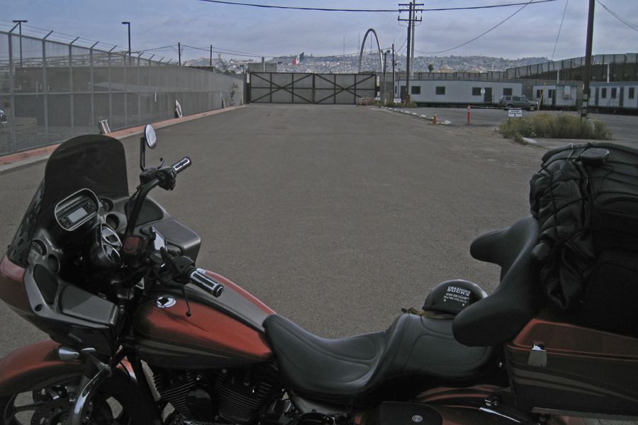
San Ysidro , CA - April 18, 2014.  Sadly no tripod but Robin and I were both there.

San Ysidro , CA – April 18, 2014. Sadly no tripod but Robin and I were both there.

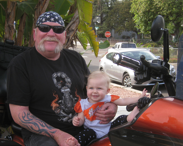
Grandpa and Annabelle. Can't wait to take her for her first ride.

Grandpa and Annabelle. Can’t wait to take her for her first ride.

Day 9 – Peoria, AZ (374 miles)

Cool & overcast this AM and heading out on my own for a while. Robin will be back with me when I get down to Fort Lauderdale, FL for the last two corners – I miss her already.

Leaving Lemon Grove (San Diego) April 19, 2014

Leaving Lemon Grove, CA. April 19, 2014 (in my new Les Wheatley Equipment Rental t-shirt)

Found a great motorcycle road this morning.  Hwy 94 eastbound out of San Diego.

Hwy 94 - east of Lemon Grove, CA  April 19, 2014

This sign means – Good Motorcycle Road Ahead.

April 19, 2014   (374 miles)

April 19, 2014 (374 miles)

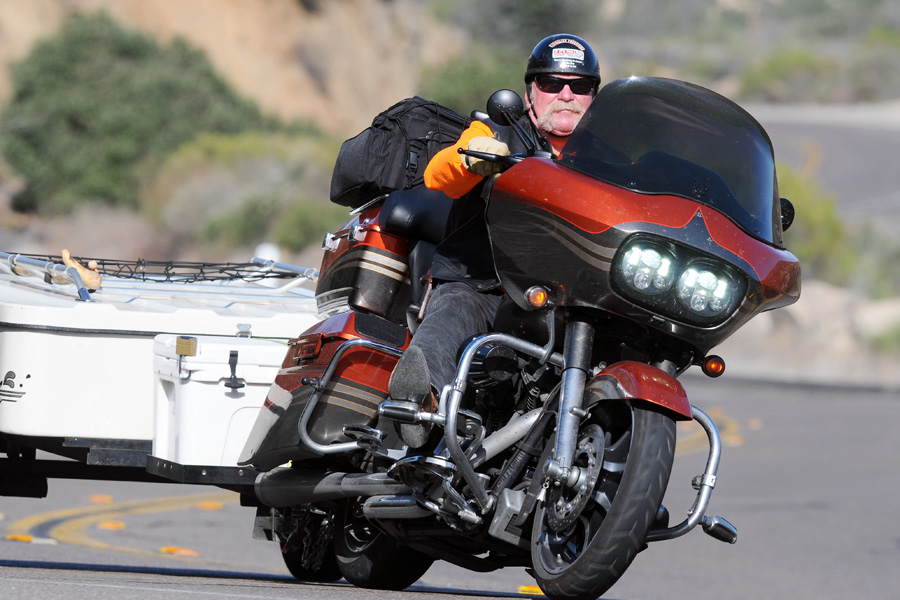
On Hwy 94 there was a guy taking pictures. He puts the pictures up on his web site and if you want one, he’ll be happy to sell you prints or a digital images kinda like the pictures at the end of the log ride at Disneyland. I saw him when I went by but I was going way too fast to try to stop, so I turned around and went back to see if he got my picture and to verify his web address so I could go look at them. We talked for about 15 minutes about motorcycles, cross country rides & bucket lists. I would like to thank Doug Aguillard from www.motophoto.us for the images and hope he enjoys going “along for the ride” as a blog subscriber.

Going up Hwy 94 – courtesy of Doug at www.motofoto.us

Things started seriously warming up after that picture was taken. Doug told me that this weekend the Yuma Prison Run was going on and I thought I might go to the ride end point at the fair grounds there in Yuma and check it out. Wrong – too hot to be standing around just out of curiosity.  Hwy 8 to Gila Bend (pronounced He-la) then northbound to the slab. Rolled into Peoria around 4:00 PM.  Looking forward to some more family time here in Arizona.

P.S. Checked out that web site and – I’m putting the next Yuma Prison Run on the calendar.

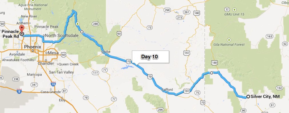
Day 10 – Silver City, NM (358 miles)

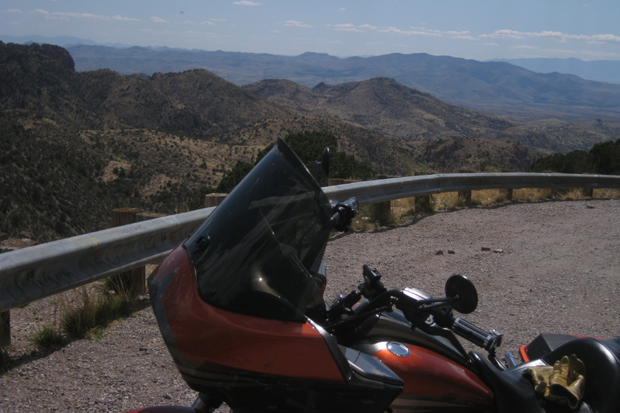
Got out this AM without breakfast as that is the tradition, you gotta earn it. Besides, I get kinda tired with a full belly; no sense in starting out tired. Breakfast ended up being half a bag of Funyuns and a Monster energy drink at a gas station outside of Fountain Hills.  Mmm Mmm Good.  You know, I’ve lived in California for more of my life than I’ve lived anywhere else combined but Arizona always “feels” like home to me. There is no place I’ve ever been that’s quite like the Arizona desert. Today the cactus was blooming and the weather, while warm, wasn’t too hot – perfect.  I tried to find a Saguaro in bloom but they were mostly just starting to bud. The ride up toward Payson took me up to 5,500 feet before descending into the Tonto Basin and Roosevelt Lake. From there I went through Globe down to San Carlos. It did get hot while I was standing next to my bike for 25 minutes in a line of stopped traffic – based on the wadded up cars on the flat beads, it was a pretty bad accident – glad I missed it (one is enough!!).  On to Safford for lunch then a left turn up into the mountains.  One thing I found quite strange when I was leaving Arizona and going into New Mexico.  I stopped to take a “Leaving Arizona” picture at the crest of the mountain and in less than a mile I was in New Mexico. The funny thing was that on the Arizona side of the mountain it was high desert landscape. As soon as I started down the mountain on the other side the pine trees were everywhere and 80 feet tall.  There weren’t even any scrub pines on the Arizona side.  Imagine the early settlers going through that pass; what a surprise!  It’s cool enough here in Silver City. Last year it was going to freeze overnight so I got a Kozy Kabin at this KOA instead of tenting it, this year I was going to Motel 6 it ($15 cheaper than a Kozy Kabin) but the weather is good so I’m back at the KOA in my tent. Met a real nice guy with a side car Harley here we talked for an hour about this and that but I’m already long on this post so that story will have to waitsome.  So much to tell, so little time….. Rest assured though – It’s ALL Good.

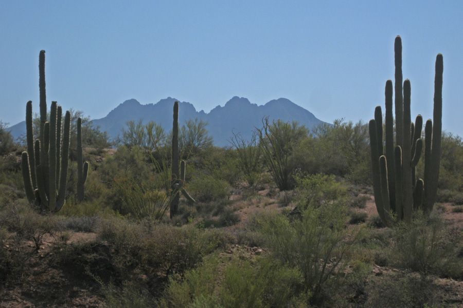
Four Peaks - April 21, 2014.  I used to laugh when I saw people taking pictures of cactus.....

Four Peaks – April 21, 2014. I used to laugh when I saw people taking pictures of cactus…..

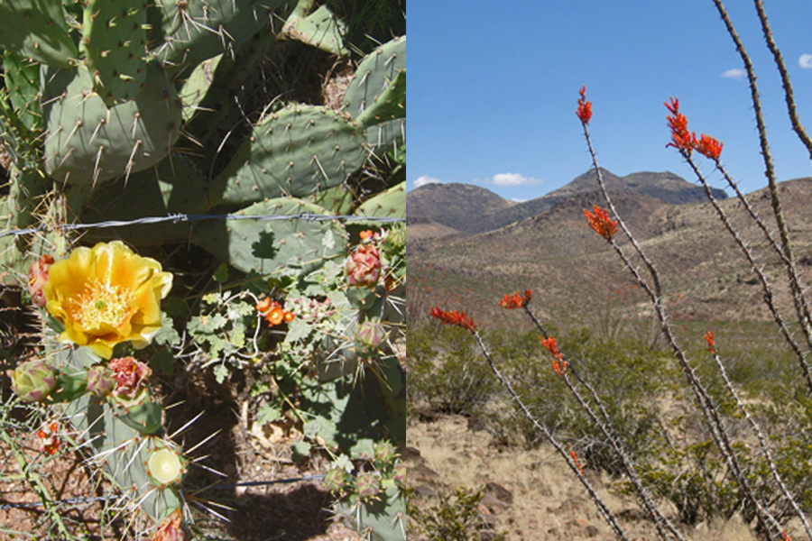
On the left is a yellow prickly pear blossom and the pink flowers are something we called "loco weed" because if the cows ate it, they got crazy. On the right the Ocotillo cactus are sporting their flames at the ends of their branches.

On the left is a yellow prickly pear blossom and the pink flowers are something we called “loco weed” because if the cows ate it, they got crazy. On the right the Ocotillo cactus (actually not a cactus) are sporting red flames at the ends of their stems.

That's Arizona in the background - New Mexico is just a mile away. The other side of the mountain has 80 foot pine trees everywhere - not a cactus in site.

That’s Arizona in the background – New Mexico is just a mile away. The other side of the mountain has 80 foot pine trees everywhere – not a cactus in site.

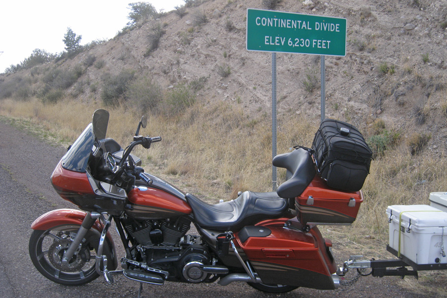
I have a few Continental Divide pictures from my travels, this is the first one with my new bagger. Hwy 180 just north of Silver City, New Mexico.  April 21, 2014.

I have a few Continental Divide pictures from my travels, this is the first one with my new bagger. Hwy 180 just north of Silver City, New Mexico. April 21, 2014.

10 - Map

Day 11 – Van Horn, TX (344 miles)

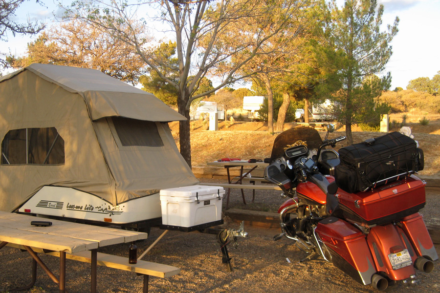
Home Sweet Home at the Silver City, NM  KOA April 21, 2014

Home Sweet Home at the Silver City, NM KOA April 21, 2014

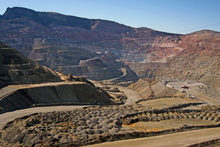
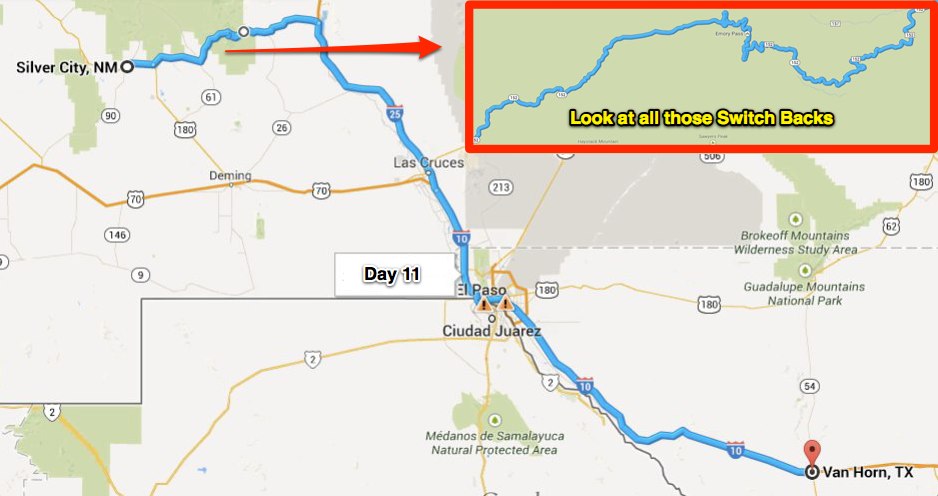
Cold last night here in Silver City, New Mexico, and still pretty dang cold this morning. I didn’t want to get out of bed until someone started a fire – but wait, this isn’t Red’s Meadows – and… besides, I was usually the one that started the morning fire anyway.  But I digress – I decided that a hot shower would be just the thing, so I got up and took one.  I spent A-While in there hoping that the sun would start shining on our situation and warming things up. That’s exactly what happened. I took my sweet time getting things wrapped back up for the road and headed for Hwy 152 (check out that link – I went the other direction but it’s a very good walk through).  A few miles after I got on 152 I came across the Chino Open Pit Mine. There were other mines along the way but I stopped here because they had a viewing area.

Chino open pit copper mine - once the largest in the world. In business since 1909

Chino open pit copper mine – once the largest in the world. In business since 1909

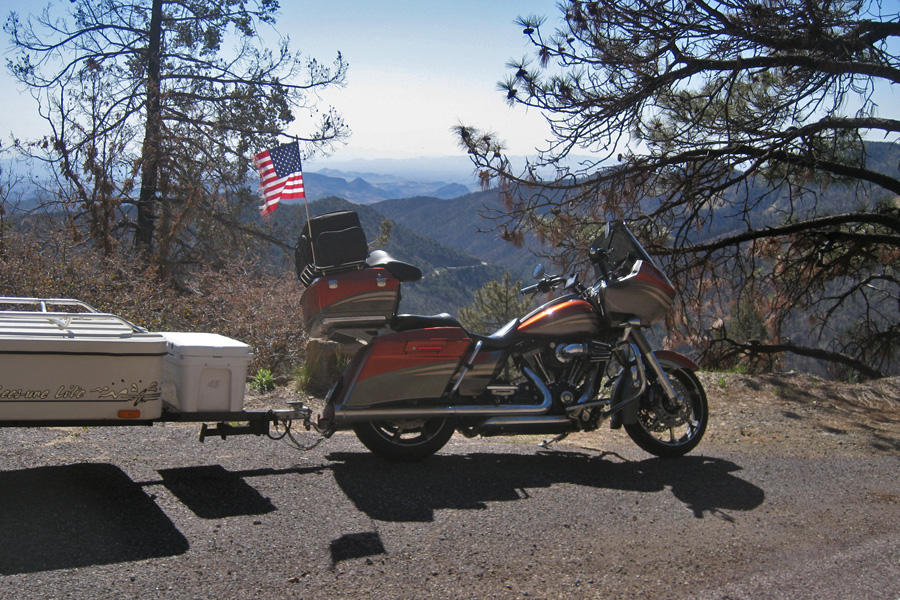
On up the road to Emory Pass at the very top of Hwy 152. This mountain road was very slow going but still a nice way to start the day.

Emory Pass on New Mexico's Hwy 152.  Elevation 8,828 - April 22, 2014

Emory Pass on New Mexico’s Hwy 152. Elevation 8,828 – April 22, 2014

After spending so much time going so slowly and making so many turns, I didn’t feel too bad about doing some straight up time on the slab to get where I was going. Interstate 25 is hardly an Interstate but I-10 certainly is. This part of the ride was actually kinda difficult because of the wind. I’d say constant 15 gusting to 25 and mostly a head wind but it swirled around enough to make you pay very close attention. With that much wind my speed on the 80 mph Interstate was just 65; That almost makes you a road hazard!! And out here in Texas (most states actually) there isn’t a separate truck speed limit. Tractor Trailers blowing by you at 85 on a windy day – well, let’s just say I’m not looking forward to doing that again any time soon.  It’s all good now though and I plan to be off the Interstate for the next few days.11 Map

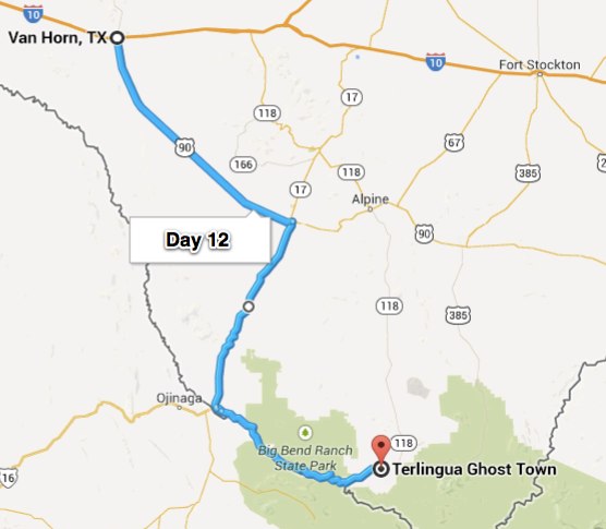
Day 12 – Terlingua, TX (237 miles)

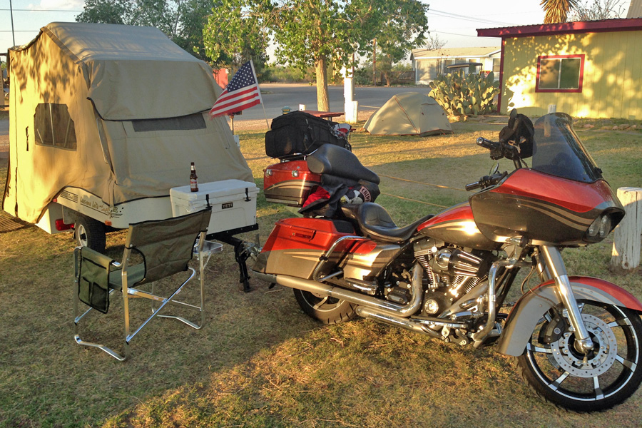
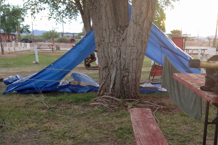
What a crossroads here at the Van Horn KOA – the guys on my right are on their way from Houston to Phoenix. One guy just built a skate park in Houston and since it was time to go, he flew his buddy out from Phoenix and they are headed back together – hitting all the best skate parks along the way. The guy on my left is a geological scientist from Denver and is out on his two week vacation he takes every year, riding his bicycle. I may actually see him again because he is driving down to Big Bend today to ride around that park. I was telling him about my little adventure and come to find out – he has ridden Hwy 152 in New Mexico on his bicycle BOTH directions. Gotta have some strong legs for that for sure!!

Van Horn KOA, April 22, 2014

Van Horn KOA, April 22, 2014

One of the reasons I like this KOA is because they have a Kafe (KOA starts everything they can with a K) that serves pretty good food. I was hoping that when I rode in that they would still be open and they were – tonight’s special, brisket (smoked by the owner), mashed potatoes, and corn. The food was excellent and the company was even better. You can see the tent sites from the dining room and a few people had been watching me make camp. One of them, name of Fred, invited me to sit with him and we were joined later by the owner’s wife, Gee.  Great to meet new people and share stories across the dinner table.

My neighbors - they are on the "blue tour"

My neighbors – they are on the “blue tour”

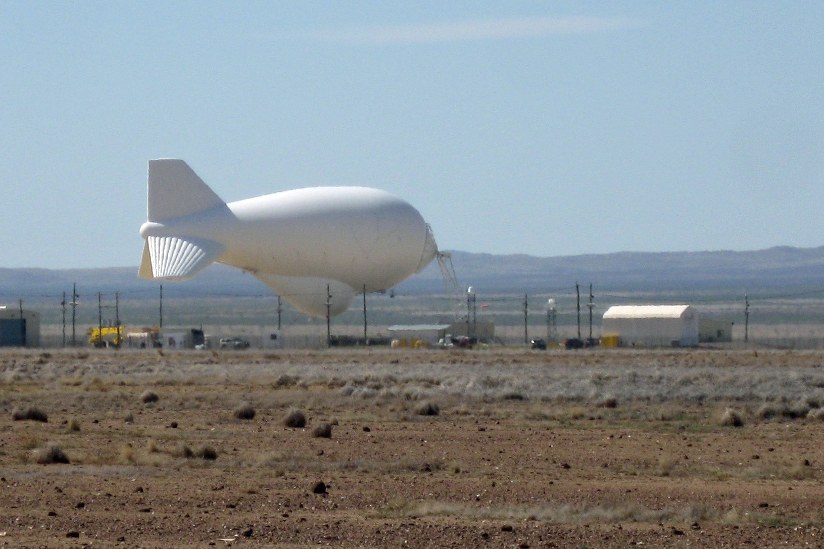
First notable thing I saw this morning on the way to Terlingua was this Department of Homeland Security radar balloon. The Aerostat System has been in use since the 1980s.  It uses giant tethered balloons at locations in Texas, New Mexico and Arizona to scan the border area with radar to detect low-flowing aircraft carrying drugs or other contraband.

RADAR balloon in the down position - too windy I'm guessing.....

RADAR balloon in the down position – too windy I’m guessing…..

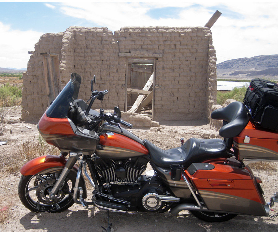
As I was leaving Marfa, I saw this old adobe house and thought I’d take a picture.  The ground around this structure is deceptively SOFT.  I had to put a large rock under my kick stand and getting out required quite a bit of spinning the rear tire and gnashing of teeth…..

Dilapidated adobe building just outside Marfa, Texas.

Dilapidated adobe building just outside Marfa, Texas.

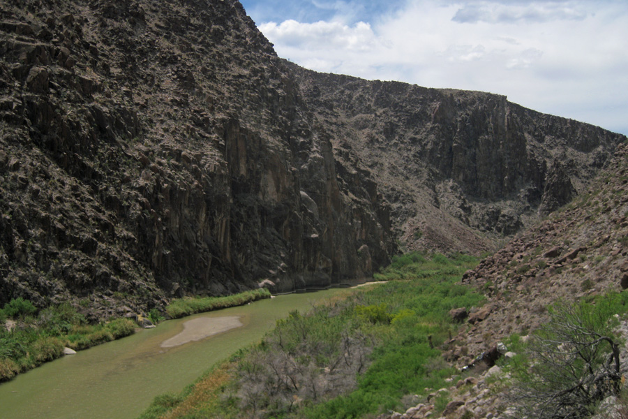
The road from Presidio to Terlingua one of the Scenic Byways listed in the book I have. The locals call it River Road – as you can see it goes right next to the Rio Grande. I was so close to Mexico that my phone thought I’d crossed the border.

The Rio Grande. No border fence necessary here.

The Rio Grande. No border fence necessary here.

12 Verizon12 Map


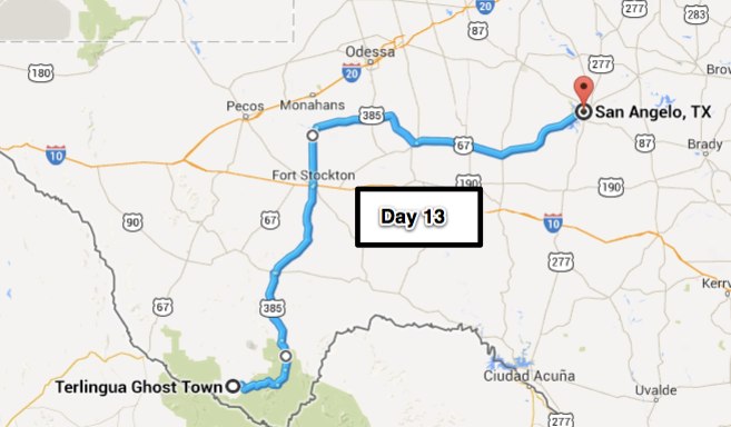
Day 13 – San Angelo ( 372 miles)

Yesterday’s post was getting long and I knew that there wasn’t going to be much to report on a day when I was riding across the Texas plains so I saved a little of yesterday for today.

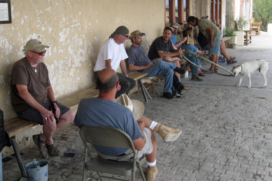
Remember the guy that invited me to eat with him in Van Horn (Fred)?  Well, he told me that he was heading out to a job that was pretty much where I was heading and that he would like to meet me in Terlingua at the Starlight for dinner. Said that he’d be back in cellular coverage a little after 5:00 & to call him. He also promised to put me up in one of the bungalows at a ranch style resort that he helps manage; I assured him I would be there. I rode into Terlingua a couple hours early but I can always find something to do. I pulled up in front of the Starlight mostly just to see exactly where it was so I could come back in a couple hours. Right next to the Starlight is the Terlingua Trading Company. On the porch were 10 or 12 locals drinking beer, soda, or water and catching on anything they might have missed since the last time they were “on the porch” which as they say is the “hub-ub of activity.” I was invited to join them and did. The stories were flying and the dogs always wanted to play.

Sitting on the porch out front of the Terlingua Trading Company. Where the locals gather

Sitting on the porch out front of the Terlingua Trading Company. Where the locals gather

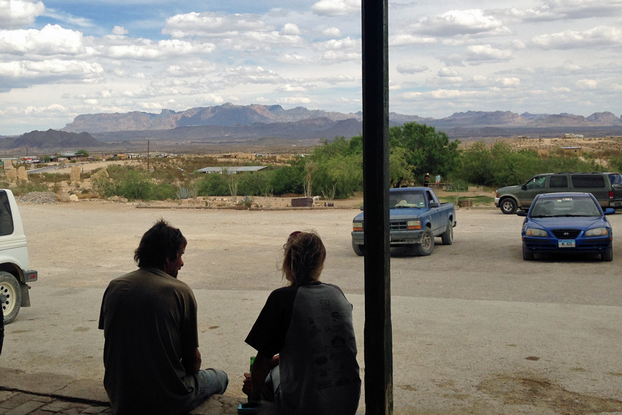
I was told that they had cold beer inside and that sounded good to me. I got talked into buying a 6 pack (6 for the price of 5). You just write your name on a sheet of paper and cross off your beers as you get them out of the fridge (honor system style). The people came and went over the next couple hours but the guy playing his guitar and singing was always there (pretty good too). And what a great view from the porch – Big Bend National Park.

The view from the porch out front of the Terlingua Trading Company

The view from the porch out front of the Terlingua Trading Company

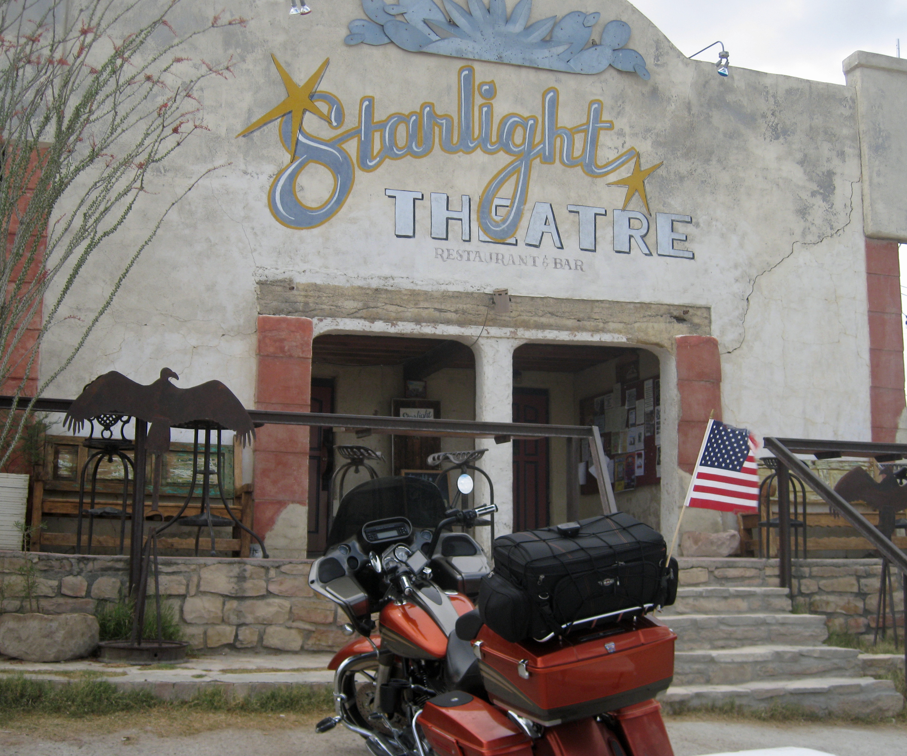
I called Fred starting at 5:00 and until 6:15, no answer. I was out of beer and patience so I went over to the Starlight and had some dinner with one of the porch sitters. Everybody around there knew Fred but they hadn’t seen him. Hope he is okay. I hadn’t checked into any campgrounds around so I just got a hotel for the night.

The Starlight Theater Restuarant & Saloon. April 23, 2014

The Starlight Theater Restuarant & Saloon. April 23, 2014

Not too much to tell for today. I’ve never been to Big Bend National Park; mostly because I’ve heard that it’s not worth the time it takes to get there and back. Today I found out for myself and I’d have to say that I’m generally in agreement with what I’ve heard. Don’t get me wrong, it’s okay and it’s a far cry from the Texas plains that pretty much surround it but as National Parks go – ehh not so much.

South end of Big Bend National Park. April 24, 2014

South end of Big Bend National Park. April 24, 2014

Oh yea, windy again – it can sure blow out on the plains pretty much a cross wind all day & when a semi goes by in the opposite direction the turbulence is amazing…  Now I’m here at the San Angelo KOA. They don’t have any tent sites so I am in a trailer site. First time I’ve been here and won’t likely be back, not the friendliest place and pretty stark. But, good enough for a night and the wifi works pretty well.

San Angelo, TX KOA.

San Angelo, TX KOA.

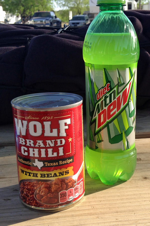
It's what's for dinner tonight.

It’s what’s for dinner tonight.

13 - mapLastly: All my positive energy and prayers today have been for a buddy of mine from LAX. Harry “why do they call him hairy” Conn has been battling cancer for a while. Today he had a tumor removed from his brain; Dr.’s say he is doing well in recovery.  Get well soon Francis.

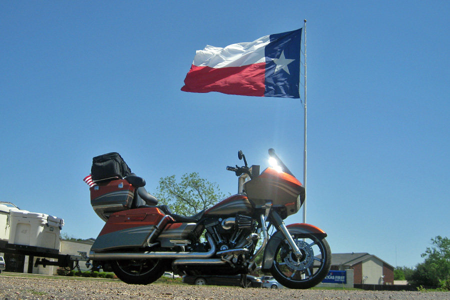
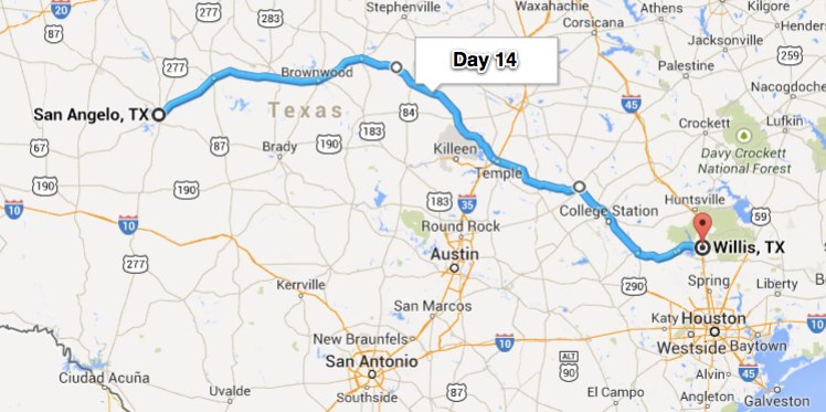
Day 14 – Willis, TX (381 miles)

First things first – Today (4/25) is my mom and dad’s 56th wedding anniversary.
Happy Anniversary Mom & Dad – you two are a testament to what true love really means!!

Got a early start this morning which I’m sure didn’t bother the kampers at the KOA very much since the first movement (slamming doors and driving around on the rocks they have for ground cover) started at 4:30.  That might not be too bad if you’re in a fifth wheel or a motor home but in a tent it sounds like they’re coming through the front door!!  So, that’s when I woke up and I never did get back to sleep – guess I picked the wrong night to skip my nightcap!  Seems like most KOA’s are located in fairly noisy areas. This one is near a very busy road, a train, many many barking dogs and an airport (the first plane of the morning departed right over our heads at 6:03 AM) – for these and many other reasons, the San Angelo, Texas KOA will be a last resort stop on any future tent camping adventures.

I had my tent all packed up and ready to go by 6:45 and after warming up the bike (I did pull out to the street for that) I was down the road before the sun peeked its head over the horizon. It was cool enough to be wearing the leather but I didn’t want to have to take it off in an hour so I just dealt with the cold, hoping I could remember it later in the day when it gets HOT (as if that would ever work).  San Angelo is where the land transitions from the Texas Plains into what they call Hill Country. It sure was nice to get away from the flat lands. After Hill Country, I rode through what they call Prairies and Lakes. The land in this area is flat enough and gets enough rain that it can be farmed; then its on to the Gulf Coast. These are pretty distinct changes in terrain.

Texas Regions

Texas Regions

From the Prairies and Lakes Region of Texas

From the Prairies and Lakes Region of Texas

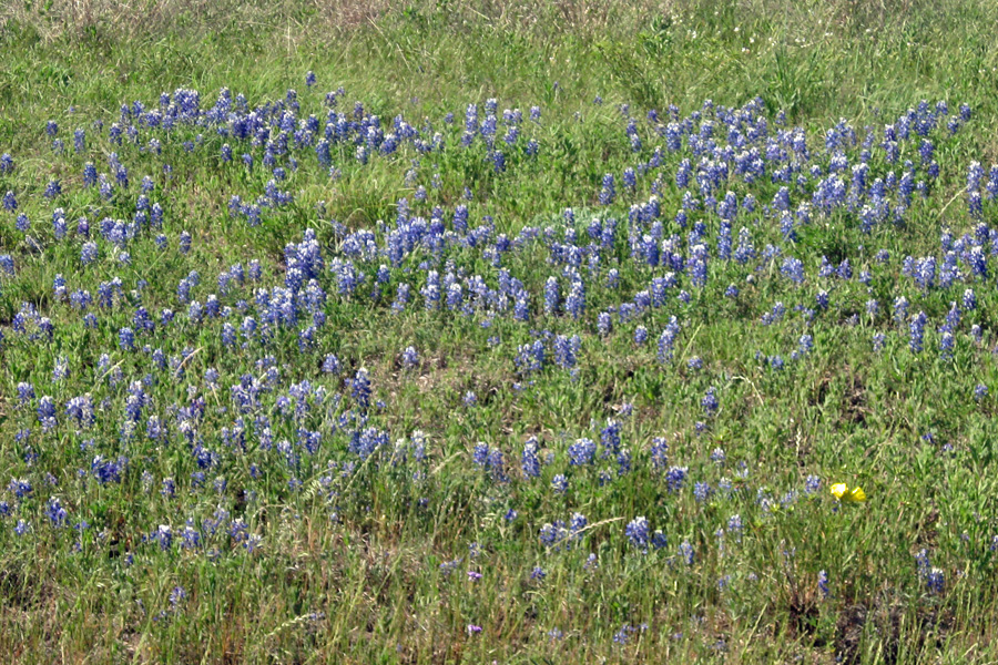
With my ride through Texas almost over it was nice to see that the bluebonnets are starting to bloom. On a motorcycle you get to smell your surroundings which, as you can imagine, can be good and bad. Fields of bluebonnets are very fragrant and definitely one of the better aromas of the road.

The Bluebonnets (State Flower of Texas) are just starting to bloom, they smell good too.

The Bluebonnets (State Flower of Texas) are just starting to bloom, they smell good too.

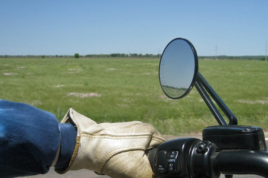
Starting out this morning there wasn’t a breath of wind, I was hoping it would stay that way but by 8:30 my old friend was back. Way better than cold or rain though.

I'm going to call this one  -  Texas equals Wind

I’m going to call this one – Texas equals Wind

Okay, gonna give my back, my bike and ya’ll a break.  I’ll be staying here in Willis with my friends tomorrow so I won’t be back on the road until Sunday.  Until Then – Take Care. 14 - Map

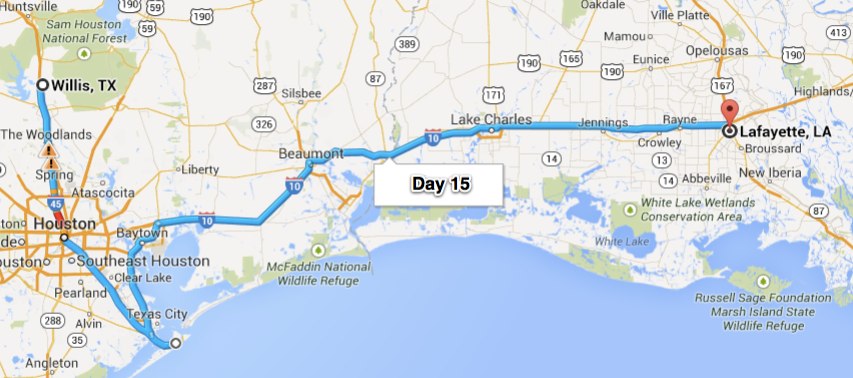
Day 15 – Lafayette, LA (334 miles)

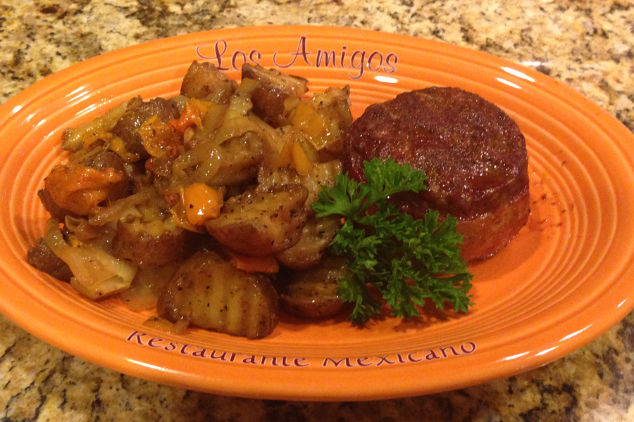
What a great time I’ve had here in Willis, TX. After I got here we hopped into Rick’s golf cart and headed over to his neighbor’s garage (the community meeting place). We sat with 4 or 5 other guys and for once I just listened to their stories. Sure is interesting how much difference there is in lifestyles of the people from one part of the country to the other.  Hunting is big out here & there’s plenty of game to go around, even if you don’t hunt you can have a freezer full.

Mini elk meatloaves wrapped in bacon and grilled home fries.

Mini elk meatloaves wrapped in bacon and grilled home fries.

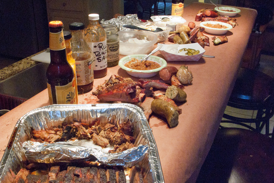
The next day Rick and I took his fire breathing Mustang out for a spin. We visited the Huntsville Prison Museum and drove over to the Penitentiary that’s right in the middle of town.15 - MustangRick is an award winning BBQ chef and after we got back from our drive he shared a few of his closely kept Pitmaster secrets to great BBQ. With any luck I’ll remember some of what he was trying to teach me.  I can tell you this – he knows what he is doing, this was a FEAST.

Brisket, Pulled Pork, Ribs, Boudin Sausage, Venison Sausage, Baked Beans, Jalapeno Poppers wrapped in Bacon.  Only thing missing was a wheel chair because I was too full to walk!!

Brisket, Pulled Pork, Ribs, Boudin Sausage, Venison Sausage, Baked Beans, Jalapeno Poppers wrapped in Bacon. Only thing missing was a wheel chair because I was too full to walk!!

A few hours after that fabulous meal we headed up to The Cactus to meet up with Ken & Terri and check out the band. Last time I was here the band was great, this time – the band wasn’t so great but the company made up for it. Looking forward to next time.

Rick and Blanca & Blanca and Terri at the Cactus.

Rick and Blanca & Blanca and Terri at the Cactus.

After spending a couple days with Rick & Blanca I’m pretty refreshed and ready to continue.

Heading out from Willis, Texas.  April 27, 2014

Heading out from Willis, Texas. April 27, 2014

This was going to be a short day so I headed down to Galveston just to check it out. When I got there it was so windy that I just turned around. From there it was just slab time with a couple little rain showers. So far I’ve been lucky with the weather – keep your fingers crossed.15 - Map

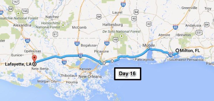
Day 16 – Milton, FL (348 miles)

Packed up the tent and headed over to the laundry room to do the web posting this morning. One reason I wanted to go to the laundry room is because they have a TV there & I could take a look at the weather channel. Looks like there might be some rain to deal with but that I can avoid the really bad stuff by hugging the coastline. As I mentioned earlier, on a motorcycle you’re subject to the aromas of the road & today, all through Louisiana, the air was sickeningly sweet – the jasmine is in bloom and it is Everywhere – glad I’m not allergic.16 - JasmineMy first destination was La. Pines Cafe. It’s one of the Diners Drive-Ins & Dives featured restaurants. I had the Smoked Prime Rib sandwich it was as good as it sounds.

16 - Big Muddy

Crossing the Mississippi River

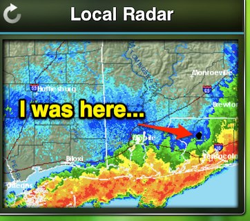
From there I crossed the Mississippi River and headed down to Hwy 90 for a little nostalgic time. Many of us were stationed at Keesler AFB in Biloxi, MS and when you’re stationed at Keesler, you spend plenty of time on Hwy 90.16 - Gulf CoastBack up on the slab and headed for Milton, FL to see a friend of mine from the Air Force that I haven’t seen in 20+ years. Kinda difficult to get caught up in just a few hours but we tried. Sleep that night was interrupted by this line of Severe Thunderstorms. I used to be able to sleep soundly through the thunder and rain – not so much any more……

16 - weather

Overnight Thunder Storm – Milton, FL April 28, 2014

16 - Map-1

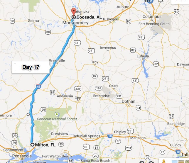
Day 17 – Coosada, AL (153 miles)

Up and out of Milton for the short ride up to Coosada, AL to see Brandy & Jayson. The skies were dark and I didn’t stop any more than I had to in an effort to get there before it started raining. The forecast for rain is 90% – so far I’ve been lucky but I do believe that the luckiest people make their own luck. I’m made some of mine by getting to Coosada early, and dry.

I didn’t really luck out in my choice of where to spend the night. The hotel I picked is right across the street from where we’re meeting for dinner but their high speed wi-fi was down. And – of course because of the inclement weather we are expecting, they won’t be out until sometime tomorrow. Not the end of the world but I asked specifically when I checked in and was told that their stuff was up and running . Oh well – roll with the punches and keep smiling. Oh yea – my cell phone internet didn’t work in my room so I couldn’t use that either.

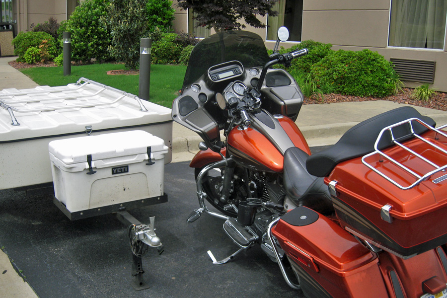
17 - Parked

Parked in front of the hotel, waiting for round 2 of the Severe Weather…

Had a very nice dinner and visit with Brandy and Jayson and back to the hotel for a really good night’s sleep. I did wake up when the thunderstorm went through but didn’t even bother going to the window to check it out.17 - Map

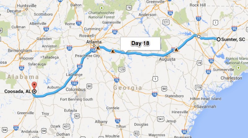
Day 18 – Sumter, SC (447 miles)

Okay – I’m lucky again – VERY LUCKY in fact.  You can see how close Milton is to Pensacola (less than 20 miles away). Pensacola had TWENTY-TWO inches of rain in two days; that started right after I left town. Hopefully that kind of thing won’t continue in my wake….

Started out this morning in the rain gear; which of course means that I didn’t need it. There was a little bit of drizzle to start with but 80 miles down the road, at my first gas stop, I was happily out of the plastic clothing.  The only way to get almost 450 miles down the road and not spend all day doing it is to take the Interstate.  Up on the slab there isn’t a whole lot to see and even if you do see something photo worthy – you can’t get the camera out in time.

Sumter, SC is very close to Shaw Air Force Base. The road I was on goes right past the departure end of the runway. I did see the F-16 low approach coming but was still a little startled at the amount of noise one of those things makes.  That’s okay though, like I always say, “That’s the sound of freedom”.  I still get a chill when I hear those military jets.  So, I leave you with this – enjoy your freedom and don’t take it for granted.18 - Map

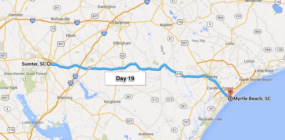
Day 19 – Myrtle Beach, SC (97 Miles)

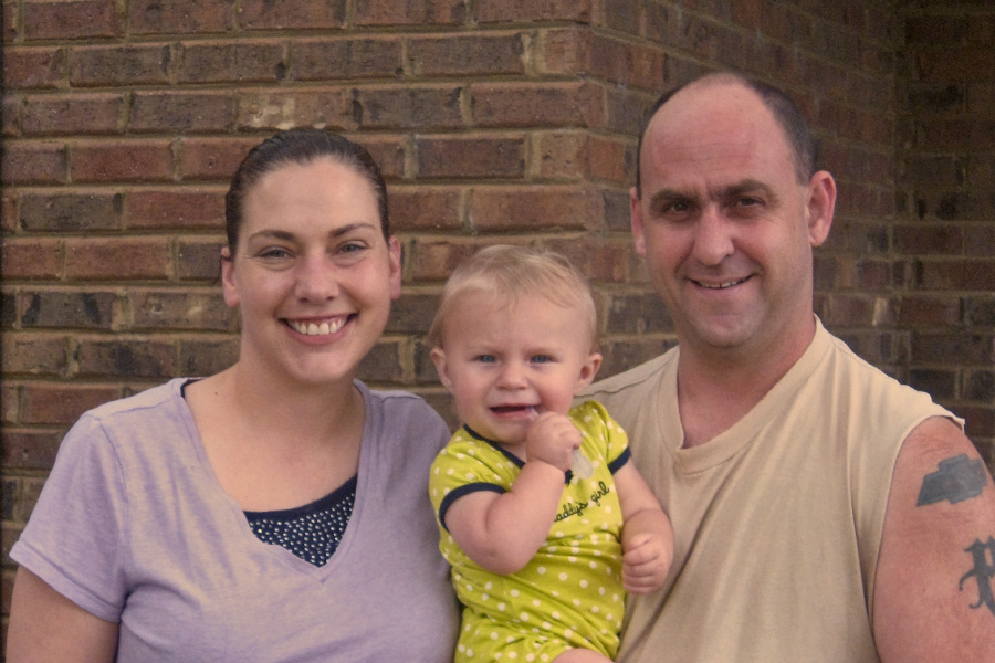
The guest room at Dawn & Eric’s house is all set up with memorabilia from their lives. Dawn’s father was a very good friend of mine it was really nice to see so much of his stuff there in the room; saddles and tack, the Furry Creek C3 brand registration certificate, family pictures, etc.  I thoroughly enjoyed the trip down memory lane – heart warming even if it was a little sad.  Great time with the Potter family – and their baby is amazing, the only time she cried or even fussed was when they gave her to me.

Dawn, Eric & Kira Potter   Sumter, SC

Dawn, Eric & Kira Potter Sumter, SC

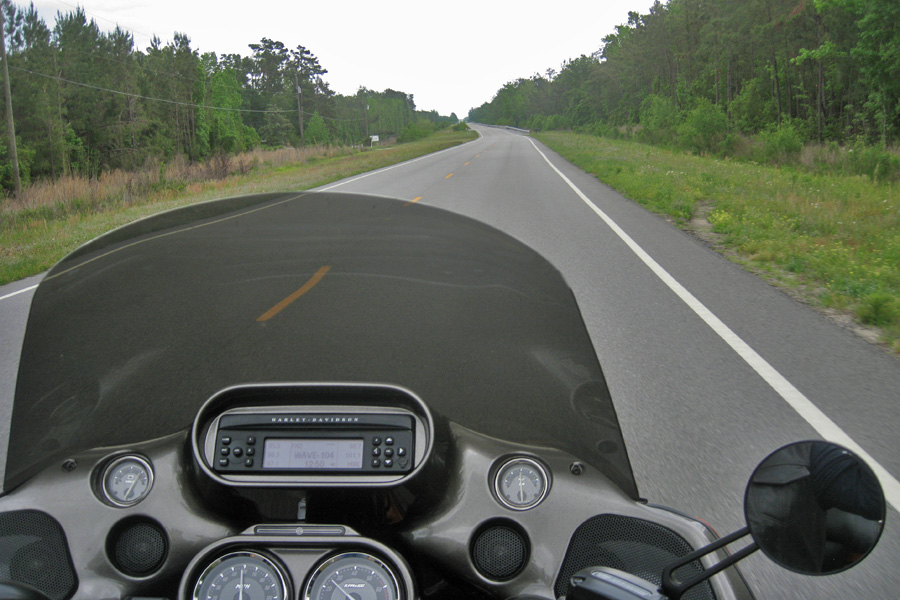
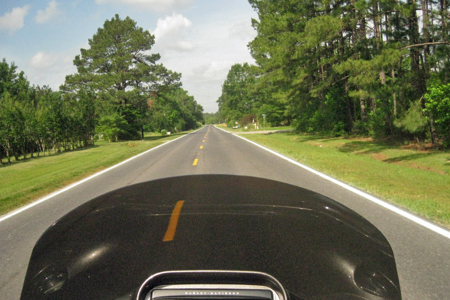
Guess I was kinda tired because I went to bed at 10:00 and slept until 8:00.  I never sleep that long unless I’m sick or something. I felt great this morning though and it looked like I was going to be dry all the way to Myrtle Beach. (“all the way”?? – that’s a joke really – less than 100 miles).  Sumter, SC is a little off the beaten path and from there to Myrtle Beach is back roads all the way.  Smooth and dry back roads, who could ask for more.

Now this is the kind of riding I like.  Too bad it was such a short day.

Now this is the kind of riding I like. Too bad it was such a short day.

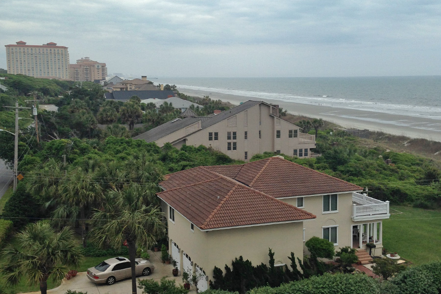
Made it to the east coast.  I’ll be here playing golf for about a week so the posts will likely drop off for a little while, but you can be sure that I’ll be back in your IN Box when I start back on my journey to the four corners of the United States.

From the balcony of our condo. Myrtle Beach, SC

From the balcony of our condo. Myrtle Beach, SC

My luck with the rain has been amazing - dodged another rain shower.

My luck with the rain has been amazing – dodged another rain shower.

19 - Map

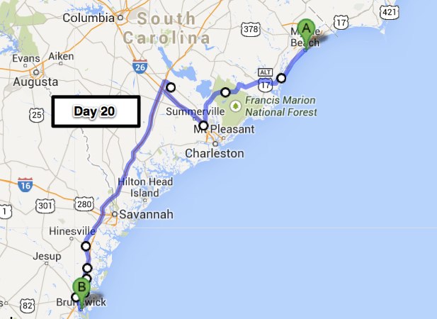
Day 20 – Brunswick, GA (338 miles)

First off I would like to wish the woman that brought me into this world and taught me so many valuable life lessons a happy Mother’s Day.  I love you Mom.

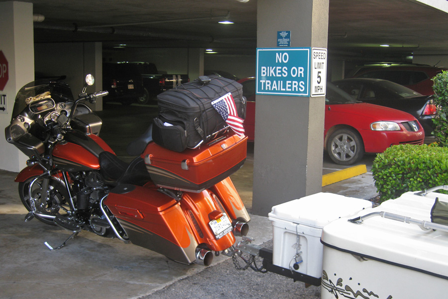
No Bikes, No Trailers - Couldn't even park at the condos where we stayed.

No Bikes, No Trailers – Couldn’t even park at the condos where we stayed.

It was so humid this morning that by the time I got the trailer and bike packed and ready to go, I was more than a little damp.  However, miles per hour = evaporation so that little issue was gone after some time on the road.  It sure feels good to be back on the bike.  Don’t get me wrong, the golf with “the boys” was a blast as always and I was certainly ready for a break last week when I got off the bike – but it’s time for the Red Rider to be back on the black top.  Besides, today was the start of Bike Week in Myrtle Beach – I got out of town just in time.

Highway 17.  Southbound leaving South Carolina.

Highway 17. Southbound leaving South Carolina.

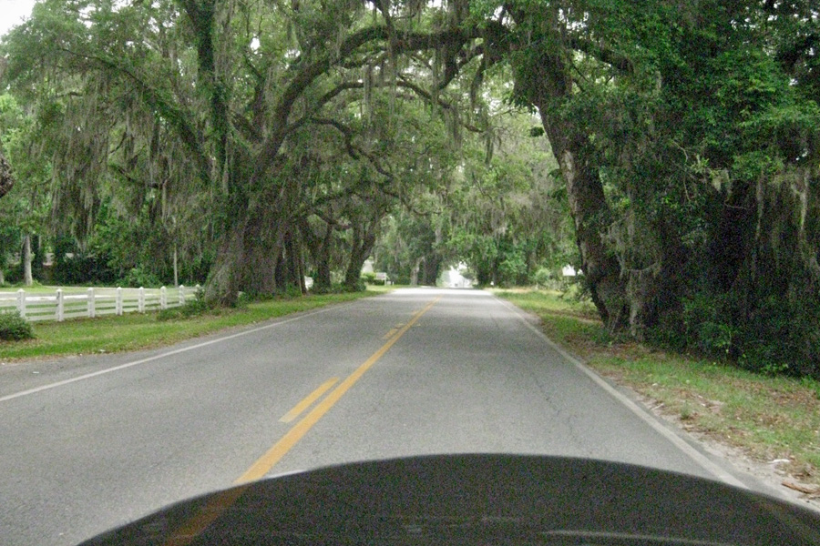
By the time I got out of South Carolina the sky had turned to a high overcast which made what could have easily been a miserably hot and humid day actually quite pleasant. There were several of these overhanging tree tunnels along the way today. These are Live Oak trees and they’re covered with Spanish Moss.  Spanish Moss is actually a living plant.  It’s a bromelaid or “air plant” that gets its nutrients and water from its surroundings vs. the ground.  Spanish Moss is prevalent in the south growing mostly on Live Oak and Bald Cypress trees.

Just one of many reasons to stay OFF the slab.

Just one of many reasons to stay OFF the slab.

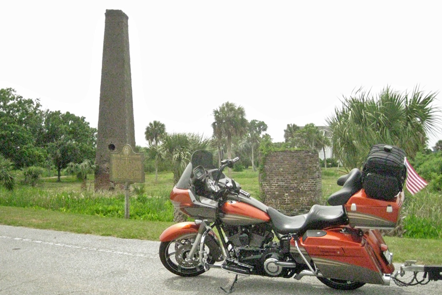
Later on down the road I decided to stop to stretch my legs in front of the old Butler Island Plantation.  I looked around a little and learned a couple things. This was a huge plantation back in the late 1700’s and early 1800’s; and they didn’t grow cotton, they grew rice. The watering was controlled by s system of dikes and canals that were installed by engineers from Holland and the water flowing through the tidal gate they installed powered the machinery in the mill long before electric power.  Mr. Butler ran into some financial difficulties and in order to get some badly needed cash sold 439 of his slaves in 1859.  That was the largest slave sale in United States history, and good timing too.  Emancipation Proclamation – January 1, 1863.

Butler Island Plantation - Chimney of the old rice mill

Butler Island Plantation – Chimney of the old rice mill

Today was one of those days that seemed to go by pretty fast.  I like this part of the country, good roads, friendly people and lots of history everywhere you look.20 Map

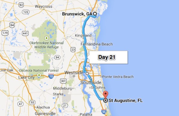
Day 21 – St. Augustine, FL (104 miles)

This morning I was up and on the slab before the sun came up. If you have to be on the slab, and you have to be on the slab in the dark – I guess 6:15 AM on Mother’s Day is a pretty good time.  I was just about the only one on the road and I-95 south of Brunswick, GA is a pretty smooth stretch of road.  All of this to meet my friend in St. Augustine at 8:00 AM so we could go to the last round of the 2014 Players Championship at TPC Sawgrass.  After breakfast at Cracker Barrel we headed for the course.  The tickets were free but the parking was $32 – COUGH.  Watched about 6 hours worth of golf before the lightning started in the distance.  We’d seen enough and decided to beat the crowd to the exits.  After a delay for the lightning and rain they finished the round but by that time we were at the pub enjoying a couple cold ones and some dinner.

The famous 17th hole at TPC - nobody here yet.

The famous 17th hole at TPC – nobody here yet.

Typical Sunday pin placement at TPC - and a couple of GREAT approach shots.

Typical Sunday pin placement at TPC – and a couple of GREAT approach shots.

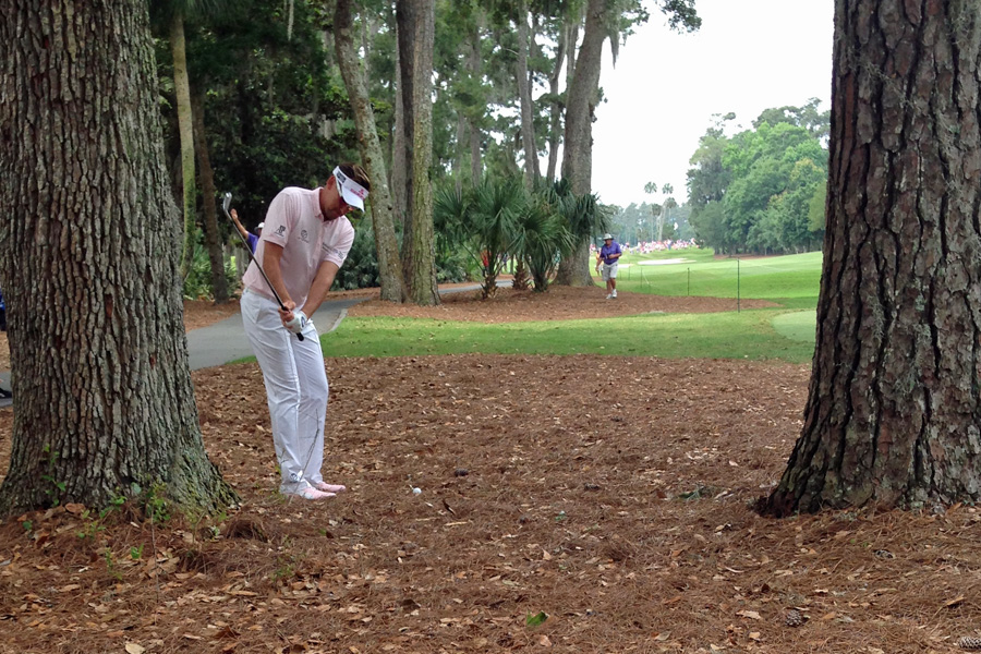
Ian Poulter's errant tee shot on the 2nd hole left him this chip back to the fairway = easy par.

Ian Poulter’s errant tee shot on the 2nd hole left him this chip back to the fairway = easy par.

Bubba Watson's SIXTH shot on the par three 15th hole at TPC - he got up & down for 7

Bubba Watson’s SIXTH shot on the par three 15th hole at TPC – he got up & down for 7

21 map

Day 22 – West Palm Beach, FL (241 miles)

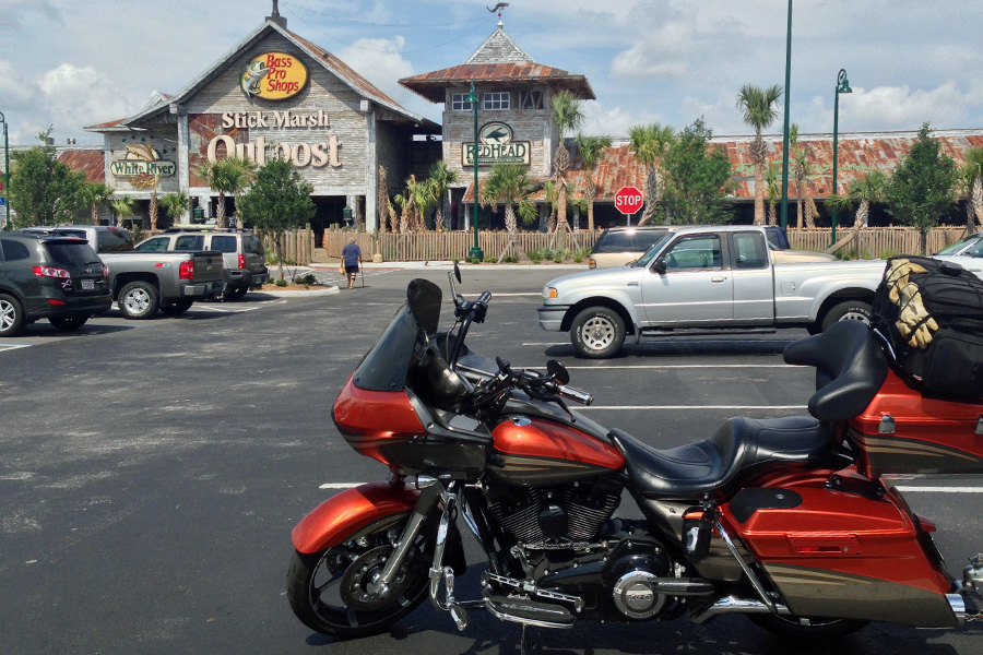
I was up and on the slab again this morning for the entire ride down to West Palm.  This time it’s okay though.  I have a tee time to make at Ibis CC and besides, if I check everything out on my way down the coast, Robin and I won’t have anything different to do on our way back up the coast.  I did stop at Bass Pro Shops because I lost the screw that holds the reel handle on.  They replaced it and good thing because Scott (my friend here in West Palm) only has one rod & reel.  This Bass Pro Shops looked a little different than any other I’d seen.

The roof is all rusted metal - On the entry it says "Welcome fisherman, Hunters and other Liars"

The roof is all rusted metal – On the entry it says “Welcome fisherman, Hunters and other Liars”

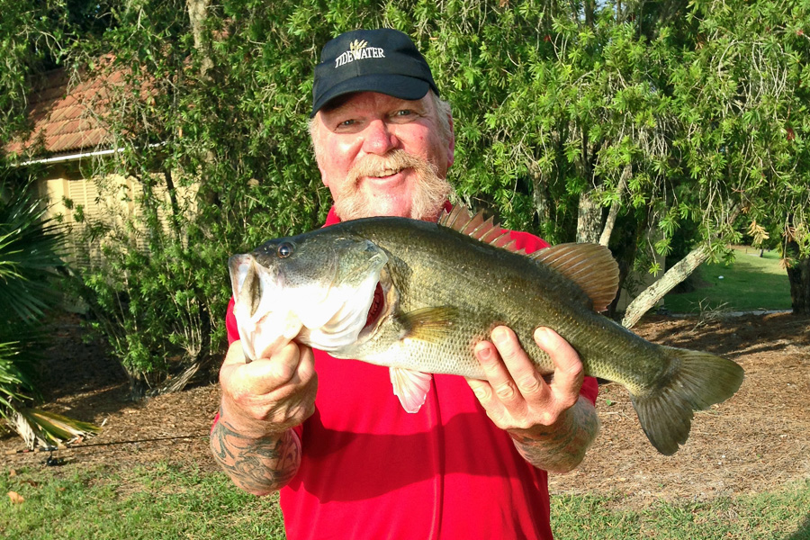
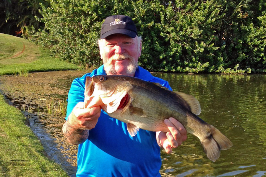
Ibis has three 18’s and today we played the Tradition.  Fairly straight forward lay out and the greens were true.  Two more rounds at Ibis and one at Trump International for this golf stop.  Scott has a pretty good set of “guest” clubs so I just shipped mine home from Myrtle Beach.  Anyway – the best thing about the golf here is the fishing afterward.  This one isn’t a big one but it’s one of the biggest bass I’ve ever caught.  There will be more fishing – hopefully there will be more catching as well.

Golfin - then Fishin.  Does it get ANY better than that??

Golfin – then Fishin. Does it get ANY better than that??

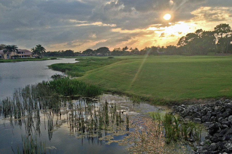
We stayed at Ibis fishing until it was time to get the golf cart back to the barn.  Nice Sunset!!

Sunset on the 4th hole of the Heritage course at Ibis Country Club.

Sunset on the 4th hole of the Heritage course at Ibis Country Club.

22 Map

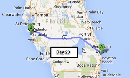
Day 23 – Sarasota, FL (194 miles)

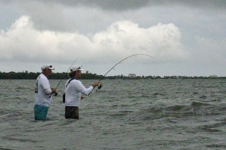
I’ve had a great time here in West Palm Beach.  You’ve already seen a picture of the bass I caught on the golf course.  Scott and I went out into the Intercostal waterway and did some more fishing with Greg Savage.  Greg has spent most of his life in this area and has forgotten more than most people know about Florida’s flora, fauna and history.  He shared a lot of his knowledge including which mangrove trees to pick out for easy access to the water, fighting conch and their eggs, etc.  It was like being out with the Crocodile Hunter –

Watching with rapt attention as some actual "catching" is going on.

Watching with rapt attention as some actual “catching” is going on.

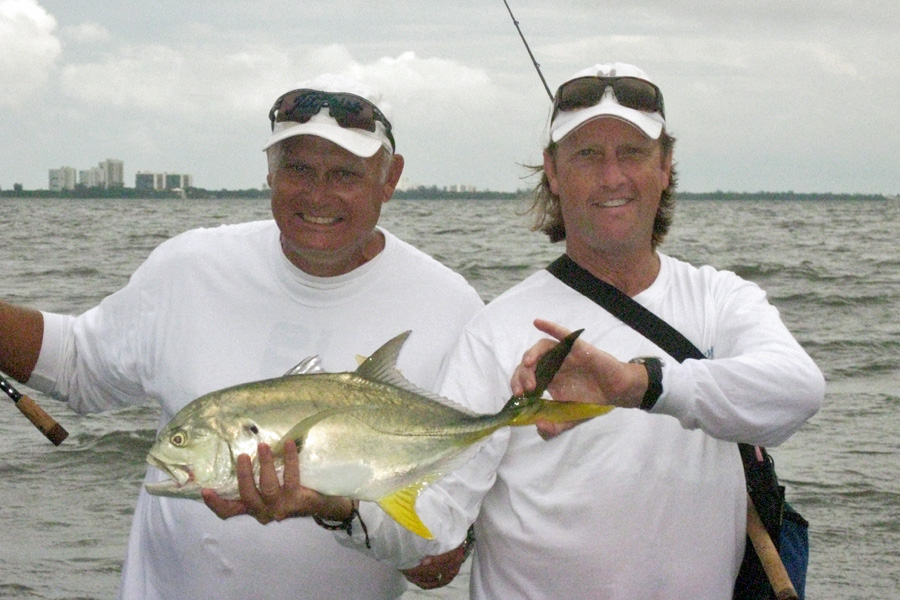
We really wanted to catch Snook since they are such good eating.  We would have been happy though with a Red Fish, or even Sea Trout.  All we caught were Jack Crevalle and you can’t eat those. The color of the plastic jerk bait we were using was electric chicken, ha ha.

Jack Crevalle - Scott was complaining that his arms were tired after getting this little guy in

Jack Crevalle – Scott was complaining that his arms were tired after getting this little guy in

All done with our fishing excursion - Thanks again Greg for taking us to your secret spot

All done with our fishing excursion – Thanks again Greg for taking us to your secret spot

Fishing and golf – who could ask for more (did I already say that).  Anyway, I was hoping that we would be able to get out on Doral ‘s Blue Monster but even with the pull Scott has with “The Donald” he couldn’t swing that this time around – seems they are having some event or something over there – nothing available.  However… Scott and Greg know a few people around the area and we were able to get out on Trump International.  This is an exclusive private course and every group must take a caddy.  The course was beautiful, greens were perfect and we all enjoyed the round.  Looking forward to going back sometime.

17th Hole at Trump International - Very nice golf course

17th Hole at Trump International – Very nice golf course

It’s difficult to leave West Palm Beach, I think I could get used to living like this –

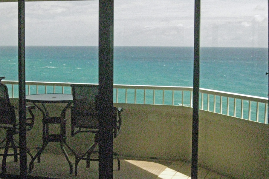
View of the Atlantic Ocean from Scott & Theresa's condo - nice digs to say the least

View of the Atlantic Ocean from Scott & Theresa’s condo – nice digs to say the least

Scott and Theresa have been awesome but it’s time to head for the other side of this state.  I’ve actually never been to Florida’s west coast until now.  They call this the Sun Coast and I’m a believer based on today’s ride. Started out a little overcast and looked like it could start raining any moment but by the time I was past Lake Okeechobee the sky was mostly blue and by the time I got to Bradenton there wasn’t a cloud in the sky.

As soon as I got out of town, the landscape was mostly orange orchards and cattle ranches.  A quiet road and an enjoyably short day on the bike.  Gonna spend a couple days here visiting friends. I had hoped to go Tarpon fishing but the wind is forecast to be high enough that the boats won’t be straying too far from harbor while I’m here – oh well, next time….23 Map

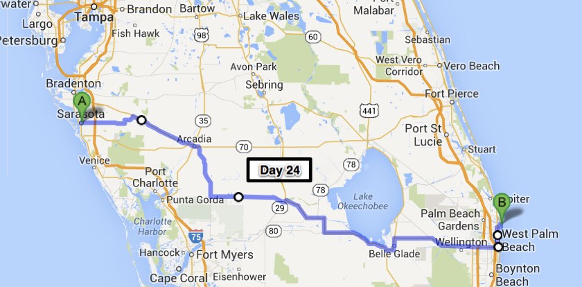
Day 24 – West Palm Beach (252 miles)

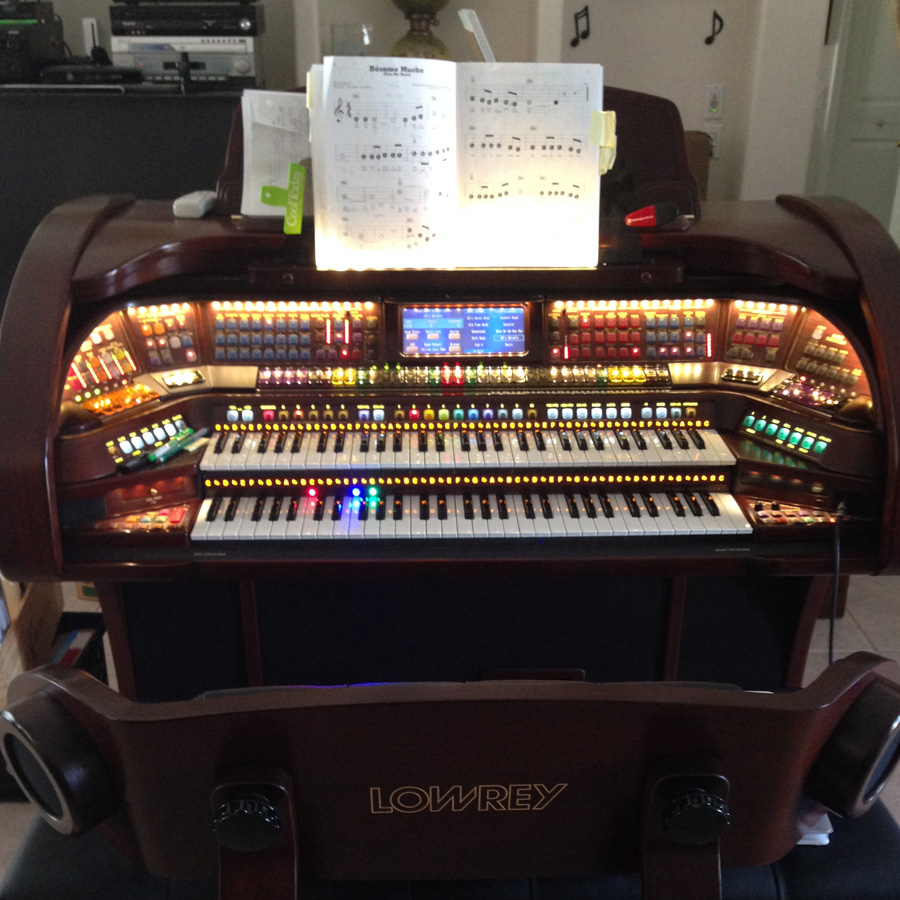
Before I rode to the west coast “The Sun Coast” of Florida, I decided to see just where in this state a friend of mine, who recently moved, was actually living.  I acquired his address and how about that – he lives within 25 miles of my Sarasota destination.  I couldn’t very well be right across the street and not at least stop in and say howdy – so that’s exactly what I did. Bob was out having fun on his latest toy, a zero turn radius riding lawn mower but was able to pull himself away from that for a little catch up time over a cold glass of iced tea.  First thing I noticed when I walked into the house was what a MASSIVE organ Bob has.

Now that is one large organ. This thing must have 300 buttons and keys - all digital of course

Now that is one large organ. This thing must have 300 buttons and keys – all digital of course

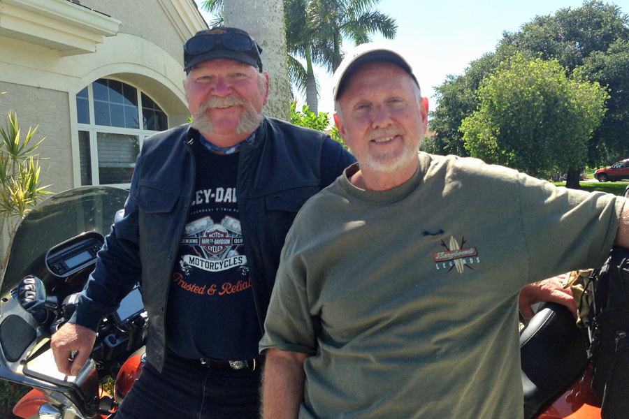
Bob, Susie and I sat and talked about retirement, the FAA, guns, computers, and various other topics for a couple hours then it was time for me to get back on the road.  Always nice to be able to drop in on old friends and you can just pick up where you left off years ago….

Gotta be thirty years we've known each other - If I only had a picture from 30 years ago....

Gotta be thirty years we’ve known each other – If I only had a picture from 30 years ago….

From Bob’s house I had to ride through down town to get to Ski’s house.  On the way this noise from my bike was starting to be of some concern.  There has been a squeak that I thought was just the trailer hitch but after several attempts to find out exactly where it was coming from – the trailer hitch was eliminated.  I actually thought that I might have a broken motor mount or possibly even a cracked frame (I know – the Irish always go to the worst possibility).  Anyway – as soon as I got to Ski’s house I called Rossiter’s Harley Davidson and they said they would move me to the front of the line, and if I got it right in, they would do everything they could to have me out of there by the following afternoon.  The next day I called them around noon and the bike was ready – all they could find was a missing rubber mount for one of the exhaust pipes.  The squeak is gone but I’m not too sure about everything being fixed – I’m probably just being paranoid.  Whatever – ride it till it breaks then get a U-Haul.

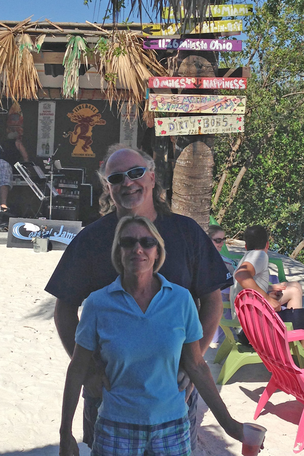
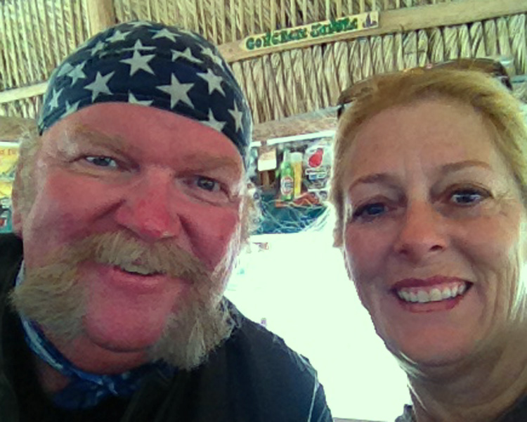
Phil, Shelley and I had a great time.  Mostly just relaxing around the house and consuming more than a few adult beverages.  We went to a Tiki Bar after we got the bike all squared away.  I’d never been to a real Tiki Bar.  It’s just an open air bar along the side of the road.  I didn’t get a good picture but I’ve been assured that we will encounter lots of them on our travels – so look for a picture in a future post.  It was a chamber of commerce day in Sarasota, not hot or humid – perfect for relaxing at the Tiki Bar. Thank you for your hospitality – Slainte.

Phil & Shelley at the Tiki Bar on "The Intercostal" Osprey, FL - near Casey Key

Phil & Shelley at the Tiki Bar on “The Intercostal” Osprey, FL – near Casey Key

Time to head back to the other side of the state again.  Since I went north of Lake Okeechobee on my way over, I went south of it on my way back.  The landscape was much the same – many orange orchards and cattle ranches. I did pass a citrus processing plant and I could smell the oranges for half a mile before I got there – they must have had 30 truck loads of oranges there for processing. I thought about stopping, but it’s Sunday, probably no tours on Sunday.  It was another easy day on the bike – sure is nice to have that squeak fixed.

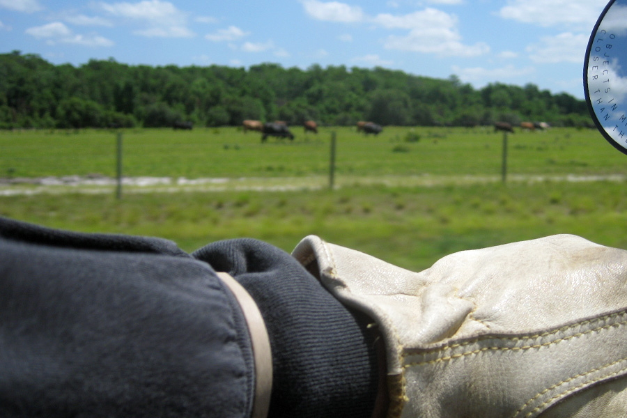
Cattle ranch along the road in central Florida - I know, wrong thing in focus but at 70 mph, that's about the best I can do.

Cattle ranch along the road in central Florida – I know, wrong thing in focus but at 70 mph, that’s about the best I can do.

24 maps


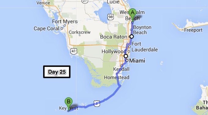
Day 25 – Key West, FL (229 miles)

Before going to the airport to pick up Robin, Scott and I played two more rounds of golf and went fishing on the golf course one last time.  I’ve already told you how awesome it is to be able to fish right there on the golf course after your round – a picture is worth 1000 words – – –

We weighed this one - 7.18 lbs.  For sure the biggest bass I've ever caught

We weighed this one – 7.18 lbs. For sure the biggest bass I’ve ever caught

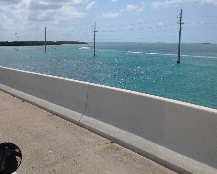
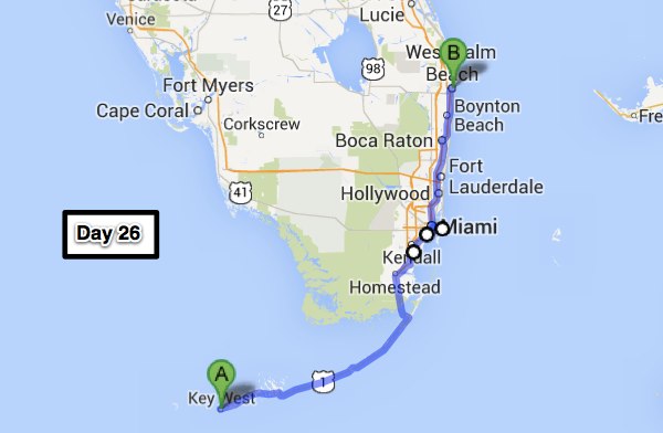
Two up again.  After being apart for over a month I was finally reunited with my awesome wife.  She has to be pretty good to put up with me and support all of my crazy adventures.  Anyway, today we are heading down to Key West, FL.  Key West is the southern most point in the continental United States and the third of the four corners of the USA for us.  It’s funny because there’s still a LOT of riding to do but it seems like the adventure is winding down now with only one corner to go – of course we aren’t stopping there; there’s still Newfoundland.25 LY SEFor those of you that may not know, my wife is afraid of heights; bridges are high; and there are lots and lots of bridges on the way to Key West.  We stopped before we crossed over to Key Largo (the first key in the chain) for some liquid courage at Gilbert’s Tiki Bar.  Robin was convinced that a “Miami Vice” (1/2 Pina Colada, 1/2 Strawberry Daiquiri with a dark rum float on top) was just what she needed.  That bar tender was right along with a couple more stops along the way, her fear of bridges became little more than Laissez-faire awareness.

Heading for Key West - the water here is very clear and Robin says "aqua" in color

Heading for Key West – the water here is very clear and Robin says “aqua” in color

I might not have been able to catch a tarpon this time around but we did get to see some up close and personal.  The bar tender at Smuggler’s Cove (our second stop for “that frozen concoction that helps us hang on”) told us to be sure to stop at Robbie’s (mile marker 77.5) to feed the tarpon.  We had to turn around because I missed the turn off but we were glad we did.  For $5 we got admission and about 10 shiners to feed to the tarpon hanging around this dock.  But watch out for the pelicans hanging around, they’ll snatch one of those shiners out of your hand so fast you won’t know what happened and they bite HARD…..

Many of these tarpon around the dock at Robbie's are over 100 lbs

Many of these tarpon around the dock at Robbie’s are over 100 lbs

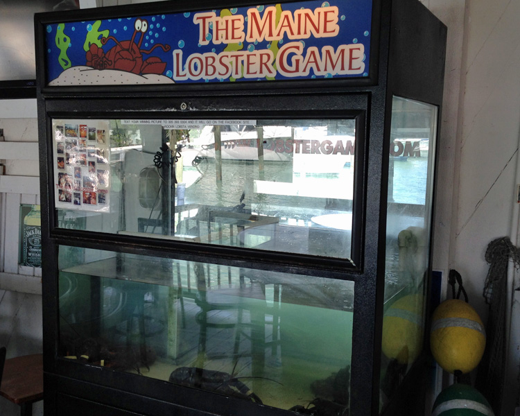
At our last stop before rolling into Key West, we saw this claw game by the door.  You know the kind, you maneuver the claw around with a joy stick until you think it’s in the proper position to pull up a stuffed animal or something then you push the button and the claw drops then comes back up, most often empty. Well, this is a new twist on that game….

Instead of stuffed toys, you can pick up a live Maine Lobster - $3.00 per try

Instead of stuffed toys, you can pick up a live Maine Lobster – $3.00 per try

The rest of the ride to Key West was uneventful.  Robin was actually doing everything she could to keep from falling asleep vs. worrying about the bridges along the way.  While you’re riding the temp isn’t too bad but if you have to stop for a street light of anything else, you start heating up real quick.  We’re all checked in now and are about to head out to enjoy an adult beverage or ten. Slainte25 Map

Day 26 – West Palm Beach (254 miles)

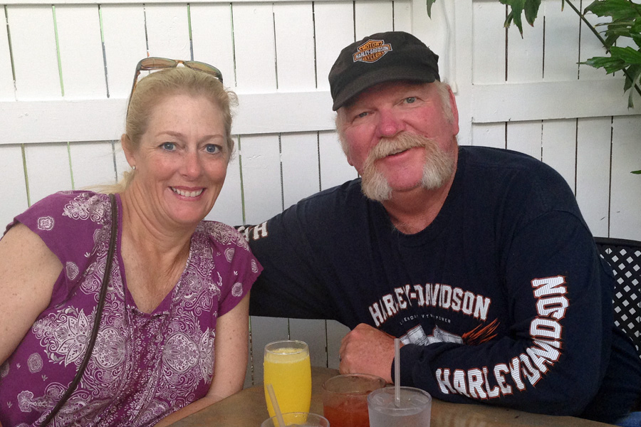
I came, I drank, I don’t remember.  Well, it wasn’t quite that bad but there were more than a few adult beverages consumed while we were in Key West.  Being big Jimmy Buffett fans, the natural first place to go was Margaritaville.  Good drinks & good food – we could have just stayed there, but Irish Kevin’s was calling.  We enjoyed the drinks and entertainment at Irish Kevin’s last time we were in town and were not disappointed this time.  Irish Kevin (the guy that owns the place) does some of the singing and entertaining – very funny guy and a pretty good guitar player and singer too.  We spent the next day with a recovery breakfast including a mimosa and a bloody maria (bloody marry made with tequila) but we were still moving pretty slow so we went back to the room to chillax for a while.  They were doing major construction two floors above us and it sounded like a living under a bowling alley.  We complained and were moved but I’m not too sure the good folks at the Crowne Plaza La Concha have heard the end of this one.

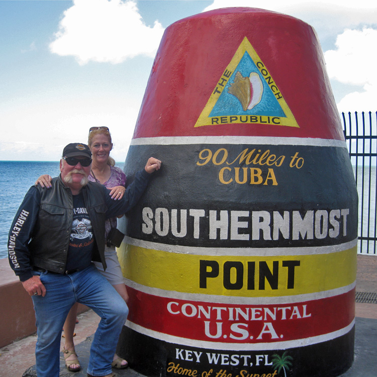
Next thing we did was go down to check out the situation at the southern most point marker.  Walking seemed like too much of a challenge so we took one of those pedi-cabs.  I doubt that the guy was too thrilled when I hopped in but for $15 for 10 min – get peddling buddy!!  The marker was just like I’ve seen in pictures but as long as we were there we decided to have our picture taken and someone that knew how to operate a point and shoot camera (not too tough – right??) snapped a shot for us.  On the way out of town the next morning, we would bring the bike and get a picture of the marker with the bike and hopefully us on it in the foreground.  I SURE wish the guy that took our picture the day before had been there for that.  There was a guy that said he would be happy to take a picture, but his ability to do so was, let’s say pathetic.  I was really pissed to see that the picture he took was nonexistent.  I was going to tell him to go ahead and take two or three just to make sure but he was standing in the street and cars & buses were coming so I just hoped the one would be good – UGH…  At least the picture from the day before was good.

I think the picture is self explanatory - May 22, 2014

I think the picture is self explanatory – May 22, 2014

My luck with missing the hordes continues.  You will recall that I missed Bike Week in Myrtle Beach by a the skin of my teeth; well, we missed Memorial Day Weekend in Key West by one day.  The traffic out of the Keys was bad – the traffic going down was 3x worse.  Whew – that was a close one; next time I’m going to take a closer look at the calendar.

We had a little extra time today so I thought it might be nice to take a break in South Beach (think Miami Vice – the TV show, not the drink).  I’ve been there on my other bike back in 2002 when we rode to Key West and back from Daytona (some great stories from that trip!!).  It looks just like it did on TV but it’s kinda cool.  OOPS – no such luck!!  The streets were all blocked off so the throngs of people coming for Memorial Day could walk around unencumbered by vehicular traffic.  The only streets that were open were under construction, what a mess.  And the way people in Miami drive – – GET ME OUTTA HERE……

The ride back was hot enough and slow enough that I got to experience “Parade Mode” on my 2014 Road Glide.  This mode kicks in when the rear cylinder head temperature gets over 285 degrees.  At that point the rear cylinder shuts off and the bike runs on one cylinder.  Sounds and feels a whole lot different for sure.  We are both ready for the cooler weather that the northern latitudes have in store for us.  Changes in Latitudes, Changes in Attitudes.

One more short stay with our friends in West Palm Beach & we’ll be on our way.   Scott and Theresa, we can’t thank you enough for your generous hospitality.  You are ALWAYS welcome at our house and please bring Riggs (their Jack Russell Terrier) with you, he and Gus will be thick as thieves in short order.26 map

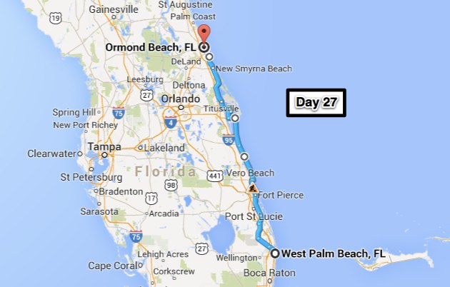
Day 27 – Ormond Beach, FL (226 miles)

Absolutely NO time on the slab today – most of the ride was on US 1 and Florida’s A1A (which is equivalent to California’s Pacific Coast Highway).  While the ride was enjoyable, there is a price to be paid for that routing – it took us almost 8 hours to go 226 miles.  A very relaxing day to say the least, nice roads – not too much traffic (surprising since it’s Saturday on Memorial Day weekend) and no rain.  It could have been a few degrees cooler – a heat index over 100 isn’t ideal.

From Key West - I forgot to put it in an earlier post.

From Key West – I forgot to put it in an earlier post.

Along A1A you get to see a lot of nice, large, very expensive homes.  We went through Boca Raton and Del Rey Beach on the way down to Key West and the homes to the north on A1A were comparable (many are for sale if you’re thinking about moving).  And how about Patrick Air Force Base – also right on A1A, those airmen have the tough duty…..

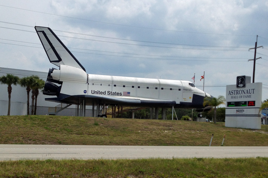
Space Shuttle Inspiration - This Space Shuttle Orbiter mockup was constructed by North American Rockwell in 1972. It was shown to NASA and Congress to win approval for the space shuttle program and now sits outside the Astronaut Hall of Fame.

Space Shuttle Inspiration – This Space Shuttle Orbiter mockup was constructed by North American Rockwell in 1972. It was shown to NASA and Congress to win approval for the space shuttle program and now sits outside the Astronaut Hall of Fame.

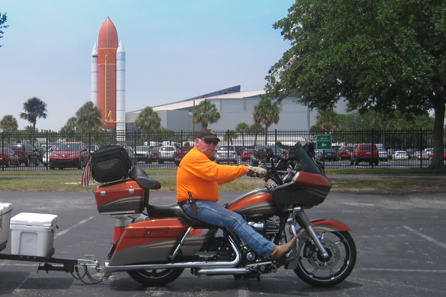
We were going to check out the Kennedy Space Center but the $110 for two price for admission kinda “hurt my feelings” (thanks for that one Theresa) so we just took a couple pictures and went on our way.  Besides, I think you would really need to spend at least four hours there to see most of the stuff and we just didn’t feel like walking around that much and we were starting to get hungry.  Now, you know that Cape Kennedy is where the I Dream of Jeannie TV series was set; but did you know that it was all filmed in California?  AND – did you know that her bottle was a special Christmas 1964 Jim Beam liquor decanter?  Me neither – –

Too cheap to go in - from the parking lot at the Kennedy Space Center

Too cheap to go in – from the parking lot at the Kennedy Space Center

When we got to Daytona I passed on the opportunity to go take yet another picture in front of the Dale Earnhardt statue at Daytona International Raceway – wouldn’t want to over do it….  It’s really too hot to tent camp so for this evening’s accommodations we opted for the air conditioned comfort at the luxurious Ormond Beach, Motel 6.  The A/C alone is worth it!!27 map

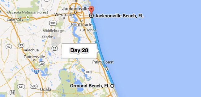
Day 28 – Jacksonville Beach, FL (87 miles)

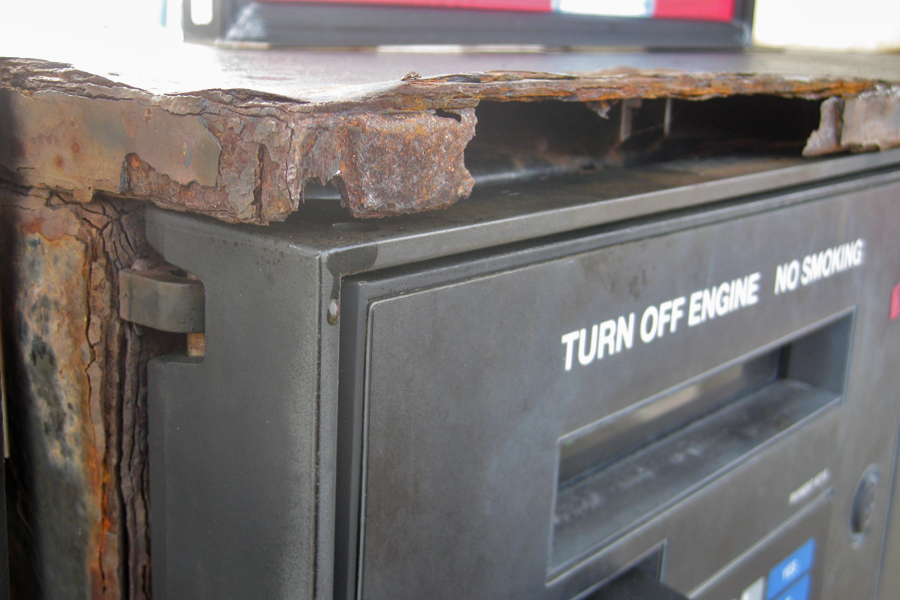
Not only was today a no slab day but we stayed on A1A as much as possible.  I’ve been on A1A north of Daytona but that was about 20 years ago – it has either changed or my memory has failed or some combination of the two.  It’s much more built up now; still, it was nice, right along the coast 90% of the way and cooler than anywhere else.  Lots of traffic southbound on A1A but not that much in our direction.  And, since it was a very short day, none of the things that start to wear you down after many hours of riding really had any effect/affect (never can figure that one out).  The salt air has a detrimental affect on the metal parts of this gas pump.

Living by the ocean has its disadvantages.

Living by the ocean has its disadvantages.

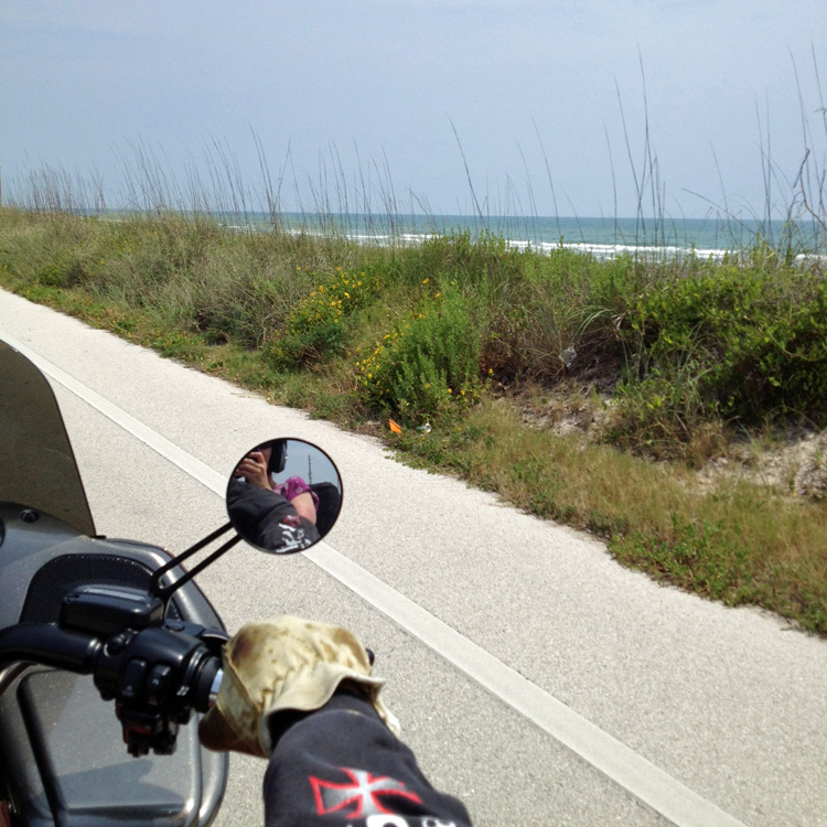
Rolling northbound on A1A - life is good.

Rolling northbound on A1A – life is good.

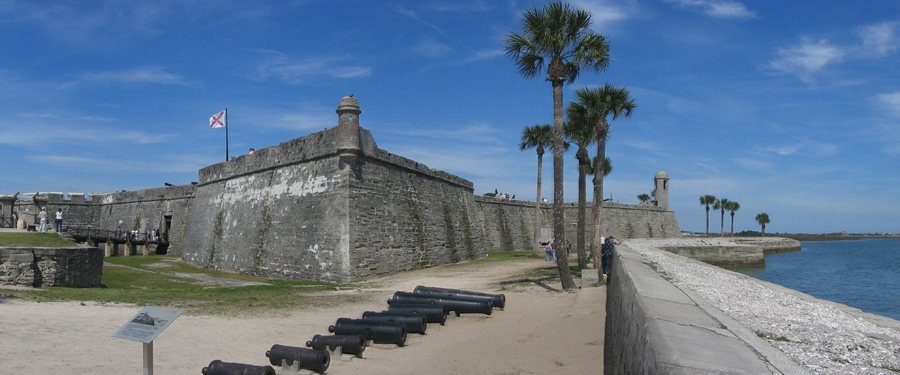
One place I wanted to stop on the way up was in St. Augustine.  Did you know that the city of St. Augustine was founded in 1565 – that’s a LONG time ago.  It’s really a very fascinating place but we’ll have to stop and check it out when it’s a little cooler – you can check it out from the comfort of your recliner if you like – just click here.  One of the interesting places in St. Augustine is the Castillo De San Marcos – it’s right on the side of the road so we did see it but we didn’t stop – next time for sure.  Here is a link if you would like to check it out – link. Last time I was here I went to their Alligator Farm and Zoological Park.  That was kinda neat – they have alligators of every size and lots of ’em. On the way out I had a fried alligator sandwich & it really did taste just like chicken – maybe a little more chewy..  Gator Farm

Castillo de San Marcos is the oldest masonry fort in the continental United States. Construction began in 1672, 107 years after the city's founding by Spanish Admiral and conquistador Pedro Menéndez de Avilés, when Florida was part of the Spanish Empire.

Castillo de San Marcos is the oldest masonry fort in the continental United States. Construction began in 1672, 107 years after the city’s founding by Spanish Admiral and conquistador Pedro Menéndez de Avilés, when Florida was part of the Spanish Empire.

Robin has a friend here in Jacksonville Beach and we stopped by to visit with her for a while.  I think it’s been almost 10 years since they’ve seen each other so they had a lot of catching up to do. Good times and good friends all along the way……  And we’re not done yet.28 map


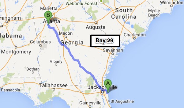
Day 29 – Peachtree City, GA (348 miles)

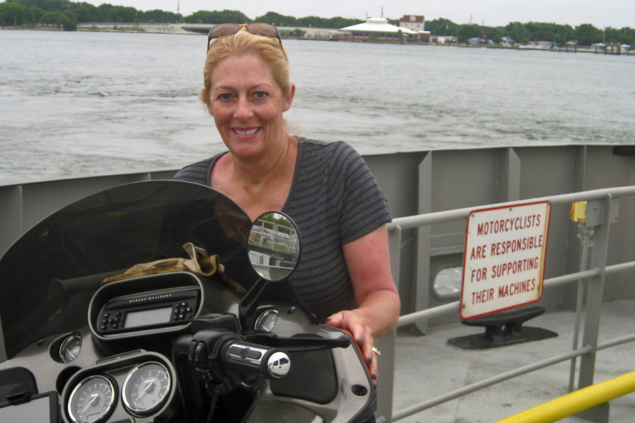
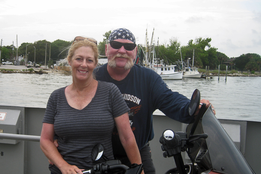
Another no slab day – well almost; a wrong turn leaving Jacksonville put us on the freeway for one mile.  The rest of the trip was on state and county roads.  If you are northbound on A1A you will be taking a ferry ride.  The St. Johns River Ferry is actually part of A1A just as if it were a bridge.  I was a little surprised that my GPS put us on a ferry but the wait was short and the five bucks was well worth the time it saved us.

My Support - check out the sign.

My Support – check out the sign.

On the St. Johns River Ferry - shrimp boats in the background

On the St. Johns River Ferry – shrimp boats in the background

As we headed north the pine trees and palmetto bushes turned into oak, sycamore and magnolia trees and of course the kudzu (the vine that ate the south).  The weather today was cooler which was wonderful as far as I was concerned, Robin actually wore her leather jacket for most of the day.  She started with it to keep warm but kept it on afterwards to keep from being pelted by all the bugs – there’s lots of bugs here in the south & the love bugs are thick!!  One thing you might not know about love bugs is that after they splat on your vehicle their remains become acidic so you better wash ’em off right away.

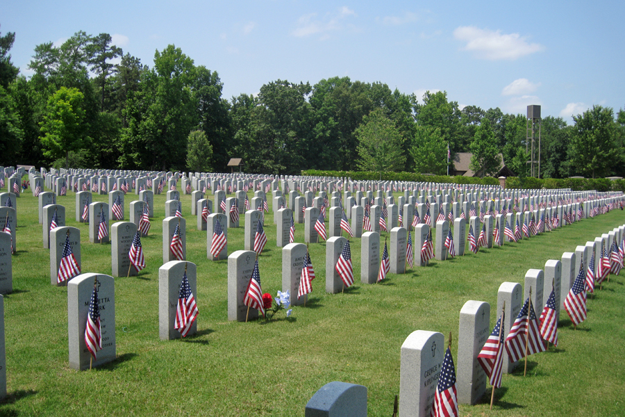
Being Memorial Day, I made a bit of a detour to Milledgeville and went to the Georgia Veterans Memorial Cemetery there.  We walked around and read lots of the markers.  I learned something else today that I’ll share with you.  Some of the markers here had names on the back as well.  Seems you can have someone buried with you (spouse usually) and they stack the two of you in there so the markers are all symmetrical and put that name on the back of the marker.  You can also be cremated and have a marker for your entered ashes.  I wouldn’t call ours a somber visit but we both spent some quiet time thankful for the fact that even with all the messed up “stuff” that goes on is this country – it’s still the best country in the world and we are lucky enough to have been born and live here.  God Bless the USA.

Georgia Veteran's Memorial Cemetery - Memorial Day, 2014

Georgia Veteran’s Memorial Cemetery – Memorial Day, 2014

Our last stop before Peachtree City was at the Dairy Queen in Monticello, GA.  When we went in, there were a few white puffy clouds around; when we came out the sky where we were heading was black – with one exception.  There was a very small area of the skyline that was a little brighter.  I’ve told you that I’ve been very lucky with the weather on this ride, well – my luck continues.  The road we were on wound it’s way between two areas of pouring down rain.  We did get a little wet but on any other road, we would have been drenched in seconds.  We high fived and laughed at our good fortune.29 map


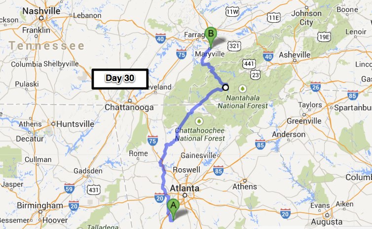
Day 30 – Maryville, TN (247 miles)

What a wonderful time we had in Peachtree City, and what a treat to have Robin along this time around – everybody likes Aunt Bobbi.  I try to get back here every year to see my nieces and when I do they do everything they can to clear their schedules to spend some time with their Uncle Lenny.  Dinner on the last night is always a blast with 8 kids ranging from 3 to 14 (most are under 8 though) and this year was no exception.  Almost everyone wanted to go for a motorcycle ride after dinner.  So, that’s what we did – you can check out the pictures here.

Love you guys & see y’all next year.

Today was an absolutely awesome day.  The weather was some of the best we’ve had for the whole trip.  It started out a little cool but that didn’t last too long – Robin never even put on her jacket.  We did have to out run another rain storm though.  We weren’t quite so lucky with this one and we got light rain for about 30 minutes so we were a little more than a little wet but we were all dried out by the time we got to the hotel.  I think the rain maker was trying to tell us our luck had run out, and sent this cloud to deliver the message- I’ve included my response.

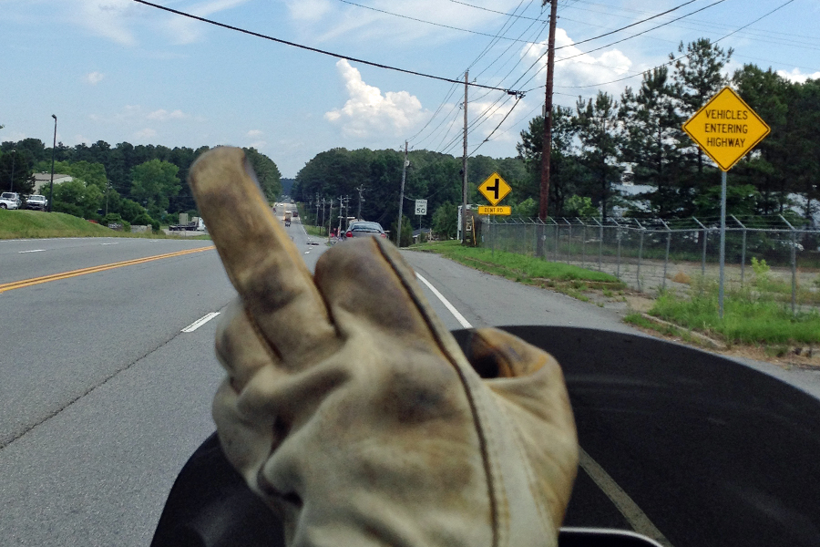
OH - YOU NUMBA ONE

OH – YOU NUMBA ONE

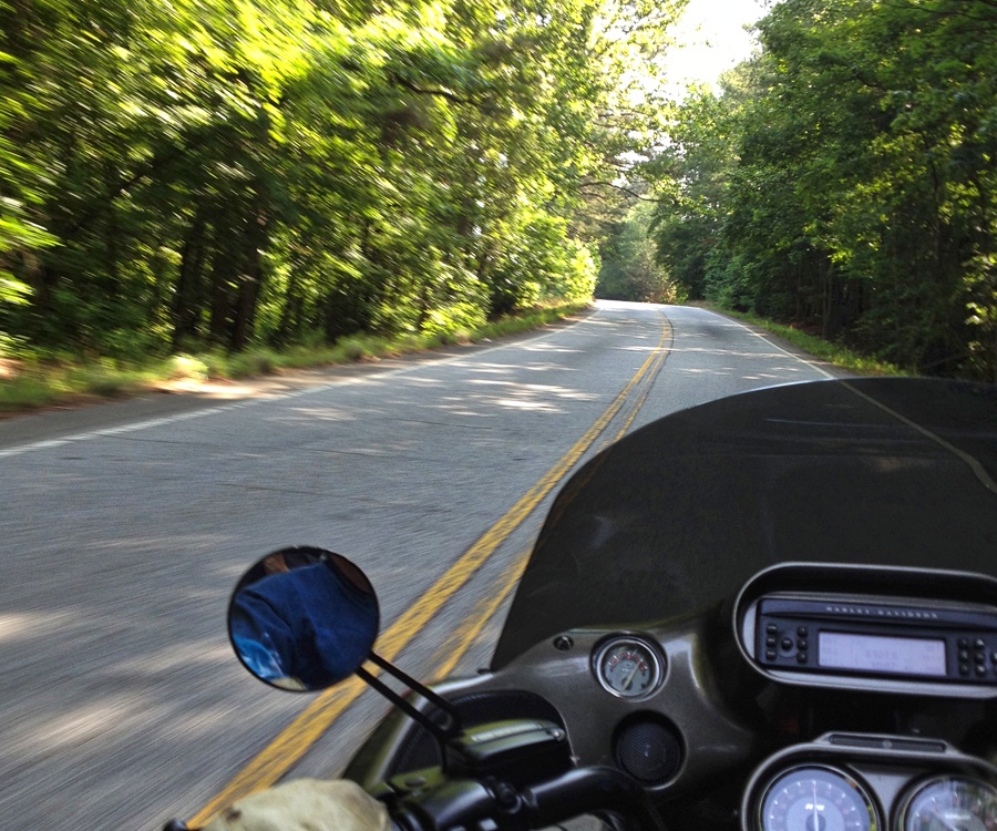
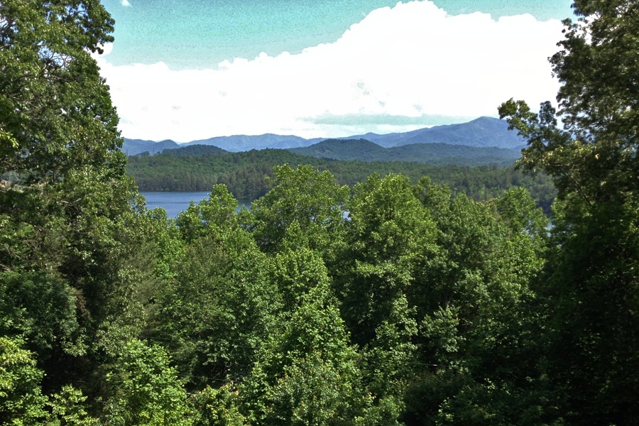
Here are a couple pictures from the road that Robin was able to snap with her iPhone while we were riding.  Sure is nice to have a photographer along to document, don’t you agree?30 Road 30 Road2We try to stop fairly often to break up the day – sometimes it’s just a gas station or on the side of the road.  This time we got lucky and had a nice view – for a little while, when the bugs started getting thick Robin beat a hasty retreat – there’s a lot of bugs in the south…..

From a Scenic Overlook where we pulled over to stretch our legs

From a Scenic Overlook where we pulled over to stretch our legs

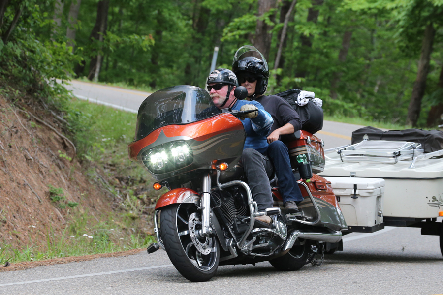
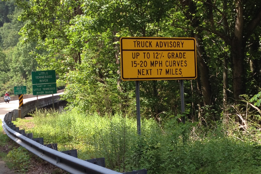
The reason for this leg of our adventure was to ride The Tail of the Dragon at Deal’s Gap.  This is a stretch of road that motorcyclists and sports cars from all over come to ride/drive.  There are 318 turns in 11 miles and there are many unfortunate enough to be unsuccessful at navigating them (there are LOTS of youtube videos if you wanna go check it out).  There’s even a makeshift shrine called the tree of shame at the Deal’s Gap Motorcycle Resort at the end of the road.  Bikers hang or otherwise attach their broken motorcycle parts after signing and dating them. We were able to complete the ordeal without having anything to add to the tree.  For our trouble I got a T-Shirt, Robin got a hat, and the trailer gets a couple of stickers.  We also got our picture taken – there are no fewer than 3 separate photographers on this stretch of road that make their living selling pictures to riders/drivers.

Dragon Slayers - Hwy 129, Deal's Gap, The Tail of the Dragon - 318 turns in 11 miles.

Dragon Slayers – Hwy 129, Deal’s Gap, The Tail of the Dragon – 318 turns in 11 miles.

Translation - Truckers, DO NOT enter the dragon!!

Translation – Truckers, DO NOT enter the dragon!!

247 miles doesn’t seem like a lot, but when you only travel on state and county roads and spend most of your time in the mountains – it takes all day.  We were ready for the day to be over when we rolled into Maryville, TN.  Since I didn’t really spend any time looking for a place to camp we just grabbed a hotel room.  It’s been a big surprise to me that the KOA’s charge so much for their tent sites.  For about the same amount of money you can stay at a Motel 6 or a Super 8.  And at the end of a long day on the motorcycle – all you care about is a place to crash.  Uh – yea, I probably could have picked a better word there……30 Map

Day 31 – Greensboro, NC (312 miles)

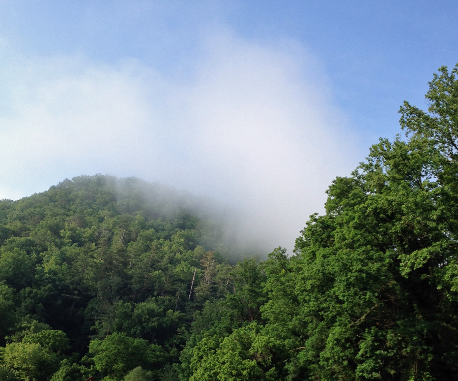
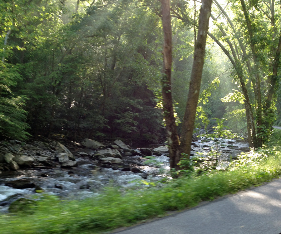
Yesterday, we left Georgia and headed up into the Smokey Mountains.  For today’s ride to Greensboro, there was just no way to get around being up on the slab for most of the day.  So, since we were going to be making pretty good time for that portion of the ride, I decided to go back up into the Smokies to start the day.  What a great way it was to start the day.  The Great “Smokey” Mountains got their name from the natural fog that hangs over the range.

A fine example this morning of how the Great Smoky Mountains got their name.

A fine example this morning of how the Great Smoky Mountains got their name.

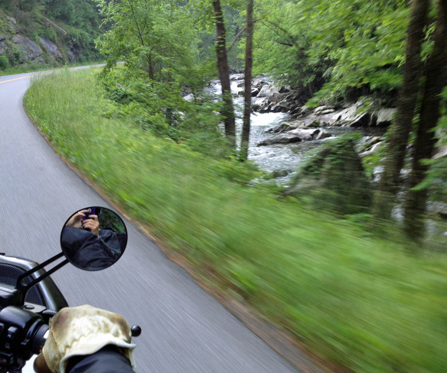
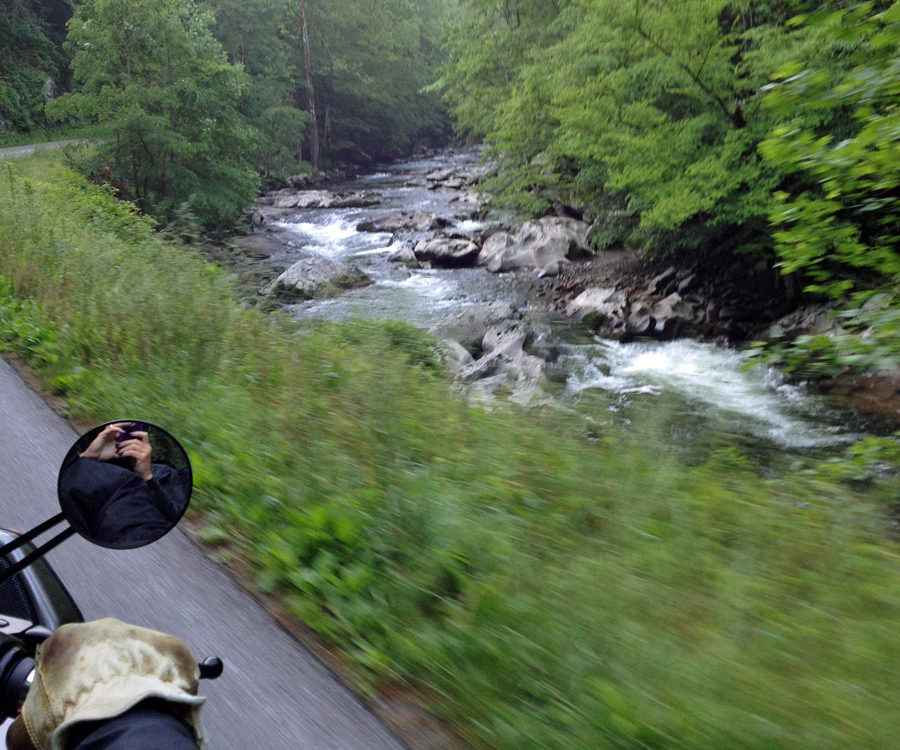
The ride through the mountains wasn’t the Tail of the Dragon but I actually enjoyed it more.  The road follows Dudley Creek as it descends out of the mountains which was cool enough, but in several places, the rays of the sun were just beginning to shine through the trees.  My copilot is one hell of an iPhone photographer – don’t you agree….31 River2 31 River1 31 River3

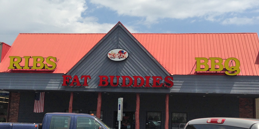
I could easily spend a week or more in this area, all the roads through the Smokies are renown motorcycle roads & I’d like to ride them all at least twice.  The first time you ride a twisty road you are pretty careful because you don’t know exactly what the road does around the next curve or over the next rise.  After you’ve seen it, you take note of where the “need to go slow here” places are and the rest you can ride more aggressively which equals more fun.  We stopped here to get one last shot of the Smokies before we headed for the slab.31 SmokiesWe didn’t make the traditional breakfast stop after 75 or 100 miles because the place I wanted to check out didn’t open until 11:00.  We rolled into the parking lot at 11:04 and we were the first ones there – except for the two “matronly” (thanks for that one babe) ladies banging on the front door because they were late opening – I didn’t count them because I’m sure they are regulars….  We waddled back out to the bike and with our stuffed bellies, struggled to stay awake for the rest of the ride to Greensboro.  And – no pix from the slab….

My Dad was following us via computer & suggested this place but I couldn't make it happen on the way in so I made it happen on the way out - YUM

My Dad was following us via computer & suggested this place but I couldn’t make it happen on the way in so I made it happen on the way out – YUM

31 map

Day 32 – Washington, NC (185 miles)

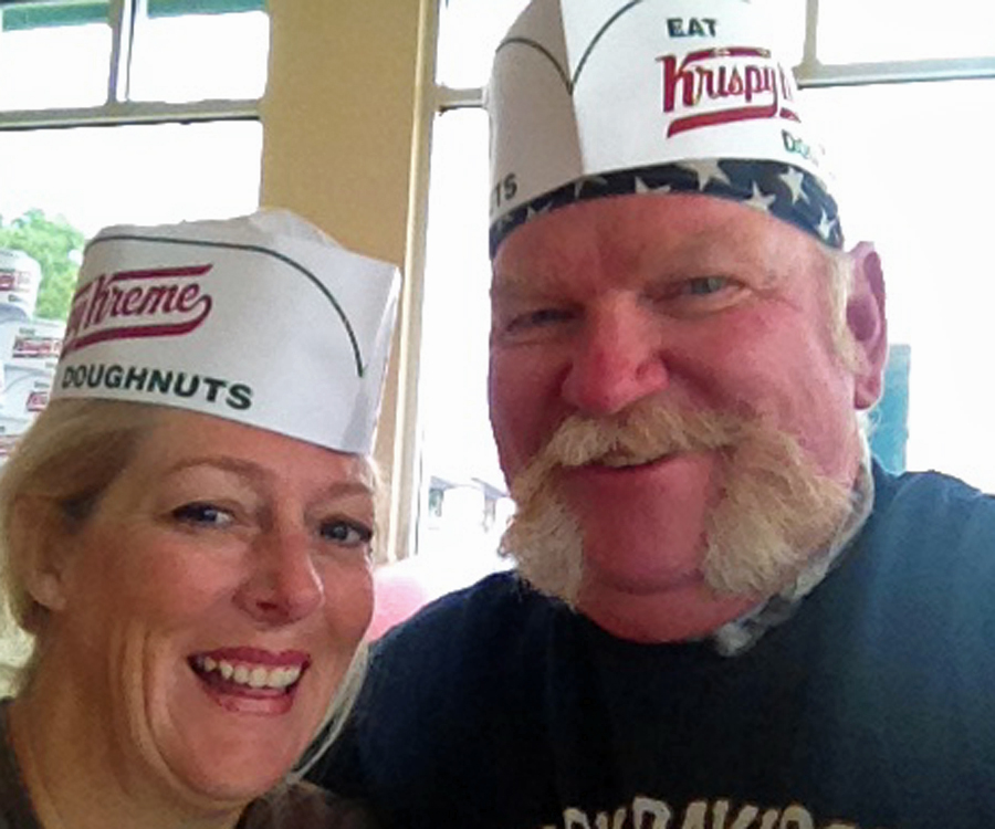
A couple days ago Robin saw a Krispy Kreme sign somewhere and got the taste in her mouth for donuts for breakfast.  Now – this girl never asks for anything, so when she does – she gets it!!  We backtracked (something I just about never do) about 4 miles to the closest Krispy Kreme and what do you know, the Hot sign was on.  That (for those of you who don’t know) means you can have your donuts hot out of the fryer immediately after they go through the glaze waterfall.  If you haven’t had ’em this way – you owe it to yourself to give it a try.  Melt in your mouth goodness!!  I won’t tell you how many we ate, but we look pretty happy don’t we?

I wouldn't recommend them as a daily part of your healthy diet - but once in a while..... YUM

I wouldn’t recommend them as a daily part of your healthy diet – but once in a while….. YUM

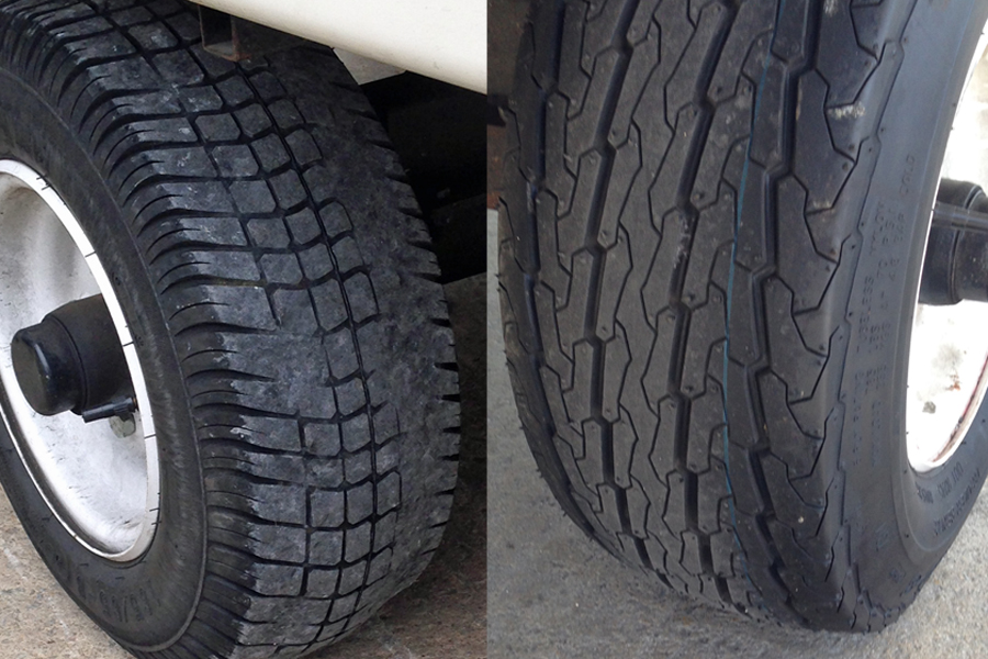
Today was a short day so I decided it was time to get new tires for the trailer.  Robin said that she was worried that one of the trailer tires would blow out, then the trailer would start swerving back and forth uncontrollably and the ensuing wreck would be horribly painful and possibly even fatal.  The tires do need to be replaced but with that little scenario running around in my wife’s head – that task has moved up to A #1 on the priority list.  I was quite surprised how difficult it was to find this size tire that’s not a golf cart tire.  We were very lucky that one of the golf cart guys pointed us in the right direction.  It took a couple hours start to finish but now we have new rubber on the trailer & Robin is all smiles again.

The tires were really worn and completely bald in many areas, we'll see how the new ones do.

The tires were really worn and completely bald in many areas, we’ll see how the new ones do.

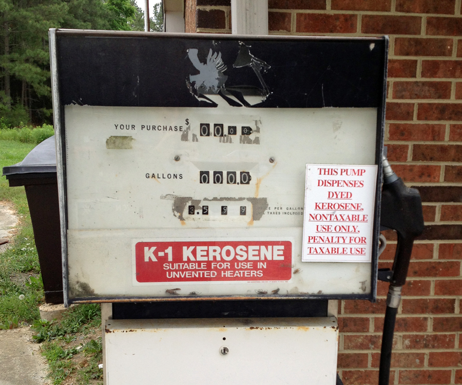
Never seen a kerosene pump before.  Looked to me like it was still being used too.

Never seen a kerosene pump before. Looked to me like it was still being used too.

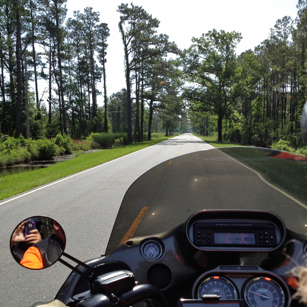
Needless to say, we were on the back roads today and if you ask me the weather was absolutely perfect.  There was at least a high overcast that kept things cool but quite a bit of the time the sky was dark enough that it could have started pouring any moment.  It didn’t rain on us at all – again.  A side note here – we have been dry, however the GPS has seen the rain, left on the bike overnight last night. However, this GPS has seen the rain and recovered quite nicely before so we are hoping for a full recovery this time as well.  It looks like it’s going to be okay, cross your fingers.

Our own private road.  Don't see stuff like this up on the slab for sure.

Our own private road. Don’t see stuff like this up on the slab for sure.

Last but not least we would like to send our positive thoughts and prayers out to our friend, Bernie Nelson.  Rest up Bernie & we’ll see you on the golf course when we get back.32 map

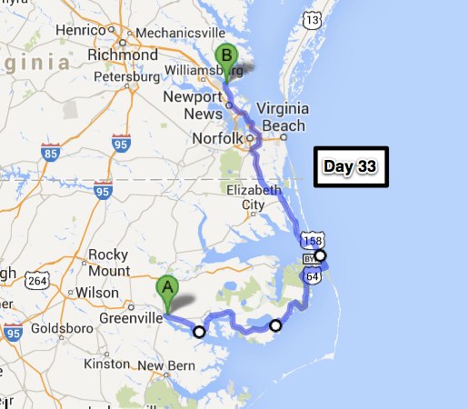
Day 33 – Yorktown, VA (265 miles)

Longish day today started with our ride out of Washington, NC down to the Pocosin Lakes and Alligator River National Wildlife Refuges.  I wasn’t expecting farm land down here so close to the ocean, but there’s a lot of it.  Mostly corn and wheat – I’m thinking that must be a good crop rotation since that’s about all we saw. The road wasn’t all that good but we had it to ourselves for the most part.  I expected to see some wildlife in these wildlife refuges but there was none to be seen.  Could have had something to do with the evidence of fire all around.

Amber waves of grain - didn't get any pictures of the corn though

Amber waves of grain – didn’t get any pictures of the corn though

Pocosin Lakes National Wildlife Refuge - not much wildlife, lots of burnt trees

Pocosin Lakes National Wildlife Refuge – not much wildlife, lots of burnt trees

When we got to the Alligator River Refuge there was some wildlife, turtles.  I should have stopped to take a picture – these guys were crossing the road for greener grass I’m guessing. They were about the size of a bowling ball cut in half.  Their almost black shells were highly visible against the light colored asphalt but in the dark you would never see them.  If you hit one of those turtles on a motorcycle, you wouldn’t have any idea what happened until the paramedics told you.  Glad our trip through was made in day time.

In front of the Black Pelican - one of the Diners Drive-Ins & Dives featured restaurants

In front of the Black Pelican – one of the Diners Drive-Ins & Dives featured restaurants

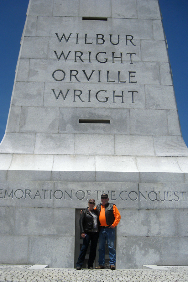
Time to get something to eat, then head over to the Wright Brothers Memorial.  I always look for one of the Diners Drive-Ins & Dives places to check out.  I saw this one and we headed over.  The food was not inexpensive but was good so we didn’t leave with hurt feelings.

In front of the Wright Brothers Memorial atop Kill Devil Hill.

In front of the Wright Brothers Memorial atop Kill Devil Hill.

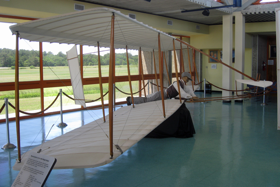
The Wright Brothers National Memorial is worth the visit for all you aviation buffs out there. Neither of us are really enthralled by aviation history but this place was quite interesting.  We took a bunch of pictures and even got souvenirs (which is rare).

One of the later gliders used to learn about air flow and the principles of flight

One of the later gliders used to learn about air flow and the principles of flight

From the starting point to the farthest point, first powered controlled flight

From the starting point to the farthest point, first powered controlled flight

From Kitty Hawk to Yorktown was an easy ride until we got into the city.  The GPS hasn’t fully recovered from its exposure to the rain so the screen is kinda dim and difficult to read.  That makes using it to get around a little “interesting”, but we made it.33 map


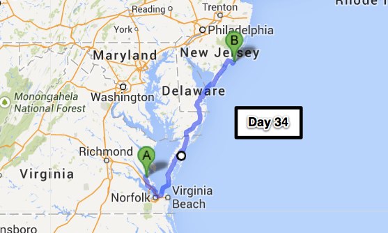
Day 34 – Atlantic City, NJ (296 miles)

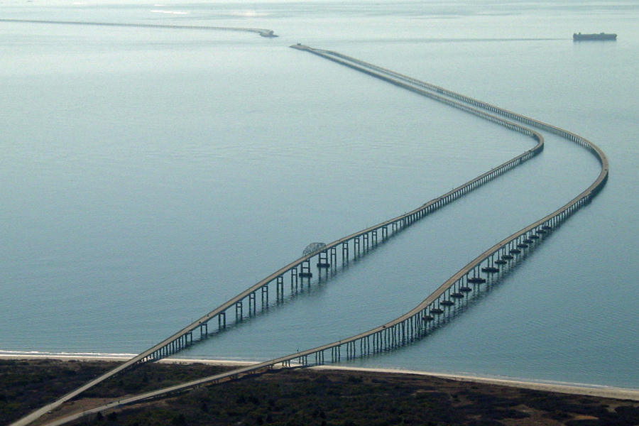
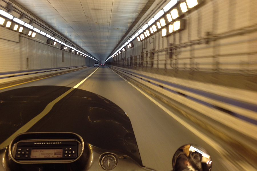
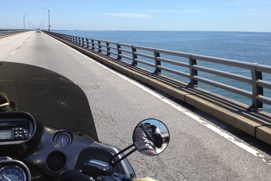
We started the day by going a little bit south to get to the Chesapeake Bay Bridge – Tunnel.  This is a 23 mile bridge that has two one mile sections of tunnel so the ships can go over on their way into and out of the harbor. When the bridge tunnel was opened in 1964 it was added to the 7 wonders of the modern world list.  This is a double whammy for us since Robin doesn’t really like the bridges and while I’m not “afraid” of the tunnels, I’m much less comfortable down there.  Maybe I’m a little claustrophobic. They were doing some work in one of the tunnels and we had to wait for about 5 minutes out on the bridge.  Robin wasn’t too happy about that but not for the reason you think.  There was probably a 6 foot swell out on the water and it being on a fixed bridge and watching that swell out on the water was making her sea sick.  I have to admit, looking at it did make me feel a little queasy too.  But we managed to make it across without any real issues; I’ve always wanted to take this route out of the Norfolk area and now I have – check that one off the list.

Overhead view of the north end of the Chesapeake Bay Bridge - Tunnel.

Overhead view of the north end of the Chesapeake Bay Bridge – Tunnel.

One of the two tunnels - it's a little "tight" down here for me

One of the two tunnels – it’s a little “tight” down here for me

You can see a little bit of the swell on the water - it got bigger farther out.

You can see a little bit of the swell on the water – it got bigger farther out.

Next stop on our northbound travels was Lewes, Delaware.  Lewes (pronounced Loo-iss) has the distinction of being the first town in the first state.  Discovered in 1609 and settled by 32 Dutchmen in 1631.  All the Dutch were massacred by a local tribe of Lenni Lenape Indians following a disagreement over a coat of arms that had been stolen by an Indian from the Dutch settlement. The tribe slayed the Indian who stole the coat of arms and presented his head to the Dutch.  At the same time, friends of the slain Indian were so upset that he had been killed they massacred the settlement in 1632 in revenge.  It was permanently settled 1658 and traded hands a couple times between the Dutch and the English.  Okay – enough history…. Our reason for being there was to avoid all the traffic around the Washington D.C. area.  I’ve been there – done that, and from now on the ferry will be my preferred way to go.

Our view of the The Cape May - Lewes ferry pulling in from the On the Rocks Bar & Grill

Our view of the The Cape May – Lewes ferry pulling in from the On the Rocks Bar & Grill

We had a little over an hour to wait for the ferry and the On the Rocks Bar & Grill there at the terminal proved to be the perfect place to sit back and enjoy a beverage & some of the best crab dip we’ve ever had (served with grilled pretzel roll toast – like crostini).  The bartenders were charming young women and made the wait seem like it took no time at all.  Speaking of bartenders – the bartender on the ferry helped us pick a place to stay here in Atlantic City.  He told us that there was a Margaritavile at the Resorts hotel and casino and that they had an outside bar called Landshark’s that was just across the boardwalk and right on the beach.  That was all we needed to hear. The hotel is nice and we spent enough time at Landshark’s that sleep was immediate and sound for both of us.  Wonderful day with AWESOME weather.

Checking on the bike from the bar on the ferry - it was a pretty smooth ride.

Checking on the bike from the bar on the ferry – it was a pretty smooth ride.

We’ve met a lot of very interesting people today and would like to welcome a couple of them to the blog.  Thanks for the Fireball Shiloh, and safe travels to Larry and Tucker.

34 map

35 – Milford, CT (248 miles)

I forgot to include this in yesterdays post and it’s too good to just leave out – so here ya go….

Chicken Bar for the urinal - this was on the ferry but I can think of several times these would have come in handy and I was nowhere NEAR a boat or open water at the time.

Chicken Bar for the urinal – this was on the ferry but I can think of several times these would have come in handy and I was nowhere NEAR a boat or open water at the time.

We were out of Atlantic City at the crack of 11:00 today.  I was still up with the chickens though, and took this shot of the boardwalk – not much going on there at 7:00 AM.35 boardwalkThe road from Atlantic City to New York is the Garden State Parkway.  This is not the Autobahn, it’s a highway with lots of toll booths on it.  I think however, that drivers believe the toll means that there will be no speed limit enforcement – and from what I saw, they’re right!!  Looks like 85 is about the maximum, regardless of the posted speed limit.  There were construction zones with a posted 45 mph limit with traffic fines doubled & everything.  I slowed from 70 to 65 and was almost a traffic hazard.  The road was pretty good for a while but there must be frost heaves in the asphalt or something because every once in a while BOOM, like running over a 2×4 at 65 mph.  Robin’s back doesn’t like those little surprises – mine either for that matter.  I think we’ve paid one or two tolls prior to today – today we paid at least SIXTY dollars in tolls.  They are not at all fond of trailers out here.  The trailer added at least $3.00 everywhere.  Car = .75 cents, motorcycle with trailer – $3.75.  Going into New York City via the Lincoln Tunnel, Car = $13.00, motorcycle with trailer – $27.00!!  I’m going to have to go to the bank tomorrow and get some more cash just to get out of here.  If you’re ever in this area, this will help you to understand the different roads:
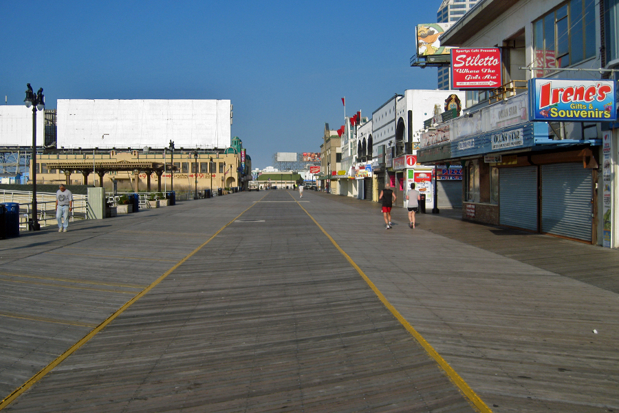
A highway is a main public road.

An expressway is a limited-access divided highway designed for high-speed traffic, with few at-grade intersections and traffic lights.

Freeways are engineered for higher speeds than expressways. Freeways usually lack intersections, traffic lights, and stop signs. Access is only provided at grade-separated interchanges. In some regions, the terms freeway and expressway are used interchangeably. The free in freeway implies freedom from traffic, but may also be used to mean ‘at no cost’, in which case a freeway is a toll-free highway.

A parkway is a scenic divided highway with a landscaped median and roadsides. Commercial vehicles are prohibited from driving on some parkways.

A turnpike is a highway on which tolls are collected.

Manhattan sky line - that's where we're headed.

Manhattan sky line – that’s where we’re headed.

The goal today was to go to the 9/11 Museum.  It just opened and Robin really wanted to go see it so I took a look at where we could park (~$40) and set the GPS.  What a mess, but here we are at the entrance to the Holland Tunnel & guess what – no trailers allowed, gotta go up and take the Lincoln Tunnel if you have a trailer.  It’s only about 3 miles they told me.  Well, they didn’t factor in that I have no way of knowing where the %*#* I am without my GPS programed.  I gave it about 3 tries before I pulled over and found something I could put in the GPS that got us over to Manhattan via the Lincoln Tunnel.  I re-programed the address of the parking garage in and we did eventually find it but… they don’t accept motorcycles & we were told that no place would – ESPECIALLY with a trailer, “What are you – Crazy?”  And there is NO other place to park.  The guy running the parking was a motorcycle rider though and after 10 minutes of consideration, let us park on the street in a handicapped spot behind his van but ONLY if we promised to make it quick because he was going to be in big trouble otherwise.

I had this nightmare one time - and now I'm in it for real...

I had this nightmare one time – and now I’m in it for real…

It was a half a mile walk from our lucky parking spot to the twin towers memorial and the museum is right there.  We took some pictures then headed over to the line to get tickets.  I spoke to one of the museum workers while Robin was in the ticket line & the bottom line was that including all the time in line to buy the tickets and then waiting for your group to be called for entrance, it was going to be at least 3 hours before we got out of the museum.  No way we can take that kind of advantage of the guy that let us park when nobody else would. Very difficult call to make – we’ve paid so much in time and trevails to get here and now to have to turn around without being able to do what we came here for in the first place – UGH.  Oh well, the 9/11 memorial was worth the trip and next time we’ll do it right and have all day.

9/11 Memorial - very emotional really.  Like eternal tears for the lives lost that day.

9/11 Memorial – very emotional really. Like eternal tears for the lives lost that day.

One World Trade Center stands like a giant middle finger.
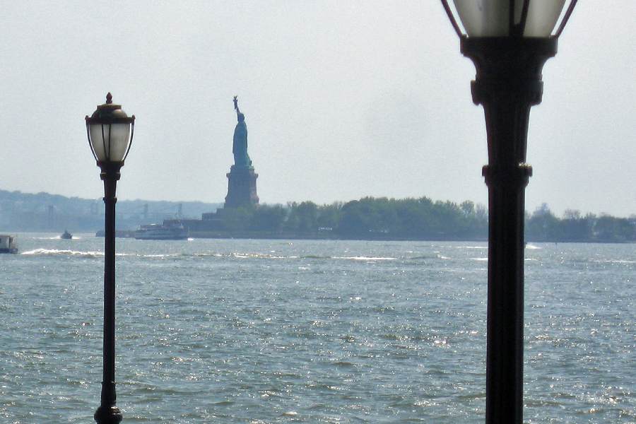
One World Trade Center stands like a giant middle finger.

35 libertyOkay – back to the bike and we begin the ever so frustrating task of getting the hell out of here.  Traffic was bad & we needed gas, I can’t imagine what you would have to charge for gasoline in Manhattan to pay the rent so, there are no gas stations.  We scratched and clawed our way northbound on West St. and then into Pelham.  Remember the movie, The Taking of Pelham 1 2 3?  Anyway – a tank full of gas and off we go trying to get to our accommodations for the evening without getting too wet.

Going under the train tracks in Pelham after finding a gas station.

Going under the train tracks in Pelham after finding a gas station.

Some things never change - trying to outrun the black sky and the rain that's coming with it.

Some things never change – trying to outrun the black sky and the rain that’s coming with it.

On Interstate 95 in Connecticut - 20 miles of stop and go.  it took 90 min to go 30 miles.

On Interstate 95 in Connecticut – 20 miles of stop and go. it took 90 min to go 30 miles.

No reservations of course since we have no idea how far we will be traveling.  Super 8 in Stamford sounds good though.  Pulled into the parking lot – no vacancies.  Checked a few more in the vicinity – must be a convention or something.  It took a long time in traffic but we got to Milford JUST ahead of the rain, dry and tired but what an adventure today has been.35 map


Day 36 – Nashua, NH (206 miles)

We started early this morning but still took all day to go just over 200 miles. We took our time and stopped in to see one of Robin’s friends at their home for lunch. Thank you Rachel and Jon for your hospitality and for taking time out of your busy day in the middle of the week.36 road1As you can see, the roads out here are beautiful.  This is about all we saw today since everything is so green and grows right up to the side of the road.  Getting around in this area without a GPS would be very difficult unless you were on the highways.  There are little towns just about everywhere an the roads between them are not straight.  In the final 70 miles today I don’t think I ever went more than 6 miles on the same road & just about every turn was onto “Main” street through a small town center.  We are fairly close to Boston here in Nashua and here is my theory.  150+ years ago all these little towns were individual townships and separated by a few miles.  Close enough to Boston to be convenient but far enough away that you were definitely out of the city.  Now – people have moved in to just about every open space between the towns and it’s all one big suburb.  Speed limits are seldom over 35 mph and the roads wouldn’t support anything faster anyway.  So, while it’s picturesque and quaint, we’ll be looking for roads with a little higher speed limit tomorrow, not the slab – just something in the middle & I’d like to be off the road before everyone is on their way home from work.36 road2Before I wrap this up, I would like to commend the state of New Hampshire for having the hands down, absolute BEST, nobody else even comes close, state motto:
Live Free or Die – that just about sums it up doesn’t it.36 map-1

Day 37 – Bangor, ME (231 miles)

Yesterday when I looked out the window there was a heavy wet fog in the air.  Not quite enough to make the ground wet but almost.  Riding in these conditions will get you very wet after a couple hours, but we have all the rain gear and stuff so we suited up to ride.  By the time we’d gotten ready – it was raining.  The forecast said rain until 4:00 PM and a look at the weather radar pretty much confirmed it.  The weather through the rest of the weekend though, is supposed to be fantastic – SO, we took a down day.  Our list of things that need to be accomplished was adding up and we could certainly get most if not all of them checked off in a day mostly dedicated to the list. We rode to breakfast in the rain but it did quit around 4:00 so our ride (nothing is walking distance here) to dinner was a dry one.  The “to do” list is now empty and I even managed to get a new front tire and an oil change done on the bike.  Now, I should be able to get home without any more maintenance on the scooter.37 RainAnother thing that I was able to do yesterday was sit down with a calendar and discuss the “extra credit” portion of my Four Corners ride.  If I were to press on to Nova Scotia and Newfoundland it would have to be at such a pace that it would take most of the fun out of it.  So, looks like we’ll be turning around after corner number four day after tomorrow.  Besides, don’t want to get it all done at once – then you have nothing left to aspire to.  As soon as I made the decision I started planning my next ride – start in August next time, ride around all the Great Lakes, pick up Robin in Boston, then head up to Nova Scotia, Newfoundland & Labrador.  Already looking forward to it….

Back to reality though – Waiting the rain out turned out to be the perfect thing to do. It was chilly starting out this morning but it warmed up to comfortably cool in our leather jackets; I don’t think Robin had her electric clothes turned on all day – she was wearing them though!!  We were leaving our breakfast restaurant, leathers on and ready to hop on the bike.  In comes five girls and a guy dressed like they are trying to stay cool in Key West.  Robin said, “You girls are making me feel like a whimp.”  They said that the sun was coming out and it would be getting a lot warmer but they were probably thinking – Uh, yea – you aren’t looking too tough.

Portsmouth, Maine - look at all those boats out there taking advantage of the good weather.

Portsmouth, Maine – look at all those boats out there taking advantage of the good weather.

Maine is a place that for some reason gives me the sense of being – solid.  The ground you see from the road is all rock; and not like the kind of rock you can go pick up either. Rock like it’s been there for ever and you’re not moving it.  Not individual rocks, one giant piece of rock.  And the soil smells very loamy, like what little of it there is above the solid rock is very rich.  Don’t know if any of that’s accurate but that’s what it seems like to me.

I don't remember exactly which town this church was in but I do remember hoping that Robin was able to take a good picture.  It was amazing and easily the coolest thing in that little town.
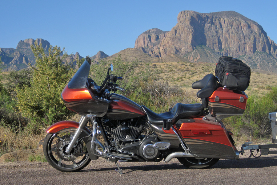
I don’t remember exactly which town this church was in but I do remember hoping that Robin was able to take a good picture. It was amazing and easily the coolest thing in that little town.

One thing I try to do is see if I can find any stand out places to eat dinner at our destination.  Since I had ample time yesterday I found a place I wanted to try.  Top rated for all its food and especially their lobster roll The Eagles Nest was where we were headed.  What they didn’t say was that this place is SMALL.  It’s on the side of a 45 mph road and there is nothing else around it.  I had it programed into my GPS and still blew right by it. Right on the river and actually built out over the side of the steep hill going down to the river, this place is so small that if you don’t catch the front door & it slams (it’s on a spring) the whole building shakes a little.  We took the window seat looking out at the river and had a great view but I’m positive had Robin seen a side view of the place and how far out on stilts we were – she would have waited for me at the bike.  Other than that the food was fantastic.  We both got the lobster roll and since they are so big, I had to eat half of Robin’s.  I’m gonna say it’s easily half a pound of lobster meat on a piece of bread smaller than a cheap-o hot dog bun.  Good Eats

If you're ever in Bangor - better give this place a try.

If you’re ever in Bangor – better give this place a try.

Yum Yum - Lobster Roll, Onion Rings & Coleslaw

Yum Yum – Lobster Roll, Onion Rings & Coleslaw

We did the first 100 miles or so on the slab then headed for the country.  Awesome roads for the most part and as green as can be.  When you get to the towns the roads deteriorate to OMG how do we get through here without having a wreck.  I’m guessing that it’s difficult to do the required maintenance when there are so few roads so they just try to patch them where they can – it’s not working so good in the long run.  But other than having to dodge a few pot holes and hang on and ride through quite a few more it’s been a great day.

37 map

Day 38 – Madawaska, ME (243 miles)

When I was planning where to stay I figured the Motel 6 would be a safe bet. After all, what are the chances I would need reservations in Bangor, Maine.  UH – pretty good if that happens to be the night the Dave Mathews Band is playing.  We were told that there was no room at the Inn and were looking at other hotels and possible campground options when someone called and canceled their reservation – We’re IN.  It got really quite while the concert was going and a little loud when everyone got back, but all in all – we were happy to be here.

Full up at the Motel 6

Full up at the Motel 6

It was a nice ride up to Madawaska even though about half of it was on Interstate 95.  All interstates are not created equal and I-95 north of Bangor isn’t that bad.  Not too much to see, but being able to go 80 (75 mph speed limit & nobody on the road) really eats up the miles.  Oh, I forgot to tell you that we were able to leave the trailer at the Motel 6 in Bangor so we were unencumbered for the run up and back to corner #4.  Now that I think about it – the trailer hasn’t been there for any of the corner runs.  Just as well – makes getting around much easier when you aren’t draggin’ an anchor.

This Four Corners ride is a sanctioned ride with the Southern California Motorcycle Association and they have quite a few riders that do it every year.  One of them loved the ride so much that he paid to have a park built in Madawaska.  Today the park exists on the donations they get and the work of volunteers.  It’s a nice little park and we made a donation and got our pictures for the blog.

Madawaska, Maine  June 7, 2014.

Madawaska, Maine June 7, 2014.

Madawaska actually has a Harley Dealer (kinda – mostly a t-shirt shop) so we quickly headed over there since we only had 25 minutes before they closed.  I was happy we weren’t there on Sunday or Monday as they are closed both of those days and they had a pretty cool shirt that I picked up as a souvenir.  Robin found one as well but it’s a bit more generic than mine.  We got a line on the best place in town to stay from the girls at the Harley dealer and headed for the Gateway Hotel.  One stop shopping, bar, restaurant, and crash pad.  Who could ask for more – well… there is one more thing we needed & didn’t have.  Internet access – their wireless wasn’t working and there was no way to use our cell phones as a hot spot because as far as our cell phones were concerned, we were in Canada – no data plan in Canada.  Oh well, just means that you had to wait a little while for this post.

The monument at Four Corners Park.

The monument at Four Corners Park.

The “going” is done now, the rest will be “coming back”.  It’s time for that too – off and on, I’ve got places to go and people to see on the way back to California and I don’t want to feel like I have to hurry to get any of it done.  This will mean a much more leisurely return trip.38 map

Day 39 – Bangor, ME (226 miles)

Last night was interesting.  We should have known that the bar experience was going to be a challenge because when I asked the bartender what kind of chardonnay they had she said, “We have the box and I think we have the bottle.”  UM – okay…. how about the bottle.  Now this young lady said she’d been a bar tender at two other places but the corkscrew was kicking her ass.  She looked like this might well be her first day ever behind a bar.  OK, that’s bad enough but when I ordered my 2nd margarita she grabbed the tequila from the display shelf behind the bar, hoisted it over her head in a simi-flourish, broke one of the wine glasses hanging in the overhead rack and one of the pieces of falling glass managed to cut her head.  She got a band-aid and was back at it.  The live music they so proudly touted was a guy with a keyboard doing lounge style Lawrence Welk.  Not my idea of a rockin place for sure.  At least the food was good & the room was clean and even though it wasn’t the best bar and band experience, we didn’t have to go anywhere for the entertainment.  I’d stay there again.

Good weather and open roads in Maine

Good weather and open roads in Maine

Everyone was saying how great the weather was and we just smile because at this point we’re thinking – we know, and you’re welcome – we brought it with us.  Today was another one of those perfect riding days.  Robin said she was a little cold but not enough to do anything about and I was just as happy as I could be.  We took hwy 1A on the way up yesterday so we took hwy 1 southbound and were greeted with a faster road that was in far better shape.  We met an interesting character at breakfast this morning.  A WWII vet, he had a couple stories about his time spent in California (in ’48) and told us about the farming they do up here (he has a large farm) which is something I’ve been wondering about.  Most all farmers up here have two fields – one is potatoes and one is oats and they rotate the crops from field to field each year.  I wish we’d taken a picture to help us remember him.

Robin says that Maine must translate, in some language, into dandilion - LOTS of em everywhere!!

Robin says that Maine must translate, in some language, into dandilion – LOTS of em everywhere!!

We were on the alert after we saw this sign.  We’ve heard moose stories from several of the locals but hadn’t seen one until today.  This little guy just wandered back up into the brush and I was glad that mama wasn’t anywhere in sight.  I still have scary moose memories from Alaska three years ago – THAT was a close one!!!

Don't believe the sign?  Believe the MOOSE - this one is just a baby

Don’t believe the sign? Believe the MOOSE – this one is just a baby

Happiness is having your own bass lake - small mouth up here I'm sure.

Happiness is having your own bass lake – small mouth up here I’m sure.

It was a nice trip back into Bangor (pronounced as two separate words Bain Gor). Since we ate at the lobster roll place on the way up, I decided to take Robin to a kinda nice place on the way back through, so we’re off to the Fiddlehead Restaurant; more on that tomorrow….

My beautiful co-pilot - on our way to dinner

My beautiful co-pilot – on our way to dinner

39 map

Day 40 – Tilton, NH (236 miles)

The goal today was to get Laconia, NH.  I was talking to another Harley guy and told him the story about how disappointed I was not to be able to get a good t-shirt when the state of New Hampshire had license to the “Live Free or Die” motto.  He told me that he got a very cool shirt at the Harley dealer in Laconia, and that’s about half way between Bangor & Albany (our next real destination) so it works out perfectly.  But before we get out on the road, I need to tell you about our dinner last night. First night in Bangor we went to “my” kinda place, you’ll remember that one with the too big to eat lobster rolls. Okay – this time through we are going for something more Robin’s style.  Fiddlehead Restaurant seems to fit the bill so here we go.

Bloody Maria & chardonnay - note the fiddlehead garnish.

Bloody Maria & chardonnay – note the fiddlehead garnish.

Nice place to start with in an older part of town in an old building that originally must have been a library or something (we should have asked). Anyway – after looking at the drink menu I just had to order a Bloody Maria with pickled fiddlehead garnish vs. celery.  Our appetizer was a cheese plate but you couldn’t see any cheese (a piece of some kind of soft cheese about half the size of my little finger was wrapped in puff pastry).   Next was a miniscule salad made with dandilion greens – it was okay. As you can see from the presentation and the explanations of the food, this place is way above my pay grade. Robin however enjoyed the experience and the food thoroughly – and that was the whole reason for coming.

My fillet on a bed of roasted beet risotto with artichoke hearts on top & some kind of cheese all around.  Robin's meatloaf on a bed of cauliflower mashed potatoes topped with pickled onions.

My fillet on a bed of roasted beet risotto with artichoke hearts on top & some kind of cheese all around. Robin’s meatloaf on a bed of cauliflower mashed potatoes topped with pickled onions.

I told you how bad the roads are here especially in town. Well, I was going to just let it go but while we were at dinner some poor guy went by walking his bike up the hill with the bent up front wheel straight up in the air. His face was pretty scratched up and he was bleeding from his chin. Now – I don’t know for sure what happened but he very easily could have fallen victim to one or more of the billion or so cracks and pot holes and face planted. Some of these things are big enough to wreck a motorcycle, I would not ride at night here unless I knew the route’s road hazards – the man hole crater is right in the middle of the lane, not too much of a problem for cars but a motorcycle going slow would be down.

These Roads!!  It's very hard to capture depth. The man hole cover pot hole is at least 8 inches deep.  Both of these are right in the middle of intersections.

These Roads!! It’s very hard to capture depth. The man hole cover pot hole is at least 8 inches deep. Both of these are right in the middle of intersections.

Riding the back roads has it’s bad points, mostly related to not being able to put many miles behind you but today we had a section of road that was particularly bad.  I wasn’t going to say anything since I just got done complaining about the roads in Bangor but Robin and I were both airborne and I think the only thing that kept the bike on the ground was the trailer.  I think it was a frost heave repair – new asphalt about 4 feet front to back and all the way across the road. In the shadows of the trees you can’t see depth and even if I’d seen it I doubt that I would have been able to slow much from 40 mph.  I just shook my head but Robin got enough of a whiplash effect from the weight of her helmet whipping her head around, that we had to stop so she could take some headache medicine.

Riding toward the light

Riding toward the light

Other than that – the ride today was fairly uneventful.  I was punished for yesterday’s hubris though. Remember, I said something about how people should be thanking us for their good weather because we are bringing it with us wherever we go?  Today we were on the run again.  About 50 miles from Laconia the sky got dark, about 10 miles later we started getting rained on; not heavy but maybe middle click on your delay wipers rain (enough to eventually make you wet).  We were riding hard toward the light though and even though the rain got worse before it got better, we did get out before the skies opened up. Kinda like a surfer just getting out of the tube before the whole thing collapses and sends him crashing into the coral.

Laconia Harley Davidson is getting ready for this weekend’s rally. The Laconia rally is the oldest motorcycle rally in the United States & it’s big stuff out here. It’s a shame we’re going to miss it – NOT. Naturally, most of the t-shirts have something about the rally on them but I managed to find one that didn’t say anything about the rally and had a pretty good “Live Free or Die” silk screen on the back (it has skulls though, Robin doesn’t like skulls so much)….40 map

while not perfect was pretty good and didn’t have anything about the rally on it.

Day 41 – Albany, NY (203 miles)

Up and at ’em this morning, headed for Albany, New York.  On the way we’ll be going through Vermont so we can add that to the sticker map on the back of the trailer.  It was another gorgeous day that turned into a little bit of a rainy day at the end but nothing serious. We even got up into the mountains for a little while.  Sure was nice to get to ride some nice turning roads for a change.  And – for a change – the roads today were overall, pretty smooth.

Finally a fun mountain road - Green Mountain National Forest, Vermont.

Finally a fun mountain road – Green Mountain National Forest, Vermont.

Vista at the top of road in Green Mountain National Forest, Vermont

Vista at the top of road in Green Mountain National Forest, Vermont

New York dead ahead, Vermont in the rear view mirror.

New York dead ahead, Vermont in the rear view mirror.

Our friend David Stillman and his wife are the reason that our destination is Albany.  David and Barbara lived here for many years and we are going to have dinner with some of their friends at Wolferts Roost Country Club.  It was sure nice to know someone that knew the area well because Robin’s riding boot has a hole in it and getting that patched up before we run into any real rain would be especially wonderful.  We got a line on a little shoe shop that David said was the best in town.  Of course I check just about everything out on Google and the reviews supported what David had to say so that was our first stop when we rolled in.  It’s a small place and even if you were looking for a shoe repair place, you would be hard pressed to find it from the busy street out front without an address.
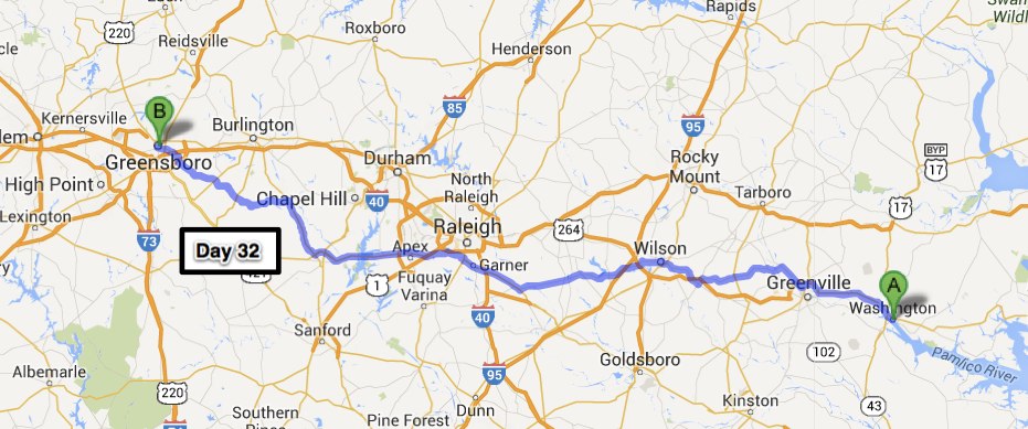
Her shoe is coming apart - she can get her finger inside the boot through the hole.

Her shoe is coming apart – she can get her finger inside the boot through the hole.

The Italian lady behind the counter said she would fix it and it would be ready in a couple hours.  What GREAT news that is and how awesome was she for stopping whatever else she was doing and getting right on Robin’s boot.  Sometimes when you’re on the road people move your issue right to the front of the line.  Two hours later I went back and the boot was ready, wow.  She said she glued the area with the hole and double stitched it on the sewing machine and that I owed her $5.  I smiled, thanked her profusely and gave her a twenty.

Colonie Shoe Repair - 42 years in the same location.

Colonie Shoe Repair – 42 years in the same location.

Off to “The Roost” to meet our hosts.  What a great bunch of people!!  Robin and I sat up on the upper deck area and enjoyed the view of the golf course and the conversation with Tommy, Tim, Frankie, and several others I can’t remember until it was time for dinner. The steak was melt in your mouth tender and the rest of the food was done to perfection. The weather was nice enough that we sat outside the whole time. Doesn’t get much better than this – next time I’m going to make sure I have enough time to enjoy a round of golf, the course looked immaculate.  We thoroughly enjoyed our time at Wolferts Roost and if we ever wind up living in Albany, we’ll see if they will accept our application for membership.

From the deck overlooking the practice green at Wolfert's Roost Country Club - Albany, NY

From the deck overlooking the practice green at Wolfert’s Roost Country Club – Albany, NY

41 map


Day 42 – Drums, PA (238 miles)

We got started a little late this morning. Partially because I was waiting to see if the weather would get any better and partially because last night’s party was a little strong for my co-pilot.  The weather didn’t look that good and never got better.  We rode the whole day in off and on rain showers (mostly on) and cold.  It’s okay though, it’s been a long time since the weather was anything but awesome so we can deal with a little cold rain.  Rainy days = slab days for the most part. Not too many sharp turns to lay the bike down in, no flash floods or streams running across the road to worry about and lots of stopping areas along the way.  No worries though, if all the days were good days – – good days would just be normal days.  I am quite the philosopher aren’t I.  Ha ha ha…….

The best it got all day.

The best it got all day.

Many of you might be asking yourself, “Drums, PA – I’ve never heard of that” which is understandable.  I’d never heard of it either until two years ago.  I was leaving Marshal, VA headed north on my, finish the lower 48 states ride and it was raining.  It was at least moderate rain from the time I got on the bike until I got off.  I rode as far as I could that day and ended up here in Drums.  The hotel I chose was a run down flea bag of a place but I just needed the day to be over.  The guy that runs the place couldn’t have been nicer – he insisted that I bring him all my wet stuff and he would have it dried for me in no time.  He put all my stuff (even my soaking wet cowboy boots) in the room where all their industrial dryers for the hotel are and he was right.  Rain suit and clothes were dry in just a couple hours and the boots were good to go in the morning.  That day I vowed that if I was in the area I would be staying at his motel.  This time our stuff wasn’t quite that wet but he still offered to dry everything.  I wish the hotel had nicer for Robin’s sake but I was good.

Obviously taken on a day with much better weather - The Lookout House Restaurant & Bar

Obviously taken on a day with much better weather – The Lookout House Restaurant & Bar

Robin might have been wanting for a classier motel but she was very happy with dinner.  I found a family owned and operated little place called The Lookout House that was within a mile or so & we headed over.  It’s almost gourmet dining in the middle of nowhere.  I knew something was up when the waiter showed up with the polished professional swagger of a waiter in a fine dining establishment.  Turns out he is a local but spent 26 years in California working at a restaurant in Brentwood (that’s $$$$ for those of you that don’t know).  Anyway, the place he worked went belly up 4 years ago and he came back home to Drums and started working at the Lookout again (he started here when he was 10).  Every course was wonderful, and the cost was low all things considered.  You might want to pick a better hotel but do yourself a favor if you’re in the area, and check out The Lookout House Restaurant & Bar – they actually have a motor lodge right here as well – maybe I’ll stay there next time.42 map

Day 43 – Spotsylvania, VA (278 miles)

Yesterday was rain, today started with fog. Okay, foggy morning, I’m sure it will clear up soon so we are off.  The road we took was a good one but the fog we were in got worse.  Robin was sure we were going to be in one of those huge pile-ups you’ve seen on the news.  We were on the Interstate and the fog was bad but I was going slowly enough that I wasn’t out-riding my visibility.  That meant that we were being passed all the time but the bike makes enough noise that I doubt anyone would be flying up from behind and run into us.  I was very surprised that the fog didn’t let up within a few miles, it was over 50 miles before we could see far enough to go the speed limit.  That was about the time it started raining…..

You could see the white line you were next to and two or three more

You could see the white line you were next to and two or three more

We stopped for breakfast and even though I was already slightly wet from the fog situation, I put on my rain suit, the smart lady I’m riding with has had hers on the whole time.  As the day progressed, the weather improved to the point that I was out of my rain gear and enjoying the day – – that all changed though.  The skies were full of clouds but none of them looked very menacing. We were just riding along, minding our own business when the skies opened up and we were in a downpour.  It only lasted about 3 minutes but that was long enough that I was completely soaked.  I just shook my head and Robin just laughed.  We ran into a few more showers and two more downpours before we got to Spotsylvania but I was so wet from the first encounter that there was no point in doing anything but pressing on.  Truthfully, if my leather boots hadn’t been part of the soaking, I really wouldn’t have cared but it takes those boots a while to dry out.  Robin’s aunt and uncle met us in the driveway with towels and we were all dried out enjoying the afternoon in short order.  Looking forward to our time here and tomorrow’s trip up to Monticello, Thomas Jefferson’s home, hope it doesn’t rain….43 map

Day 44 – Marshall, VA (87 miles)

Our stay with Aunt Peggy and Uncle Jay was quite enjoyable.  Jay was a pilot for the Navy during the Vietnam War and made the Navy his career.  He has so many great stories and I could sit and listen to him for hours on end.  Peggy is no slouch either, she is one tough lady and in addition to her time spent supporting her military husband and raising their children she is very knowledgeable about horses and “horse things” – so you know, she and Robin had their own stuff to discuss.  We are already planning our next trip to Spotsylvania.44 RPJWhen Jay found out that I’d never been to Monticello he said that he was going to take care of that & we were on the road to Thomas Jefferson’s home.  Right before you get to Monticello there is a place you have to stop called Michie (pronounced Micky) Tavern.  Back in the late 1700’s and up until mid 1800’s it served as a rest stop and watering hole for travelers.  The food they serve is much the same as you would have gotten if you’d been a traveler 200 years ago and you eat off pewter plates.  The food is really very good & go ahead and take an extra helping of the stewed tomatoes, you won’t be disappointed.44 Michie TavernThe tour of Monticello was quite interesting; we barely made it in before they suspended operations due to the lightening.  Did you know that most of older trees at Monticello have lightening rods on them?  It was quite a storm and it was nice to know that the house we were in had stood the test of time for over 200 years. Monticello needs to be on your “list” if you’re ever in the area.  There is SO much history out here – looking forward to next time.
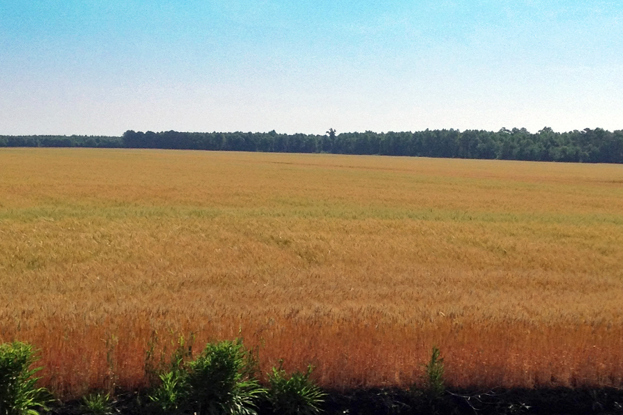
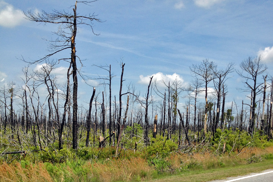
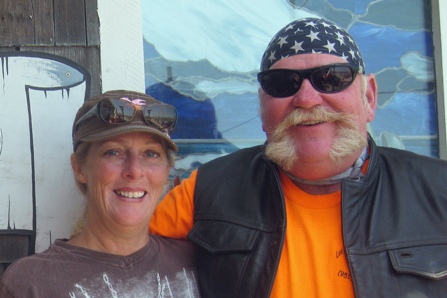
Monticello's back yard - Black skies from the storm in the background

Monticello’s back yard – Black skies from the storm in the background

Thomas Jefferson was truly an amazing man.  Someone once said that Thomas Jefferson was a gentleman of 32 who could calculate an eclipse, survey an estate, tie an artery, plan an edifice, try a case, break a horse, and dance the minuet.  I could go on and on but if you’re that interested I’m sure you’ve already done your research.  I will leave you with this quote from JFK.  He was having a dinner at the White House honoring the Nobel Prize winners of the Western Hemisphere.  He said, “I think this is the most extraordinary collection of talent,  and of human knowledge, that has ever been gathered together at the White House, with the possible exception of when Thomas Jefferson dined alone.”44 road1I still have my co-pilot and photographer but need to get back into practice so I took a couple pictures along the way today.  It was a short ride but the scenery along the way was exactly what I was looking for – especially after having been so wet just a couple days ago.44 road2I learned something while in one of the shops around Monticello that I’ll share with you:
The history of the Lead Pencil –
Soldiers on the frontier during the French & Indian War found the Quill Pen quickly wore out and was difficult to replace. They tried charcoal which was easy to obtain but very messy to use and did not last at all. The soldiers knew that their led musket balls marked easily on the paper cartridges used to hold the powder and ball for loading, and they knew that they could change the shape of the ball by hammering. One solider, using this knowledge, hammered a ball into the shape of a squared stick with a point and the “Lead Pencil” came into common use, first by soldiers and later in schools on the frontier. This use of a hammered lead stick or “pencil” continued throughout the mid-nineteenth century. Today’s pencils are graphite.44 map


Day 45 – Lynchburg, VA (187 miles)

I’d like to thank Paul and Cindy for being such great hosts, I really should have stayed another day but the weather today was perfect and I didn’t want to lose such a great riding day.  They understood my need to take advantage of the weather, and I was on my way a little after 10:00.  Stopped in town for a quick bite and to verify my route. Paul and Cindy live in God’s Country – truly one of the nicest places I’ve seen, but it’s remote enough that the cell coverage and internet out there is a little sketchy (depending on where on the property you are).  Anyway – route verified, belly full-o breakfast, and ice chest re-stocked, I headed for the north end of Skyline Drive, a designated National Scenic Byway.45 SkylineI really couldn’t have asked for a better day weather wise, cool and sunny without a chance of rain.  I was a bit concerned that being a weekend, the traffic might be heavy; but I had the road to myself all day (with a couple exceptions).  There was a little bit of traffic northbound – including a classic car club.  These guys looked great – about 40 cars, ranging from 30’s to 60’s and everyone in the vehicle was dressed in period correct (matching the car) clothing.  If I’d known they were coming I would have pulled over and taken a video. Skyline Drive and the Blue Ridge Parkway run along the spine of the Blue Ridge Mountains.  The traffic would have been much worse in the fall when the leaves are changing colors.

The Shenandoah River Valley from the park's welcome center.

The Shenandoah River Valley from the park’s welcome center.

Looking southeast from one of the many overlooks along Skyline Drive

Looking southeast from one of the many overlooks along Skyline Drive

The ride on Skyline Drive was very scenic and the roads were flawless. Only problem was that the speed limit is 35 for 105 miles. I pushed it up to 40 a few times, and that made things a little more fun but the guys with the blue lights were out and active so I just putted along spent a lot of time looking around.  And, I wasn’t in a hurry to get anywhere so that was fine, just a little boring after the first couple hours. Then… I got to the Blue Ridge Parkway (now that was FUN) – speed limit up to 45 which isn’t really all that fast but after over three hours of 35 it seems like you’re FLYIN – and, no blue lights in sight. I didn’t push it much over 50 which was about as fast as I could go in the corners anyway; and there were lots and lots of those.  It was a good time and the same or better as far as scenic, just not very many pull outs to take your time and really get a good look. There is a short stretch where you are right on the top of the ridge line and you can see Virginia to the east and West Virginia to west from the same spot. I’d recommend the Parkway over Skyline Drive if you can only do one (it’ll save you some money too as Skyline Drive is part of the Shenandoah National Park so you have to pay to get in).  Looking forward to camping again – this KOA was nice but the roads inside are steep and are covered with pretty deep gravel – not really “motorcycle friendly”.
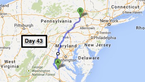
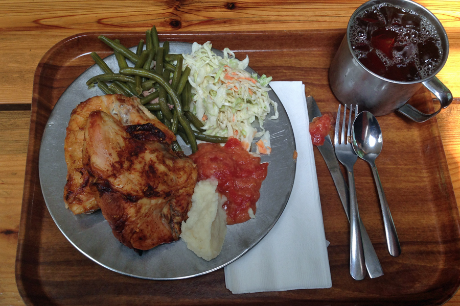
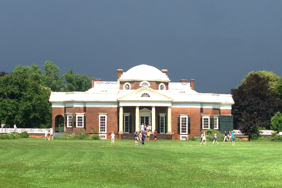
Dang, I shipped my fishing pole back with my golf clubs.  Lynchburg/Blue Ridge Parkway KOA

Dang, I shipped my fishing pole back with my golf clubs. Lynchburg/Blue Ridge Parkway KOA

45 map

Day 46 – Grayson, KY (340 miles)

Today began just like yesterday ended – on the Blue Ridge Parkway.  I know that there are better ways to start your day, but I think this has to be one of the best ways that you can do alone.  It literally put a smile on my face that lasted for a long time.  After about an hour on the Blue Ridge Parkway my stomach was chewin on my backbone so I got off the Parkway hoping to scare up some breakfast somewhere.  I headed for Bedford, VA and along the road I saw a sign for the D-Day National Memorial.  It’s right there in Bedford and one of the people I talked to at breakfast said it was not to be missed; SO – belly full of biscuits and off I go.  There is a fee but it’s only $10 ($8 if you’re prior military – no proof necessary).  I don’t really have time for a guided tour but I’ll take a look around and get back out on the road.  So, I stuck my admission sticker (it said I was a veteran) to my chest and rode up to the memorial.

I pulled up to the gift shop where some people were sitting out on the covered porch.  As it always does, the bike and trailer drew a lot of attention.  I was just going to go in the gift shop, take a look around then head over to the memorial.  An older man wearing a baseball cap adorned with many small pins of the ribbons he earned stood up and saluted me & thanked me for my service.  I coughed and said that I was in the luxury condo version of the “service” during peace time and thanked him for his service.  Then we started talking……  He ended up being my tour guide almost an hour later and I never did get into the gift shop.  This guy was amazing, his father was there on the beach at Normandy so he had so much personal knowledge to share – I wish I’d recorded everything he said.  He kinda stuck to the script when he was talking about the memorial but if someone asked him a question you could see him start to smile, take a deep breath, and start the answer with a little more thrown in for good measure; he was just bursting with information.  I was very happy that I took the time to go on the tour.  A kid that was in the same KOA campground with me last night showed up and was just going to take a look around then go and I encouraged him to take the time and do the tour – I hope he took my advise.  Here are several of the pictures I took.

The metal star in the water is called a hedgehog and was designed to rip open anything that got too close.  Solider lying dead on the beach is one of the Bedford Boys.  The window slits represent the machine gun bunkers.

The metal star in the water is called a hedgehog and was designed to rip open anything that got too close. Solider lying dead on the beach is one of the Bedford Boys. The window slits represent the machine gun bunkers.

One of the biggest surprises was that the landing boats like you see in the background made out of granite were actually made out of 3/4 inch plywood!!

One of the biggest surprises was that the landing boats like you see in the background made out of granite were actually made out of 3/4 inch plywood!!

Medic going up the beach with a solider, note the cross on his helmet and lack of a weapon

Medic going up the beach with a solider, note the cross on his helmet and lack of a weapon

Climbing the cliffs up to the machine gun positions.

Climbing the cliffs up to the machine gun positions.

Over the Wall

Over the Wall

L-3 observation aircraft - the cloth covering didn't offer much protection but it also continued to fly quite nicely even if it had a few holes in it.

L-3 observation aircraft – the cloth covering didn’t offer much protection but it also continued to fly quite nicely even if it had a few holes in it.

General Eisenhower with a depiction of the assault map overhead.  This sculpture is so detailed that you can read the writing on his class ring.

General Eisenhower with a depiction of the assault map overhead. This sculpture is so detailed that you can read the writing on his class ring.

The Final Tribute

The Final Tribute

I have a couple plans for today and tomorrow and they involve getting a little ways down the road so the two and a half hours I spent at the D-Day Memorial put me up on the slab for the rest of the day.  No big deal – my time at the memorial was worth a little slab time and I had such a great day yesterday and this morning – eating miles on the slab didn’t bother me at all.46 map

Day 47 – Lexington, KY (198 miles)

Before I get into today’s post I would like to send my heartfelt condolinces out to Betty Thomas and the whole Thomas family and all of Bob’s friends.  We lost Bob and he will be sorely missed by all of us.  Hands down, the nicest man I have ever known.

I was going to camp last night but the skies were looking pretty dark and it was still pretty hot at 6:30 so I headed for town.  The Super 8 here was $55 tax included, the room was a good one, & I ended up sleeping in a little.  I said that there was something I wanted to do today and the earlier I get to Lexington the better so I got up on the slab again for about 100 miles.  My aunt lives in Lexington and I’m headed for her house to drop the trailer then go over to a couple of the distilleries on the Bourbon Trail.  I’ve always wanted to do that and I have the time on this trip so I’m taking advantage.  The first place I stopped was Four Roses; I’d never heard of them before but they make a good enough Single Barrel Bourbon that I bought a little bottle before I left.  This is also the only place I took “the tour”.  I’ve been through the distillery at Jack Daniels and this one was about the same.  After talking to other people that had been to more than one tour – they confirmed they were all pretty much the same – “Seen one…..”

Four Roses Distillery - Built in 1910

Four Roses Distillery – Built in 1910

47 4Roses OldFrom the Four Roses I went over to Wild Turkey – they have a very nice gift shop and I was just looking around when one of the clerks asked me if I wanted a tasting (free).  I said sure but I know what Wild Turkey tastes like so I tried a couple of their products I’ve never had.  One was American Honey & it’s a blend of honey (go figure) and Bourbon.  The other was their spiced Bourbon and although both were actually pretty good, I was going to buy a bottle of the American Honey but figured I’ve already got one bottle of Bourbon, I don’t need to be hauling a liquor store around with me.  Besides, they said it’s their second best seller – right after their 101 proof, so I think I should be able to find it when I want some.  A good sipping dessert type drink.  The view from their new tasting room is quite nice.

View from the tasting room at Wild Turkey - Angel's Roost I think it was called

View from the tasting room at Wild Turkey – Angel’s Roost I think it was called

The rest of these shots are all from Woodford’s Reserve.  I said I only went on the Four Roses tour but that is incorrect – the only way to get down to where I could take pictures was to get on the tour bus so that’s what I did.  I guess I forgot because I didn’t really “learn” anything…. Ha ha.  Anyway – this distillery is listed as a National Historic Landmark so I wanted to get some pictures.  Woodford’s Reserve isn’t my favorite but in the tasting they have something they call double barreled that is put back in another barrel and aged for another year.
YUCK  I didn’t even finish my sample!!

Limestone buildings (circa 1878) are part of the distillery here at Woodford's Reserve.  The rails that you see the barrels on runs over 500 feet from where the barrels are filled.  Each barrel weighs over 500 lbs.

Limestone buildings (circa 1878) are part of the distillery here at Woodford’s Reserve. The rails that you see the barrels on runs over 500 feet from where the barrels are filled. Each barrel weighs over 500 lbs.

Where the barrel railroad ends - the barrel house where they age the Bourbon (6-9 years)

Where the barrel railroad ends – the barrel house where they age the Bourbon (6-9 years)

There are more barrels of Bourbon aging in Kentucky than there are people living in Kentucky

There are more barrels of Bourbon aging in Kentucky than there are people living in Kentucky

These didn't fit in the old limestone barrel house and will be sent to one of several more modern facilities

These didn’t fit in the old limestone barrel house and will be sent to one of several more modern facilities

47 map

Day 48 – Paducah, KY (356 miles)

Really enjoyed my time with my Aunt Kathleen and Marty in Lexington.  She is a real kick and we are always happy to see each other.

My wonderful Aunt Kathleen, her husband Marty & the Red Rider

My wonderful Aunt Kathleen, her husband Marty & the Red Rider

I still have a couple distilleries I want to check out on my way out of town so this morning I’m headed for Buffalo Trace then over to Maker’s Mark to dip my own bottle.  I got one of those What to See in Kentucky magazines somewhere and saw that there is an old covered bridge pretty close to Buffalo Trace so I went there first.  Talk about in the middle of nowhere…

On the way to the covered bridge, a tree covered road.

On the way to the covered bridge, a tree covered road.

What a joke these rumble strips are - you're going to know that there's something really wrong - WAY before you get to the rumble strips!!

What a joke these rumble strips are – you’re going to know that there’s something really wrong – WAY before you get to the rumble strips!!

Bridges were covered back in the day to protect the timbers from the elements.  There are actually quite a few covered bridges still standing in Kentucky – I don’t think any of them are open to traffic.  There were a lot of kids playing in and around this one when I got there.

Switzer Covered Bridge - 120 feet long and 11 feet wide, built 1855

Switzer Covered Bridge – 120 feet long and 11 feet wide, built 1855

48 BT2

One of the original barrel houses at Buffalo Trace

One of the original barrel houses at Buffalo Trace

The old bottles on display at Buffalo Trace Distillery

The old bottles on display at Buffalo Trace Distillery

Buffalo Trace was an interesting place (I really didn’t mean to rhyme that – sorry).  I would have liked to spend some money there but I don’t need another t-shirt or more weight from another bottle of hooch – So, I just headed over to Makers Mark, I’m going to be adding a bottle of Bourbon there for sure since I’m going to dip my own.  For those of you who may not know, Makers Mark bottles are all sealed with a red wax that drips down the bottle and if you go there, you can dip your own bottle.  When I got to the dipping area there was a young man (I’m guessing 14) that I was going to ask to take a video with my camera.  Some lady that works there jumped forward and volunteered so I figure they must do this all the time and know “the deal”.  I told her what the deal was with my camera – push once & let off the button, it’s recording, push again and it stops. Guess she was flummoxed – second shot ruined by people I shouldn’t have given the camera to – at least I was able to get one still.  By the way, the video of her carrying the camera back to where I was standing came out perfect…..

Just barely one usable shot from what should have been a long movie.

Just barely one usable shot from what should have been a long movie.

48 map


49 – Poteau, OK (512 miles)

I have a picture from Knob Hill, KY that I mislabeled so it didn’t get into yesterday’s post.

Abraham Lincoln lived here for 5 years 1811-1816

Abraham Lincoln lived here for 5 years 1811-1816

Time to start heading home with a bit of a purpose (as evidenced by the number of miles I rode) as we have to get ready for our trip to Canada at the end of the month.  I was up early and helmet on (Missouri has a helmet law) I was on the road by 7:00.  While I was in Myrtle Beach I got one of those “states I’ve been to” maps to stick on the back of the trailer.  Today I will add Illinios, Missouri, Arkansas and Oklahoma.  I didn’t ride through very much of Illinois though; at the most it was one mile.  First I crossed the Ohio River into Illinois, then the Mississippi River into Missouri.  Here is what it looked like.49 3 states

Crossing the Ohio River into Illinois

Crossing the Ohio River into Illinois

This is the Mississippi River crossing into Missouri

This is the Mississippi River crossing into Missouri

This is mostly farm land out here.  I don’t know what kind of fields they were working on, or what they were spraying but the crop dusters were out in force.  When I saw the first one, I risked life and limb (loose gravel dirt road) to get some good pictures.  I must have seen 15 more over that 100 miles.  I stopped one more time to get some shots of another one (close to the road this time) and didn’t even bother with the closest one that was flying right over the road I was on.  I probably would have gotten some of whatever he was spraying on me, it was that close.  I don’t guess crop dusters use flaggers to mark their runs anymore with GPS and all the sophisticated avionics available.  Did you know they can carry up to 800 gallons??

Nice rolling road through some of the Missouri and Arkansas farm lands.

Nice rolling road through some of the Missouri and Arkansas farm lands.

I know it's a dangerous job dodging the power lines and trees; not to mention the exposure to all those chemicals, but it sure looks like they're having fun up there.

I know it’s a dangerous job dodging the power lines and trees; not to mention the exposure to all those chemicals, but it sure looks like they’re having fun up there.

How early do you think you need to be on the crop duster guy’s calendar?  Would you have to get on his calendar before you planted your crop so it could be fertilized or pesticided (my own word) at the right time???  Just thoughts from the road, if I’d seen someone that looked like a farmer I’d have asked, but they’re likely all working.  These guys were sure busy today.

Lined up, polished and ready to go to work.

Lined up, polished and ready to go to work.

I wonder if local farmers harvest their own crops anymore.  I’ve ridden past a thousand farms and very few of them have any type combine visible.  I guess they could all be in a barn somewhere, but I think mostly they hire a harvest crew that comes out and does the work.  OR – maybe this is a combine storage area and these all belong to lots of individual farmers.

One more thing today that kinda made me smile.  I passed a convoy of school buses (3 or 4) and support vehicles full of camping gear all headed to “camp”.  The kids came over to the left side of the bus and waved, thumbs up, etc.  It reminded me of when we would be riding in the bus somewhere and we would all try to get the semi drivers to honk their air horns.  Do the big trucks even have that air horn chain over the driver side door anymore?  It’s probably all electronic these days & nobody under 40 even knows what that left arm gesture means….49 map

Day 50 – Plainview, TX (507 miles)

Eastern Oklahoma is Oklahoma’s answer to Texas’ Hill Country.  I’ve been through many parts of Oklahoma and this is by far the best yet; most of it is pretty flat farm land but out here, it’s cattle country.  Farming has to be much more profitable than ranching though because as soon as it gets flat enough to have a farm, that’s all you see – no cattle ranches in the flat lands out here.

In Ada, Oklahoma their town "mascott" is a buffalo.

In Ada, Oklahoma their town “mascot” is a buffalo.

Before I left Oklahoma I was able to see some aircraft in the pattern at Altus Air Force Base.  Home of The 97th Air Mobility Wing they have C-17’s and KC-135’s based there.  For those of you that might not know – those are both BIG aircraft so the pattern they were flying around in was visible from at least 8 miles away.  Pretty cool seeing such large aircraft make steeply banked turns – sorry no pictures this time, the road was pretty busy and had no real shoulder.

It was cool enough in the morning and even later in the day I had some cloud cover and it was really quite pleasant.  Then, I stopped for gas and a bite to eat and when I got back out on the road it was severe clear and H.O.T.  I’m going to have to make my run through the California desert at night or very early in the morning so I don’t melt.

Some parts of Texas are like this and lots of fun to ride through

Some parts of Texas are like this and lots of fun to ride through

Many - MANY more parts of Texas are like this - not so much fun.

Many – MANY more parts of Texas are like this – not so much fun.

If you're moving somewhere and you wonder about the wind, check out the trees & bushes.  These were not the best examples but they were convenient (the wind is not really blowing in this shot).

If you’re moving somewhere and you wonder about the wind, check out the trees & bushes. These were not the best examples but they were convenient (the wind is not really blowing in this shot).

I took another pretty big bite out of the remaining mileage today.  I can’t ride much more than 500 miles going on the back roads with a trailer for lots of reasons.  One is I would be riding into a setting sun and I try to avoid that.  Another is that by then I’ve been on the bike ten or eleven hours and that’s enough when you’re doing it day after day.  I was shootin’ for Clovis, NM but I ran into a fuel remaining issue.  I had to backtrack once before back in Kentucky.  When I got on the bike at my Aunt’s house, the fuel remaining gauge read 100 miles.  I’d only ridden 65 or so when the fuel light came on & the closest fuel ahead of me was 2 miles past where my gauge said I’d run out.  SO – not wanting to take that chance (been there, done that – 3 years ago) I turned around and rode 8 miles back to the closest gas station (I hate backtracking)….  Anyway, today was kinda the same deal, not enough gas to get to Clovis so I stopped here.  I stayed in Plainview, Texas last year on my way to Las Vegas and it was not a good experience. However, it was mostly a hotel and hotel location thing, so this time I stayed at the Super 8 vs. Days Inn and it made all the difference. They have laundry here and there are plenty of places to eat within walking distance.  The girl at the desk said that the Mexican joint right next door had awesome food & a full bar so I headed over. The food was barely passable but the margaritas made up for it – inexpensive too.  Two margaritas (almost Los Toros quality) and dinner was less than ONE margarita at Chili’s in Peachtree City, GA – never go there.  Okay – time to get on the road, my goal today is to try to stay cool and hydrated – it’s the first day of summer.50 map

Day 51 – Clovis, NM (91 miles)

When I was in Myrtle Beach I was thinking that it might be cool to have one of those “states I’ve been to” maps on the back of my trailer.  I asked Robin to see if she could find one that would fit the trailer and she was up to the task.  She mailed it (& a few other things) to me & I promptly put it on the back of the trailer and started adding states. Just about everywhere I go someone asks me about my trip, the “camper” (tent trailer) or something else having to do with my ride – I get a lot of questions about the map.  The rest of my ride home will be through states I’ve already been to so all the stickers for 2014 are on – here’s what it looks like:

Deal's Gap, The Tail of the Dragon, Four Corners sticker from Madawaska, the Bourbon Trail and 32 out of the Lower 48 states.  Now that's a bike ride!!

Deal’s Gap, The Tail of the Dragon, Four Corners sticker from Madawaska, the Bourbon Trail and 32 out of the Lower 48 states. Now that’s a bike ride!!

The Longest Day It’s the first day of summer and the longest day of the year, I used all the daylight and some of the night.  Last night I checked my route for today and programed a couple of the waypoints into my GPS so I’d be ready to go early. Going to stop for a picture or two at the NARO’s Very Large Array in New Mexico (you may remember this place from the movie Contact) and spend the night in Show Low up in the Arizona pines. I want to see if the same bar tender is there that I met a couple years ago. She was so interested in my Alaska ride (still in the planning stages back then) that she called her husband and had him come down to the bar to talk to me about it.  I’m sure he would like to hear about what actually happened on that trip.  Additionally, it should be much cooler in Show Low which is always a concern this time of year in Arizona.

NARO - Very Large Array is a radio astronomy observatory.

NARO – Very Large Array is a radio astronomy observatory.

Another 500+ mile day but with a 5:45 AM start – shouldn’t be a problem.  When I started the bike – there was a problem.  It sounded like a little man in the bottom of the motor with a hammer trying to get out.  Hmmm…. Well, it’s too early to do anything about it here and now so I figured I’d soft pedal it down the road to Clovis, NM and reevaluate.  I the knock went away at 2800 rpm so I kept the bike at that rpm and about 50 mph to Clovis.

This guy never complains - and he always keeps up.

This guy never complains – and he always keeps up.

When I got to Clovis – it was worse.  My brother lives in Albuquerque and I could leave the bike there, fly home and come back with my truck to pick everything up; but Albuquerque is  255 miles away and I’m afraid the little man will come out of the motor if I try to go that far.  Guess it’s time for the Nuclear Option, get a U-Haul, put the bike in the back and the trailer on the bumper and go home that way.  Now, Clovis, New Mexico is not a very big town but they do have a U-Haul dealer.  Dan, the manager, had a 10 foot truck he could rent me but it didn’t have a ramp so we had a predicament – how do we get the bike in the back of the truck.  Dan made a few phone calls to his buddies to see if someone could bring a ramp over but that wasn’t working out.  They say necessity is the mother of invention and I have to agree.  Walking around the U-Haul lot I have an idea – we push the bike backwards into a trailer then lower the trailer ramp into the back of the truck and I just ride it in.  I know you are thinking – get the camera ready, this could be a $10,000 video – but it all went perfectly.

While not technically "on the hook" it's the same to me.  At least I can get it & the trailer home.

While not technically “on the hook” it’s the same to me. At least I can get it & the trailer home.

Some of you might have noticed that my blog posts are a day behind.  I made it to Kingman, AZ the first night and made it home yesterday, June 22.  The bike is back in the garage and will have to wait until we get back from Canada for the attention it needs.  You might think my luck finally ran out and I might agree If I’d broken down in the middle of nowhere, no shade in sight and no cell phone coverage.  Just the fact that the U-Haul dealer in Clovis had a truck available seemed like divine intervention to me.  This year’s ride ended a little early but no sour grapes from me. Looking forward to getting the bike fixed and next year’s ride around the Great Lakes & maybe, just maybe – Newfoundland.  Thanks for riding along.  15,000+ miles.51 map-1