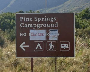
 The Guadalupe Mountains are a park and the whole thing is closed due to fire. I’ve always got a plan B but you hate to have to put that into effect when you think you’re done for the day. Oh well, it was going to be a cold night up there in the mountains, now I’m in the climate controlled comfort of the Motel 6 in Carlsbad, NM. I’m here with about 50 members of the Bandidos MC. They are an outlaw club but I’m sure it’ll be one of those, “Don’t start no trouble, won’t be no trouble” things. Hopefully there won’t be an all night party, one of them is next door.
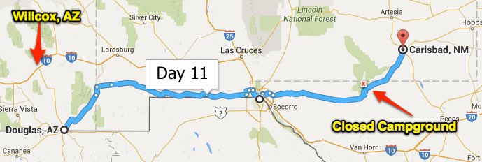
Okay, that was the end of the day, let’s get back to the beginning. Douglas is right on the Mexican border, and in order to go east and stay in the United States, you have to go north first. That ride put the Chiricahua (chair-a-COW-a) Mountains off to my left. I told you that I lived in this area as a child and many stories were told about the Chiricahua Apache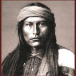 Indians and their last free chief, Cochise. This was one BAD Indian and he fought for his land and people against the Army for 10 years and was never defeated in battle. He died of natural causes on Apache land in the Chiricahua Mountains in 1874 and was secretly buried at a place called Cochise Stronghold, an impenetrable hideout he often used. Nobody has ever found his burial site even though Cochise Stronghold is now a popular destination for locals to picnic, & hike. Good memories…
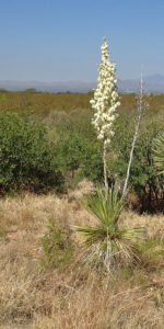 This is Yucca Cactus and mesquite bush territory. There are almost no thorny cactus anywhere around here. I have no idea what changes in the climate cause that, but it’s way better for walking around hunting dove and quail as I did in my youth. California’s Joshua Tree is next of kin to the yucca cactus. This is a yucca with a couple mesquite bushes and the Chiricahua Mountains in the background.
I only went as far north as I had to before I turned right and followed the southern most route across New Mexico into Texas at El Paso. That is one desolate stretch of road; at one point I saw a couple people walking. They appeared to be husband and wife walking across the USA or something. I think if there had been any shade anywhere close I would have stopped to get their story – no shade, no story. This road was rough, but about 25 miles of it was brutal, it was like asphalt whoops, no wonder I didn’t see any other motorcycles. I kept thinking it would end soon and was wondering why my new shocks seemed to have failed all together. I actually stood up on my floorboards; which is no easy task. If it hadn’t changed I would have been looking for another route. For those of you not familiar with whoop-de-doo’s watch this video.
The Continental Divide is the point where all the water finds the ocean to the east or the west. The water behind me goes east to either the Gulf of Mexico or the Atlantic, and on the other side it flows into the Pacific Ocean or the Sea of Cortez. There are other lesser Continental Divides but this is the Great Divide and runs from the tip of Alaska, all the way to Nicaragua; I guess that’s where the continent of South America starts & they have their own divide. Anyway – this is the southernmost divide road sign in the United States.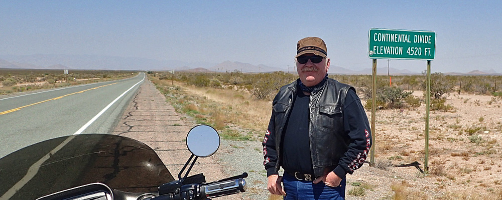
Being so close to the border, there is quite a bit of Border Patrol activity. One of the things you’ll see are these tire drags (most of them not this elaborate). Border Patrol drag them on the ground next to the barbed wire fences along the road, then come back later and count the foot prints as a way to tell where and how many people are crossing over.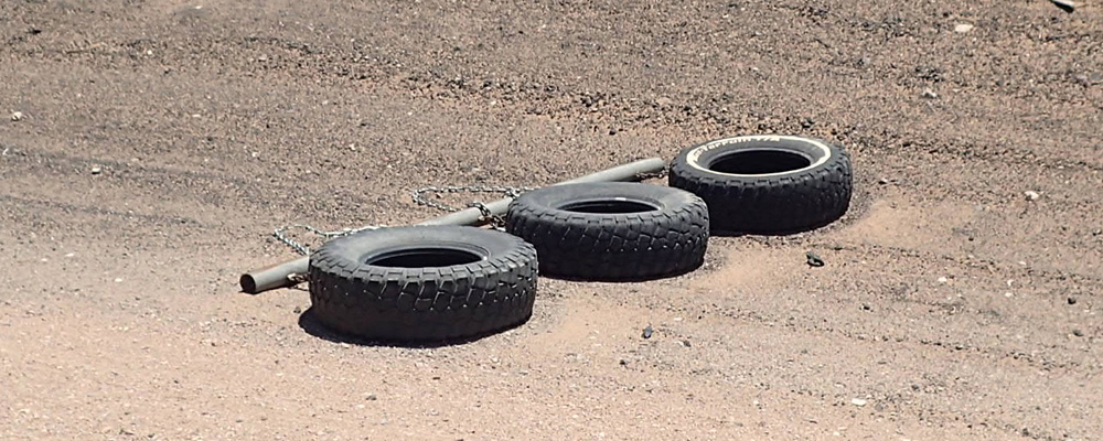
I’ve been to El Paso a few times and I’m always surprised at how close they are to Mexico. You could stand on Interstate 10 at one place and easily hit a pitching wedge over the river into Mexico. And the freeway is elevated there so it looks even closer than that. Speaking of I-10, getting through El Paso has been a traffic nightmare every single time I’ve been there. Today I tried to stay off the freeway but you can’t get there from here due to all the construction; so after 15 minutes of dead ends I gave up and got on the freeway. These genius’ have Interstate 10 necked down to two lanes for several miles. UGH – I could not wait to get out of the city!!
I made it out without getting a ticket (lane splitting is only legal in California) and the rest of the day was enjoyable. I tell you what, you know you’re in Texas when – the speed limit on a two lane road is 75mph – the sign as you leave town says Next Services 129 miles – and, people start saying, “I tell you what”………..

Sounds like you’re having an interesting trip. Was just asking one of the guys on the course what those funny looking plants are that pop up every year. Now i know! Interesting how the border patrol uses those tires…..pretty primitive but apparently works. Trying to picture what the continental divide looks like. I’ll do some homework. Look forward to your daily reviews. You’d make a great travel, scenery and history writer. Maybe next life!
Hi Lenny,
I love reading your diary. Thanks for sharing.
Be safe
Careful with side routes two days down the road as you approach Beaumont. Even as far west as SAT my sis says water is not your friend right now.
When you’re in ELP, Mexico must be way off to the right…I’ve seen you pitching wedge shots!!! Great updates…be safe… EB
I had no idea that gila monsters only come out in May and June…what do they do for food and water the rest of the year? Or is that the only time they’re out in the daylight? Tire drag was interesting. Never knew hawks worked in tandem. COOL ride!